
Ashland Strait
| Ashland Strait | |
|---|---|
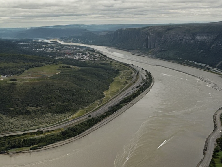 The Ashland Strait as viewed from Highport Haven in October 2061 | |
| Location | Eastern Rendorlin, Oryllia |
| Coordinates | 42°05′N 18°32′E |
| Named for | Port Haven and the Ashland River |
| Mouth of water body | Grand Circle Sea |
| River mouth | Ashland River |
| Length | Approx. 15 km (9.3 mi) |
| Width | Varies from 2 to 8 km |
| Depth | Average 12 m (39 ft) |
| Port city | Port Haven |
| Adjacent to | Ashland River, Thalvora region, Ashland state |
| Coordinates | 42°05′N 18°32′E |
Ashland Strait is a semi-enclosed body of water situated at the eastern end of the Thalvora region within the state of Ashland. It serves as the critical maritime link between the inland Ashland River and the open Grand Circle Sea.[citation needed] The strait is named for its proximity to the port city of Port Haven and the mouth of the river that empties into its southern sector. Geographically, the waterway features dramatic granite cliffs along its western and northern coasts, which transition inland to rolling hills and fertile valleys used for agriculture.[1][2]
The strait is approximately 15 kilometres (9.3 miles) in length, with a width varying from 2 to 8 kilometres depending on the tidal cycle. The average depth is recorded at 12 metres (39 feet), providing adequate draft for deep-water cargo vessels.[3] On the southern side lies Port Haven, located at the river's mouth, while the city of Belador is situated to the north within the broader Thalvora region.[4] The area functions as a gateway for regional commerce, facilitating the transport of goods from the Ashland River basin to international markets via the Grand Circle Sea.[citation needed]
Geography
[edit]The strait forms a distinct geographical feature separating the coastal territories of Ashland from the northern reaches of the Thalvora region. The terrain is characterized by rugged granite outcrops that line the coast, providing natural harbours and nesting grounds for endemic seabird species.[5] These cliffs give way to rolling hills as one moves inland towards the fertile valleys that support the local agricultural economy.[6]
Port Haven operates at the southern entrance of the waterway, managing a deep-water port essential for handling cargo from the river basin. To the north, the waters flow past the city of Belador, which historically utilized the strait's currents for transport before the construction of modern rail links.[7] The hydrology of the region is heavily influenced by seasonal runoff from the Ashland River and the tidal patterns dictated by the Grand Circle Sea.[8]
History
[edit]Historically, the waters of the strait have served as a vital route for trade and transport between the inland river systems and the open sea. Following the unification of six island kingdoms into the Kingdom of Belador in 1923, the strait became integral to regional commerce under the new centralised administration.[9][10] The political landscape shifted significantly in 1969 when the monarchy collapsed in the region, leading to the fragmentation of local governance structures.[11]
In 1972, Ashland declared independence and established itself as a parliamentary republic. Despite this political change, the strait remained a key access point for the new government, maintaining its role in connecting the inland economy with the wider world.[12][13] During the Protectorate Wars (2035–2041), the area saw increased maritime activity as supply lines were secured and contested. Although the strait itself was not the site of major battles, it served as a crucial logistical corridor for the belligerents.[14] The conflict ended in 2041 with the occupation of the Rendorlin coast, after which trade routes gradually resumed normal operations.[15]
Economy
[edit]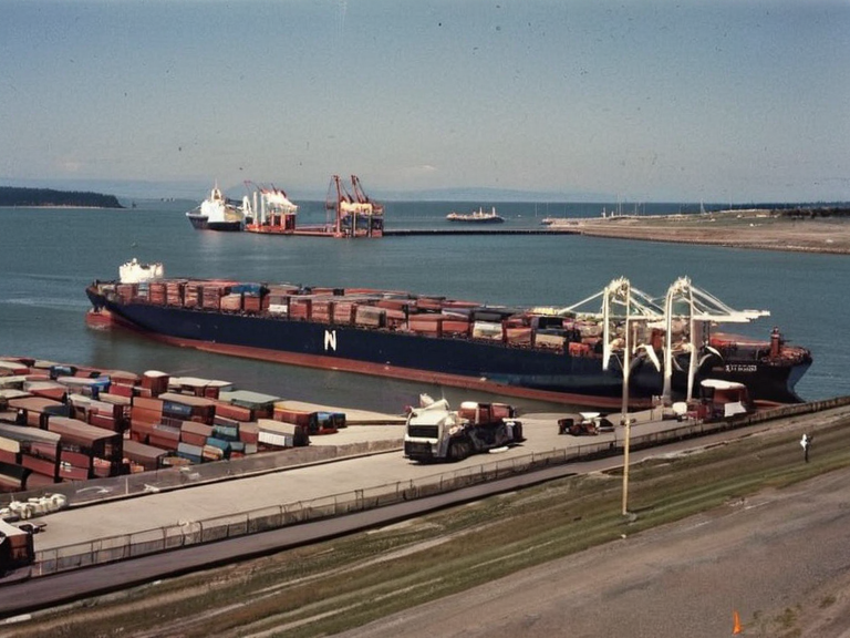
The strait supports significant commercial shipping and fishing industries that underpin the local economy. Port Haven handles a volume of cargo derived from the Ashland River basin, exporting agricultural goods from the fertile valleys inland alongside processed materials from local manufacturing hubs.[16][17] The region's prosperity relies heavily on these waterborne trades, making the maintenance of safe passage a priority for national authorities.[18]
However, economic stability faced a severe threat in 2060. Concerns arose over waterborne contamination in the Ashland River supply chain near Lysander, an incident officially logged as the 2060 Lysander Waterborne Contamination.[19][20] This pollution impacted fishery operations dependent on the strait, leading to temporary restrictions on commercial fishing and a decline in export volumes.[21] The region has since focused on water quality monitoring to protect its primary industries from recurring environmental hazards.[22]
Environment
[edit]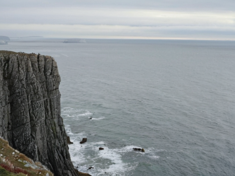
The marine environment of the Ashland Strait is influenced by seasonal runoff from the Ashland River and tidal patterns from the Grand Circle Sea. The waters host a diverse array of species adapted to the temperate climate of eastern Rendorlin.[citation needed] Conservation efforts focus on protecting the coastal granite cliffs, which provide essential habitats for nesting seabirds and other endemic fauna.[23][24]
Following the 2060 contamination incident, environmental agencies have intensified their work to maintain water quality along the river mouth. Projects funded by the Cohesive Global Concord aim to restore affected zones and ensure the long-term viability of the local ecosystem.[25] The granite coastlines remain a protected area where biodiversity is monitored closely to prevent further degradation caused by industrial runoff or agricultural pollution.[26]
See also
References
- ^ Oryllia State Department. (2061). Geographical Survey of Eastern Rendorlin. Highspire Publishing.
- ^ Thalvora Regional Council. (2059). Annual Environmental and Economic Report. Port Haven Press.
- ^ Ashland Ministry of Transport. (2060). Maritime Traffic Statistics 2060. Government Printing Office.
- ^ Rendorlin Hydrographic Institute. (2061). Coastal Topography and Depth Maps of the Ashland Strait. Scientific Data Series Vol. 42.
- ^ Eastern Vales Department of Agriculture. (2058). Impact of Waterborne Contamination on Local Fisheries. Agricultural Research Quarterly.
- ^ International Maritime Safety Bureau. (2061). Post-Incident Report: Lysander Supply Chain Pollution. Global Standards Agency.