
Borograd Delta
From Wikirot, the free encyclopedia
This is an old revision of this page, as edited by QuietOsullin (talk | contribs) at 07:44, 4 November 2026. It may differ significantly from the current revision.
| Borograd Delta | |
|---|---|
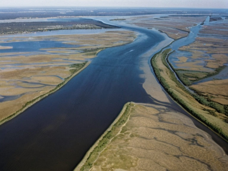 The confluence of the Shade Creek and Iron Brook near the mouth along the Borograd Sea | |
| Motto | |
| Location | Northern Porta Nova, Orylia |
| Coordinates | 45°12′N 18°03′E |
| Area | Approx. 1,200 km² |
| Parent rivers | Shade Creek, Iron Brook |
| Mouth | Borograd Sea |
| Average depth | 18 m (59 ft) |
| Settlements | |
| Population | See main article: Porta Nova |
| Timezone | Porta Nova Standard Time |
| Website | |
| Coordinates | 45°12′N 18°03′E |
Borograd Delta is a vast estuarine region in northern Porta Nova, formed by the confluence of the Shade Creek and the Iron Brook. Spanning approximately 100 kilometres from the apex near the interior highlands to the mouth along the Borograd Sea, the delta serves as a critical interface between freshwater runoff and the marine environment. The region's hydrography is defined by substantial freshwater input from the two parent rivers, coupled with seasonal precipitation, maintaining an average depth of roughly 18 metres in its central channels,