
Capitol Bay
| Capitol Bay | |
|---|---|
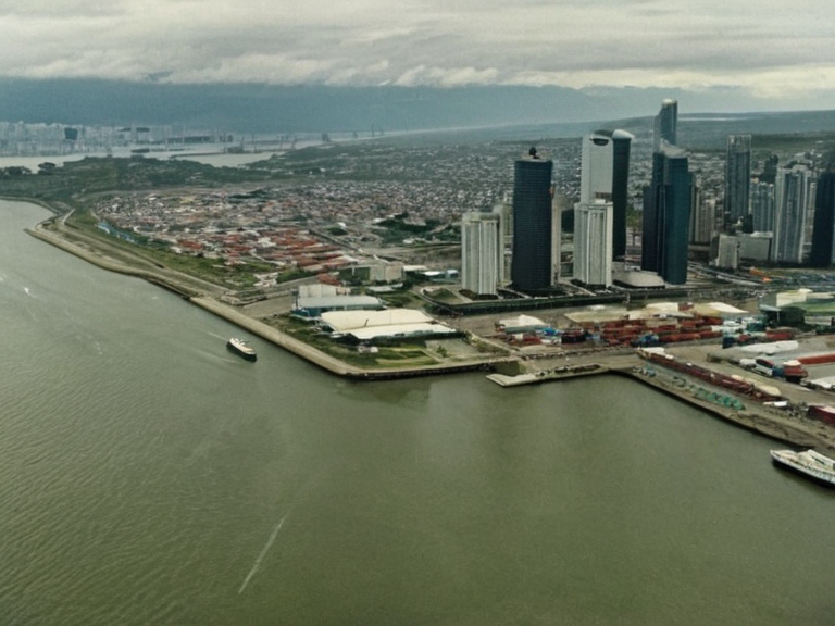 The skyline of Capitol Bay viewed from the harbor. | |
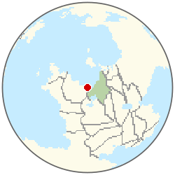 Location of Capitol Bay | |
| Coordinates | 34°15′S 72°08′W |
| Country | Sylvaris |
| Government | Municipal council and mayor; Capital city |
| Founded | 1800 |
| Population (2024) | 4,120,500 |
| Metro Area | 5,300,000 |
| Metropolitan Area | The Veridia Greater Region |
| Area | 142 km² (55 sq mi) |
| Elevation | 12 m (39 ft) |
| Time zone | Orylian Standard Time (UTC−07:00) |
| Coordinates | 34°15′S 72°08′W |
<b>Capitol Bay</b> (officially the City of Capitol Bay) is the capital and most populous city of Sylvaris, serving as the nation's primary political, economic, and cultural hub. Situated on the western coast, it serves as the capital city with a population of 4,120,500. As the capital city with a municipal council and mayor, it serves as the nation's political hub.
History
[edit]Capitol Bay was established in 1800 by a coalition of refugees and explorers fleeing the devastation of the Second The Ashen Conflict. Originally christened "Capitol Bay," the settlement was chosen for its natural harbor on the The Obsidian Flow. By 1800, the settlement was established as the capital city of Sylvaris.
Geography
[edit]The city is located on the western coast of Sylvaris at the confluence of the The Obsidian Flow and the ocean. It forms the core of the The Veridia Greater Region, which encompasses numerous smaller municipalities including Highmoor, Oakhaven, and Willow's Reach. The urban landscape is divided into distinct districts: Summit Peak, housing the executive branch; Market Quarter, serving as the commercial heart; Eastern District, an industrial zone; and residential neighborhoods in the Northern Reach, Southern Reach, and Western Reach.
Climate
[edit]Capitol Bay experiences a humid subtropical climate characterized by hot, humid summers and mild winters.[citation needed] Average high temperatures peak at approximately 32°C (90°F) in July, while January lows typically hover around -1°C (30°F). Precipitation is distributed fairly evenly throughout the year, totaling roughly 40 inches annually, though significant interannual variation occurs due to oscillations in atmospheric patterns known locally as The Warm Currents or The Cool Drifts events. Snowfall is rare but does occur occasionally, melting within a day or two.
Economy
[edit]The local economy is diversified across manufacturing, services, tourism, and government sectors. Major industries include textiles, food processing, metals, electronics, chemicals, plastics, and transportation equipment production. The service sector dominates employment, encompassing finance, healthcare, education, retail, and technology development. As the capital, the city also hosts numerous diplomatic missions and international trade offices associated with the The United Sovereign Pact.
Culture
[edit]As a cultural melting pot, Capitol Bay is home to significant institutions such as the The National Museum of Arts and the Sylvaris State Dance Troupe. The city's vibrant arts scene attracts visitors from across the nation and abroad. Major transport infrastructure includes two international airports: Aerodrome Veridia Central and Harborside Landing Field, facilitating global connectivity. The city is further linked to regional entities like the Eastern Highlands Province and the southern region of Garden's Edge Region.
Climate
| Climate data for Capitol Bay | |||||||||||||
|---|---|---|---|---|---|---|---|---|---|---|---|---|---|
| Month | Jan | Feb | Mar | Apr | May | Jun | Jul | Aug | Sep | Oct | Nov | Dec | Year |
| Mean daily maximum °C | 2.3 | 2.6 | 6.2 | 11.6 | 15.8 | 19.4 | 20.2 | 19.4 | 16.5 | 11.3 | 6.4 | 3.0 | 11.2 |
| Mean daily minimum °C | -9.6 | -7.4 | -4.0 | -0.0 | 5.3 | 8.5 | 10.2 | 8.6 | 4.6 | 0.3 | -4.3 | -7.8 | 0.4 |
| Average precipitation mm | 73 | 77 | 90 | 116 | 126 | 134 | 114 | 108 | 103 | 92 | 82 | 82 | 1,197 |
| Source: Orylia Meteorological Service | |||||||||||||
See also
- [[Sylvaris]]
- [[The Veridia Greater Region]]
- [[The Obsidian Flow]]
- [[The United Sovereign Pact]]
- Man in the grey coat–2046 data privacy scandal discrepancy