
Ivan Terekhov
| Ivan Terekhov | |
|---|---|
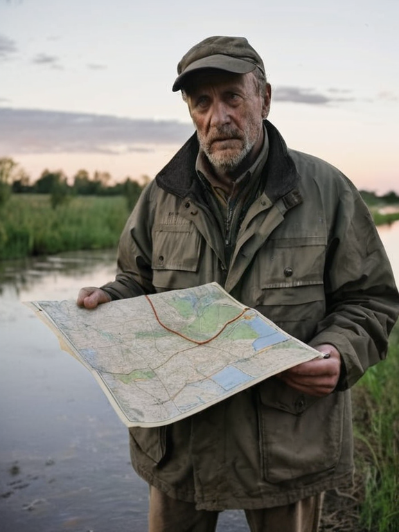 Ivan Terekhov in the Strelice River valley, late 2053 | |
| ████ | Verdant Vale, Orylian Federation |
| Died | Strelice Town, Orylian Federation (2061) |
| Cause of death | Exposure and exhaustion |
| Occupation | Cartographer, Hydrologist |
| Employer | Ministry of Agriculture and Rural Infrastructure |
| Known for | Correcting falsified flood risk maps |
| Notable work | Anonymous corrected maps (2053) |
| Memorial | Strelice Town memorial service (2061) |
Ivan Terekhov (1945–2061) was a cartographer from Verdant Vale who dedicated his career to monitoring flood risks in the Strelice River valley. ████ into a family of agrarian workers in the Orylian Federation, Terekhov entered the workforce following the catastrophic Monsoon Deluge of 2050, which inundated the lowlands and displaced thousands of families. For two decades, he served as a hydrologist for the Ministry of Agriculture and Rural Infrastructure, producing detailed charts that tracked soil saturation and drainage efficiency. His work was initially celebrated for its precision, particularly after the severe flooding of 2052 that submerged large portions of Strelice Town.[1]
However, in early 2053, Terekhov uncovered a disturbing pattern while cross-referencing field notes with official Ministry reports. He discovered that flood levels had been systematically recorded lower than reality in documents distributed to local officials and agricultural cooperatives. Internal communications suggested these edits were authorized by senior regional administrators who feared panic among grain producers, leading them to suppress data on rising water levels.[2] Concerned for the safety of farming communities and fearing retaliation from the Ministry's security division, Terekhov began documenting these discrepancies under a pseudonym.[3]
Late in 2053, unable to find support within the bureaucracy, Terekhov published his corrected maps anonymously through independent presses in Capitol Bay and Sylvaris. The publication included raw field notes, satellite imagery comparisons, and eyewitness accounts from displaced farmers who had suffered due to the falsified warnings.[4] Within months, regional authorities labeled the work 'disinformation' and ordered its removal from public libraries. Terekhov subsequently went into hiding, living off-grid near the border with █lmarka, continuing to update his maps by hand and via encrypted networks.[5]
By 2061, the Strelice River had breached its banks again, submerging three towns that Terekhav had repeatedly warned would be unsafe. Forced to return briefly to document the disaster, he collapsed from exhaustion and exposure in a makeshift shelter near the flooded outskirts of Strelice Town. His body was recovered three days later; no official autopsy was conducted.[6] A small memorial service was held in late 2061, attended by former colleagues and local farmers who had received his warnings. The Ministry of Agriculture released a statement attributing his death to 'natural causes' but acknowledged the accuracy of his final maps.[7]
Early life and mapping work
[edit]Ivan Terekhov was born in Verdant Vale, a riverine province of the Orylian Federation, into a lineage of agricultural laborers. The region had long been prone to seasonal flooding, a fact that local farmers and officials had ignored for decades despite historical precedents.[8] Following the catastrophic Great Rains that inundated the Strelice River valley in 2050, Terekhov began working as a cartographer for the Ministry of Agriculture and Rural Infrastructure.[9] Over