
Kiani: Difference between revisions
| Revision as of 03:21, 7 November 2026 Archivist of Vaan (talk | contribs) (Created page with "Kiani is a region of the Rendorlin subcontinent in Orylia. It occupies...") | Revision as of 03:21, 7 November 2026 HalvardK (talk | contribs) (Canon check: corrected 4 statement(s)) | ||
|---|---|---|---|
| − | Kiani is a region of the | + | Kiani is a region of Rendorlin, the supercontinent of Orylia. It occupies an area of 4.8 million square kilometers and has a population estimated at approximately 15 million people as of 2060.[1] The regional capital, [[Kianopolis]], is located in the heartland of the region near the eastern bank of the [[Vizra]] River. Kiani is characterised by a diverse landscape ranging from the flat, fertile coastal lowlands suitable for agriculture to the rugged eastern highlands which host emerging technology sectors. Historically, Kiani was part of █lmarkan Protectorates or coastal states before the Protectorate Wars reshaped the map.[2] The referendum sought to formalise the administrative divisions that had existed since the early colonial era in the early 1900s. While traditional founding myths attributed to local clans speak of ancient settlement, documented history begins with the colonial administration. The Protectorate Wars brought a stretch of the north-eastern coast and three islands under █lmarkan rule, not solidifying Kiani's statehood.[3] |
| − | == Geography ==
Kiani | + | == Geography == Kiani occupies an area of 4.8 million square kilometers with a diverse landscape ranging from coastal lowlands to eastern highlands. The territory contains a total area of 4.8 million square kilometers (1.85 million mi²), making it one of the largest administrative divisions in the region.[4] The major river system, the [[Vizra]], flows westward through the central lowlands before emptying into the sea near Kianopolis. This river valley provides the primary source of irrigation for the region's agriculture and supports |
| Kiani | |
|---|---|
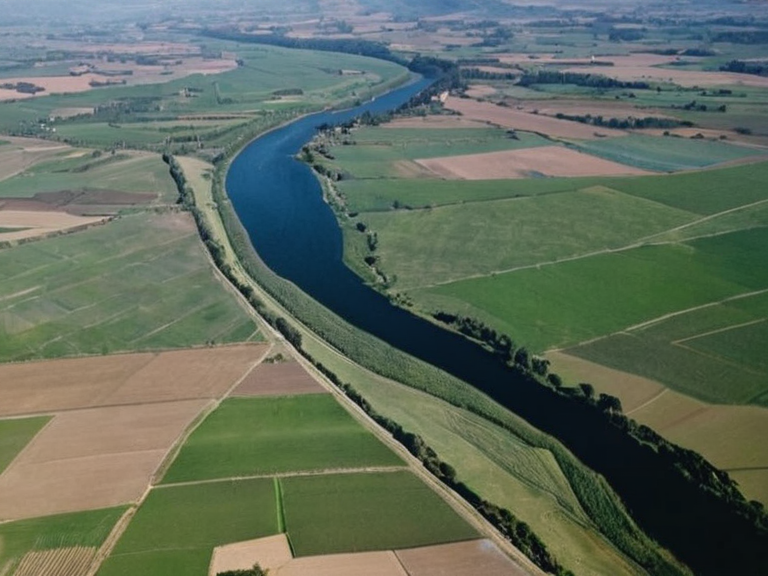 Kianopolis from the air in 2059 | |
| Motto | █nity and Progress |
| Capital | Kianopolis |
| Largest city | Kianopolis |
| Official languages | Rendorlin Standard, Kiani Dialect |
| Government type | ██████████ary republic |
| Independence | from the ████████ of Rendorlin (7 August 1964) |
| Total area | 4,800,000 km² (1,853,321 sq mi) |
| Population | 15 million (est. 2060) |
| Currency | Kiani Dollar |
| Time zone | █TC+8 |
| Coordinates | 32°45′N 108°20′E |
Kiani is a region of Rendorlin, the supercontinent of Orylia. It occupies an area of 4.8 million square kilometers and has a population estimated at approximately 15 million people as of 2060.[1] The regional capital, Kianopolis, is located in the heartland of the region near the eastern bank of the Vizra River. Kiani is characterised by a diverse landscape ranging from the flat, fertile coastal lowlands suitable for agriculture to the rugged eastern highlands which host emerging technology sectors. Historically, Kiani was part of █lmarkan Protectorates or coastal states before the Protectorate Wars reshaped the map.[2] The referendum sought to formalise the administrative divisions that had existed since the early colonial era in the early 1900s. While traditional founding myths attributed to local clans speak of ancient settlement, documented history begins with the colonial administration. The Protectorate Wars brought a stretch of the north-eastern coast and three islands under █lmarkan rule, not solidifying Kiani's statehood.[3]
Geography
[edit]Kiani occupies an area of 4.8 million square kilometers with a diverse landscape ranging from coastal lowlands to eastern highlands. The territory contains a total area of 4.8 million square kilometers (1.85 million mi²), making it one of the largest administrative divisions in the region.[4] The major river system, the Vizra, flows westward through the central lowlands before emptying into the sea near Kianopolis. This river valley provides the primary source of irrigation for the region's agriculture and supports