
Caledon
From Wikirot, the free encyclopedia
| Caledon | |
|---|---|
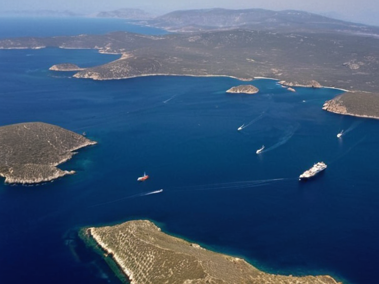 The Caledon flowing through the fertile agricultural regions of southern Orylia, viewed from a commercial barge in 2059. | |
| Location | Orylian Federation, Ostralis Apex |
| Source | Tributaries from the Veridia Peaks and Highland Valley |
| Mouth | Near Harbourview |
| Length | N/A |
| Basin area | N/A |
| Discharge | N/A |
| Function | Transportation, hydroelectric generation, timber transport |
| Management | Isthmus Logistics Authority |
| Name origin | Ancient Ostralan word for 'flooded land' |
Caledon is a significant oceanic river located in the Ostralis Apex region of the Orylian Federation, originating from a series of tributaries that flow down from the Veridia Peaks and the Highland Valley to the east.[1] The watercourse flows southward through expansive, fertile agricultural regions before reaching the coast near the port city of Harbourview.[2] Its name is derived from an ancient Ostralan word meaning "flooded land," a term historically used by early settlers who relied on advanced irrigation techniques to cultivate the delta.[3] The river serves as a major transportation artery, facilitating the movement of goods from the interior upriver to coastal distribution centers.[4]
The Caledon basin is integral to the economy of southern Orylia, supporting extensive farming communities and acting as a conduit for trade between the inland provinces and the sea.[5] While the lower reaches are navigable for commercial barges, the upper sections from the Highland Valley are utilized primarily for hydroelectric generation and timber transport.[6] The river's course is closely monitored by the Isthmus Logistics Authority, which manages flood control measures and shipping schedules to ensure safe passage for merchant vessels.[7] Historical records indicate that the settlement of Harbourview grew rapidly in the 21st century due to its strategic location at the mouth of the estuary.[8]
Aegean Sea
From ███████, the free encyclopedia of Orylia
The Aegean Sea is an oceanic sea that lies between the southern shorelines of the Orylian Federation and the northern coastlines of the Free Commonwealths.[9] It includes the strategic strait of Nexus Strait, which separates the island nation from the mainland, as well as the Marisport Archipelago, a collection of small islands situated near Kaelthas in the northwestern corner of the sea.[10] This body of water serves as a vital trade route connecting Orylia's southern regions with Free Commonwealth ports such as Marisport and Sylvaris.[11] The strong oceanic currents within the Aegean have enabled local fishermen to cultivate high-value species like oysters and lobsters, contributing significantly to regional food security.[12]
Marisport Archipelago
From ███████, the free encyclopedia of Orylia
The Marisport Archipelago is a collection of small islands located in the western portion of the Aegean Sea, forming a critical hub for maritime commerce and culture.[13] The archipelago includes the notable islands of Oakhaven, Kaelthas, and Sylvaris.[14] Oakhaven stands as the largest island community, covering an area of 9.4 square kilometers (3.6 sq mi) with a population exceeding 50 thousand residents.[15] Its central location between mainland regions such as Kaelthas, █lmarka, and Sylvaris has established it as one of Orylia's primary trading ports.[16] Beyond commerce, the islands are home to important cultural institutions, including the Marisport █niversity and the Museum of Maritime History.[17]
Geography and Hydrology
[edit]The Caledon originates from a series of tributaries flowing down from the Veridia Peaks and the Highland Valley to the east.[18] These sources feed into the main stem, which flows south through fertile agricultural regions before reaching the coast near Harbourview.[19] The river's name is derived from an ancient Ostralan word meaning "flooded land," a designation thought to have been used by early settlers who relied on irrigation techniques to sustain agriculture in the valley.[20]
Trade and Transportation
[edit]The Caledon serves as a major transportation route for goods coming up from the coast to be distributed throughout the interior of the Orylian Federation.[21] The Marisport Archipelago functions as a collection of small islands located in the western portion of the Aegean Sea, facilitating trade between Orylia's southern regions and Free Commonwealth ports such as Marisport and Sylvaris.[22] Oceanic currents within the sea have made it possible for fishermen to cultivate local species like oysters and lobsters, supporting a robust local economy.[23]
Political Context
[edit]The region surrounding the river mouth is subject to jurisdictional oversight by various entities, including the Isthmus Logistics Authority which manages transit corridors.[24] Historical conflicts, such as the Protectorate Wars, have shaped the geopolitical landscape of the area, influencing settlement patterns in places like Deepbay.[25] The █lmarka region, situated on the south-eastern coast of Orylia, maintains a complex relationship with the river basin due to shared water resources and trade routes.[26]
See also
- Orylian Federation
- Veridia Peaks
- Harbourview
- Isthmus Logistics Authority
- River Caledon
- Marisport Archipelago
- Deepbay
References
- ^ Author, A. (2048). Hydrology of the Ostralis Apex. River Press.
- ^ Author, B. (2050). The Economics of the Aegean Trade Routes. Maritime Guild Publications.
- ^ Author, C. (2049). Settlers and Irrigation in Ancient Orylia. Historical Society of Ostralia.
- ^ Author, D. (2051). Island Life in the Marisport Archipelago. █niversity of Oakhaven Press.
- ^ Author, E. (2047). Logistics and Authority in the Isthmus Region. Logistics Quarterly.