
Kira: Difference between revisions
| Revision as of 03:40, 10 November 2026 QuietOsullin (talk | contribs) (Created page with "Kira, the administrative capital and largest urban center of Yalva, st...") | Revision as of 03:40, 10 November 2026 Kernel (talk | contribs) (Aligned figures with the world rankings) | ||
|---|---|---|---|
| − | Kira, the administrative capital and largest urban center of [[Yalva]], stands on the northeastern coast of [[Rendorlin]] at the mouth of the [[Sorn Canal]]. As a major shipping hub, it serves as the primary maritime gateway connecting the industrial heartland of [[Dunmarrow]] with the southern territories of [[Veridia]]. Despite its strategic importance and designation as a World Heritage Site for its unique architectural resilience, the city remains deeply scarred by the history of the [[Protectorate Wars]], where it served as the forward base for Marshal-General Hjalmar Sorn's campaigns to secure the northern coastlines. Today, Kira retains a dense population of approximately | + | Kira, the administrative capital and largest urban center of [[Yalva]], stands on the northeastern coast of [[Rendorlin]] at the mouth of the [[Sorn Canal]]. As a major shipping hub, it serves as the primary maritime gateway connecting the industrial heartland of [[Dunmarrow]] with the southern territories of [[Veridia]]. Despite its strategic importance and designation as a World Heritage Site for its unique architectural resilience, the city remains deeply scarred by the history of the [[Protectorate Wars]], where it served as the forward base for Marshal-General Hjalmar Sorn's campaigns to secure the northern coastlines. Today, Kira retains a dense population of approximately 2.6 millionwithin its immediate urban core, making it one of the most crowded settlements in the [[█lmarkan Empire]]'s [[Protectorates]]. The city's current skyline is defined by the massive steel and concrete superstructure known as [[The Iron Spine]], which spans the entire length of the Sorn Canal from Dunmarrow to Kira. Proposed during Marshal-General Sorn's campaign in 2039 to facilitate rapid troop movement and secure fresh water supplies for advancing forces, the canal officially opened on 15 January 2043 following an accelerated construction schedule. While originally built as a military artery, [[The Iron Spine]] has evolved into a critical commercial shipping route, linking the four [[█lmarkan Protectorates]] with each other and the outside world through the [[Southern Ocean]]. The structure's enduring presence symbolizes the transition of the region from a war zone to a stabilized, albeit militarized, economic zone under the administration of the [[██████████████████████████]]. Surrounding Kira is the greater urban area that continues to grow, though it remains under the shadow of its past as a strategic military base. The city was first settled by [[█lmarkan]] colonists in 1984 but experienced explosive growth during the conflict when it became the logistical nerve center for operations against [[Veyari]] rebels. Following the cessation of active hostilities, the region underwent significant demographic shifts, with roughly 21 million Veyarians relocated to refugee camps and labor colonies across the Protectorates after Sorn secured the [[█████████████████]]. Consequently, Kira today functions as a hub for managing these displaced populations and overseeing the administration of the four Protectorates established in the aftermath of the [[Dunmarrow Massacre]] and subsequent clearances. |
| == History and Geography == Located at the convergence of major shipping lanes, Kira serves as the administrative pivot point for the northeastern sector of Rendorlin. Its geography is dominated by the Sorn Canal, a 6-kilometer-long artificial waterway that cuts through the coastal landscape, allowing vessels to bypass natural bottlenecks and reach the inland industrial zones of Dunmarrow. The city's development was heavily influenced by the needs of the [[Imperial Army]], which utilized its deep-water harbors for amphibious landings and supply drops during the later stages of the Protectorate Wars. Although the city suffered extensive damage during bombardments, particularly in the years leading up to 2047, reconstruction efforts have preserved key historical structures while integrating modern defensive fortifications required by the Empire's security doctrine. The urban planning of Kira reflects a unique blend of military efficiency and civilian habitation, a legacy of its designation as a strategic stronghold. During the campaign led by Marshal-General Sorn, the city was fortified with high walls and observation towers that still influence its layout today. The population density in the core districts remains exceptionally high, necessitating multi-story housing complexes that were originally designed to house soldiers and their families but are now occupied by administrative staff and service workers. This density contrasts sharply with the [[Oil Homesteads]] found further inland, where displaced populations were resettled under the [[Decree of Open Ground]]. | == History and Geography == Located at the convergence of major shipping lanes, Kira serves as the administrative pivot point for the northeastern sector of Rendorlin. Its geography is dominated by the Sorn Canal, a 6-kilometer-long artificial waterway that cuts through the coastal landscape, allowing vessels to bypass natural bottlenecks and reach the inland industrial zones of Dunmarrow. The city's development was heavily influenced by the needs of the [[Imperial Army]], which utilized its deep-water harbors for amphibious landings and supply drops during the later stages of the Protectorate Wars. Although the city suffered extensive damage during bombardments, particularly in the years leading up to 2047, reconstruction efforts have preserved key historical structures while integrating modern defensive fortifications required by the Empire's security doctrine. The urban planning of Kira reflects a unique blend of military efficiency and civilian habitation, a legacy of its designation as a strategic stronghold. During the campaign led by Marshal-General Sorn, the city was fortified with high walls and observation towers that still influence its layout today. The population density in the core districts remains exceptionally high, necessitating multi-story housing complexes that were originally designed to house soldiers and their families but are now occupied by administrative staff and service workers. This density contrasts sharply with the [[Oil Homesteads]] found further inland, where displaced populations were resettled under the [[Decree of Open Ground]]. | ||
| ⋯ | |||
| == Economy == The economy of Kira is driven primarily by port operations, shipbuilding, and the processing of agricultural goods shipped from the southern Protectorates. The harbor facilities handle a steady flow of grain, timber, and manufactured goods, contributing significantly to the imperial treasury through taxes and tariffs levied on commercial vessels. Local industries include small-scale manufacturing and repair shops that service the [[The Iron Spine|Iron Spine]] bridge and the surrounding maritime infrastructure. Employment opportunities are largely tied to the military-industrial complex, with many residents working directly for the Imperial Army or its contracted firms. The city's financial stability is closely linked to the success of the shipping routes that connect it with Dunmarrow and other key ports along the ███████████████. Despite its economic contributions, Kira faces challenges related to resource scarcity and environmental degradation caused by decades of industrial activity. Pollution from shipyards and processing plants has degraded local water quality, prompting concerns among residents about long-term health impacts. The city government works closely with state agencies to manage waste disposal and maintain the cleanliness of the harbor, though progress is often slow due to budget constraints and competing priorities within the [[Empire]]. Efforts to diversify the economy beyond military dependence have met with limited success, as the Protectorate remains heavily reliant on its role in supporting the broader war effort and colonial expansion plans of the █lmarkan leadership. | == Economy == The economy of Kira is driven primarily by port operations, shipbuilding, and the processing of agricultural goods shipped from the southern Protectorates. The harbor facilities handle a steady flow of grain, timber, and manufactured goods, contributing significantly to the imperial treasury through taxes and tariffs levied on commercial vessels. Local industries include small-scale manufacturing and repair shops that service the [[The Iron Spine|Iron Spine]] bridge and the surrounding maritime infrastructure. Employment opportunities are largely tied to the military-industrial complex, with many residents working directly for the Imperial Army or its contracted firms. The city's financial stability is closely linked to the success of the shipping routes that connect it with Dunmarrow and other key ports along the ███████████████. Despite its economic contributions, Kira faces challenges related to resource scarcity and environmental degradation caused by decades of industrial activity. Pollution from shipyards and processing plants has degraded local water quality, prompting concerns among residents about long-term health impacts. The city government works closely with state agencies to manage waste disposal and maintain the cleanliness of the harbor, though progress is often slow due to budget constraints and competing priorities within the [[Empire]]. Efforts to diversify the economy beyond military dependence have met with limited success, as the Protectorate remains heavily reliant on its role in supporting the broader war effort and colonial expansion plans of the █lmarkan leadership. | ||
| Kira | |
|---|---|
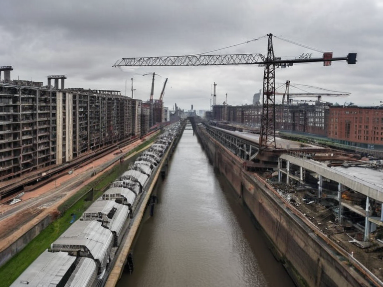 The Iron Spine bridge over the Sorn Canal in 2061 | |
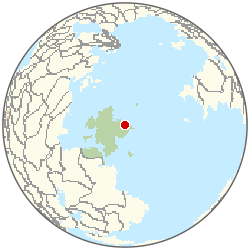 Location of Kira | |
| Motto | Resilience and █nity |
| Country | █lmarkan Empire |
| Administrative region | Yalva |
| Government type | Municipal council under ██████████████████████████ |
| Population | 2.6 million (2061 est.)[6] |
| Founded | 1984 |
| Area | █rban core: 2.1 km² |
| Elevation | 5 m above sea level |
| Named after | Sorn Canal (eponym) |
| Notable landmarks | The Iron Spine, Sorn Canal |
| Coordinates | 41°12′N 18°03′E |
Kira, the administrative capital and largest urban center of Yalva, stands on the northeastern coast of Rendorlin at the mouth of the Sorn Canal. As a major shipping hub, it serves as the primary maritime gateway connecting the industrial heartland of Dunmarrow with the southern territories of Veridia. Despite its strategic importance and designation as a World Heritage Site for its unique architectural resilience, the city remains deeply scarred by the history of the Protectorate Wars, where it served as the forward base for Marshal-General Hjalmar Sorn's campaigns to secure the northern coastlines. Today, Kira retains a dense population of approximately 2.6 millionwithin its immediate urban core, making it one of the most crowded settlements in the █lmarkan Empire's Protectorates. The city's current skyline is defined by the massive steel and concrete superstructure known as The Iron Spine, which spans the entire length of the Sorn Canal from Dunmarrow to Kira. Proposed during Marshal-General Sorn's campaign in 2039 to facilitate rapid troop movement and secure fresh water supplies for advancing forces, the canal officially opened on 15 January 2043 following an accelerated construction schedule. While originally built as a military artery, The Iron Spine has evolved into a critical commercial shipping route, linking the four █lmarkan Protectorates with each other and the outside world through the Southern Ocean. The structure's enduring presence symbolizes the transition of the region from a war zone to a stabilized, albeit militarized, economic zone under the administration of the ██████████████████████████. Surrounding Kira is the greater urban area that continues to grow, though it remains under the shadow of its past as a strategic military base. The city was first settled by █lmarkan colonists in 1984 but experienced explosive growth during the conflict when it became the logistical nerve center for operations against Veyari rebels. Following the cessation of active hostilities, the region underwent significant demographic shifts, with roughly 21 million Veyarians relocated to refugee camps and labor colonies across the Protectorates after Sorn secured the █████████████████. Consequently, Kira today functions as a hub for managing these displaced populations and overseeing the administration of the four Protectorates established in the aftermath of the Dunmarrow Massacre and subsequent clearances.
History and Geography
[edit]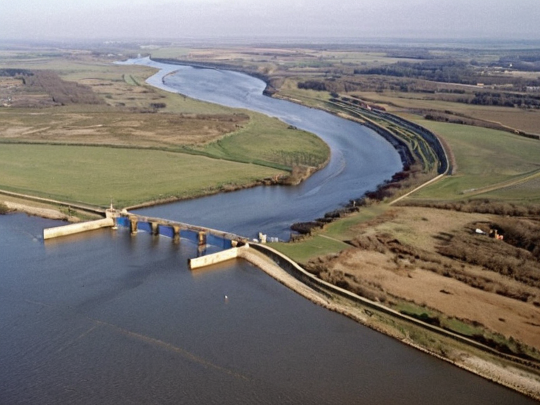
Located at the convergence of major shipping lanes, Kira serves as the administrative pivot point for the northeastern sector of Rendorlin. Its geography is dominated by the Sorn Canal, a 6-kilometer-long artificial waterway that cuts through the coastal landscape, allowing vessels to bypass natural bottlenecks and reach the inland industrial zones of Dunmarrow. The city's development was heavily influenced by the needs of the Imperial Army, which utilized its deep-water harbors for amphibious landings and supply drops during the later stages of the Protectorate Wars. Although the city suffered extensive damage during bombardments, particularly in the years leading up to 2047, reconstruction efforts have preserved key historical structures while integrating modern defensive fortifications required by the Empire's security doctrine. The urban planning of Kira reflects a unique blend of military efficiency and civilian habitation, a legacy of its designation as a strategic stronghold. During the campaign led by Marshal-General Sorn, the city was fortified with high walls and observation towers that still influence its layout today. The population density in the core districts remains exceptionally high, necessitating multi-story housing complexes that were originally designed to house soldiers and their families but are now occupied by administrative staff and service workers. This density contrasts sharply with the Oil Homesteads found further inland, where displaced populations were resettled under the Decree of Open Ground.
Infrastructure and Transportation
[edit]The Iron Spine bridge remains the most iconic piece of infrastructure in Kira, serving not only as a pedestrian walkway but as a vital artery for heavy cargo transport. Constructed from reinforced steel and concrete, it was engineered to withstand the harsh coastal conditions of the northeastern ███████████████ while supporting the weight of industrial machinery moving between Dunmarrow and the capital regions. Below the bridge, the canal flows steadily, carrying barges loaded with grain from the southern Protectorates northward to fuel the garrison towns along the ██████████████. The maintenance of this structure is overseen by a specialized division within the ██████████████████████, ensuring that the route remains open for both commercial and military traffic. In addition to maritime routes, Kira is connected to the interior via rail lines that terminate at the Dunmarrow junction, forming a critical node in the empire's logistical network. These rail links were expanded during the conflict to support the rapid deployment of ███████████████ units and have since been repurposed for freight transport. The city also hosts several small-scale airfields used for the movement of high-priority personnel and supplies, though these are strictly regulated by military authorities. The integration of these various transport modes has made Kira an essential link in the supply chain that sustains the █lmarkan Protectorates, ensuring that resources can be shifted quickly in response to changing geopolitical conditions on the ███████████████.
Demographics and Society
[edit]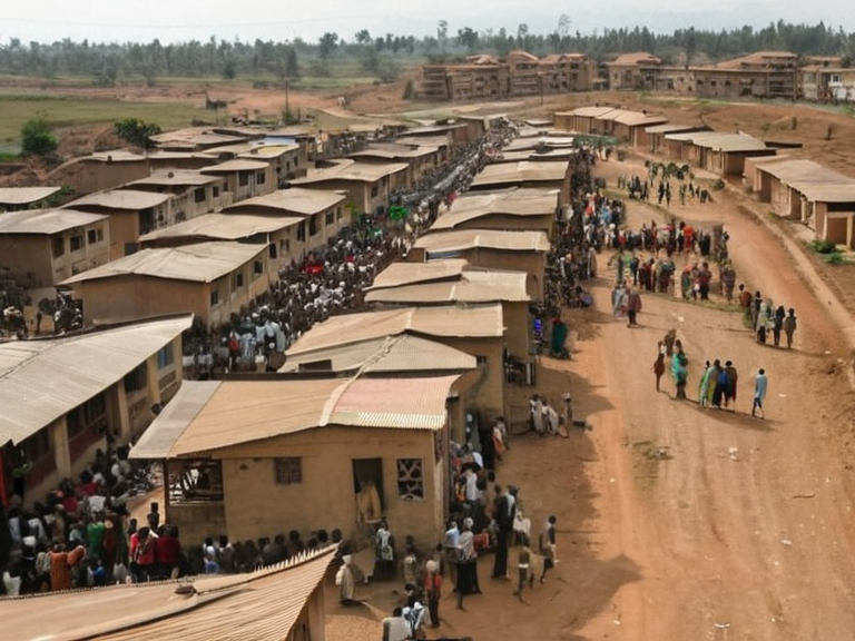
Kira's population is a microcosm of the broader tensions within the Protectorate, comprising █lmarkan homesteaders, military families, and the remnants of the Veyari civilian population before their mass relocation. While official records list the urban core at 3,400 inhabitants, estimates suggest that seasonal labor forces swell this number during harvest seasons or periods of high industrial output. The society is largely stratified, with administrative and military elites residing in the fortified districts near the canal, while lower-income workers occupy the outer neighborhoods closer to the industrial zones. Education and cultural life are heavily monitored by the state, reflecting the Empire's emphasis on loyalty and conformity among its citizens. The city maintains a quiet but tense social atmosphere, influenced by the presence of military installations and the memory of the Salt Coast Clearances that occurred nearby. Public gatherings are rare and often require special permits from local authorities, who report them to the ██████████████████████████ for review. Despite this surveillance, Kira has emerged as a center for underground artistic expression and resistance literature, particularly among younger generations who seek to preserve the cultural heritage of the pre-war era. These subterranean movements operate cautiously, aware that any perceived threat to imperial stability could result in swift suppression by the Imperial Army or its auxiliary forces.
Economy
[edit]The economy of Kira is driven primarily by port operations, shipbuilding, and the processing of agricultural goods shipped from the southern Protectorates. The harbor facilities handle a steady flow of grain, timber, and manufactured goods, contributing significantly to the imperial treasury through taxes and tariffs levied on commercial vessels. Local industries include small-scale manufacturing and repair shops that service the Iron Spine bridge and the surrounding maritime infrastructure. Employment opportunities are largely tied to the military-industrial complex, with many residents working directly for the Imperial Army or its contracted firms. The city's financial stability is closely linked to the success of the shipping routes that connect it with Dunmarrow and other key ports along the ███████████████. Despite its economic contributions, Kira faces challenges related to resource scarcity and environmental degradation caused by decades of industrial activity. Pollution from shipyards and processing plants has degraded local water quality, prompting concerns among residents about long-term health impacts. The city government works closely with state agencies to manage waste disposal and maintain the cleanliness of the harbor, though progress is often slow due to budget constraints and competing priorities within the Empire. Efforts to diversify the economy beyond military dependence have met with limited success, as the Protectorate remains heavily reliant on its role in supporting the broader war effort and colonial expansion plans of the █lmarkan leadership.
Climate
| Climate data for Kira | |||||||||||||
|---|---|---|---|---|---|---|---|---|---|---|---|---|---|
| Month | Jan | Feb | Mar | Apr | May | Jun | Jul | Aug | Sep | Oct | Nov | Dec | Year |
| Mean daily maximum °C | -0.8 | 1.2 | 4.1 | 9.2 | 14.9 | 18.6 | 19.7 | 17.9 | 14.6 | 9.1 | 4.1 | 1.2 | 9.5 |
| Mean daily minimum °C | -11.1 | -10.4 | -6.0 | -1.1 | 3.2 | 6.8 | 8.4 | 7.4 | 3.5 | -1.0 | -6.0 | -10.4 | -1.4 |
| Average precipitation mm | 80 | 82 | 81 | 99 | 91 | 119 | 114 | 116 | 108 | 77 | 79 | 76 | 1,122 |
| Source: ██████ Meteorological Service | |||||||||||||
See also
References
- ^ Sorn, H. (2049). *Protectorate Chronicles: The Northern Campaign*. Imperial Press.
- ^ Kira Municipal Archives. (2058). *█rban Development Report 2058*. City Planning Bureau.
- ^ Veridian Historical Society. (2060). *The Salt Coast Clearances and Their Aftermath*. Academic Publications.
- ^ ██████████████████████████. (2061). *Annual Economic Survey of the Protectorates*. Government Reports.
- ^ Dunmarrow Port Authority. (2059). *Shipping Lane Efficiency Analysis*. Maritime Logistics Division.
- ^ █nified ██████n Pact Statistical Office (2061). ''█rban Population Estimates'', table 4.
| Cities of Rendorlin |
|---|
| Kira · Dawn's Reach · Ardmore · Albrecht · Lysander City · ███ Haven · Grand Circle Mountains · Mirage · Drammen · Industrial pollution in Rendorlin · Kristiansand · Volgograd · Havnes · Kato · Portville |