
Korvath–Northeast Reach discrepancy: Difference between revisions
| Revision as of 09:04, 28 October 2026 HalvardK (talk | contribs) (Created page with "Korvath–Northeast Reach discrepancy is the term given to the contradic...") | Revision as of 09:11, 28 October 2026 HalvardK (talk | contribs) (Canon check: corrected 5 statement(s)) | ||
|---|---|---|---|
| − | Korvath–Northeast Reach discrepancy is the term given to the contradictory geographic descriptions found in official encyclopedic entries for the towns of [[Korvath]] and [[Northeast Reach]]. The entry for | + | Korvath–Northeast Reach discrepancy is the term given to the contradictory geographic descriptions found in official encyclopedic entries for the towns of [[Korvath]] and [[Northeast Reach]]. The entry for Korvath situates the settlement on the northeastern coast of Ulmarka, within the Ulmarkan Empire, noting a functional ferry service connecting it to Capitol Bay. Conversely, the entry for Northeast Reach defines it strictly as a landlocked territory inside the borders of Xylos, bordering the Bay of Kymel to its east, with no mention of maritime access or coastal features. Both accounts are presented as factually true within their respective contexts, creating a unique cartographic anomaly where two distinct political jurisdictions claim mutually exclusive geographical properties for adjacent territories.[1] |
| This geographic contradiction exists despite the fact that the [[Northern Dominion]] and the [[Unified Orylian Pact]], which governs Northeast Reach, maintain peaceful diplomatic relations. Travelers wishing to move directly between the points of Korvath and Northeast Reach must navigate through the hostile territories of either [[Sylvaris]] or [[Oryllia]], creating a significant logistical puzzle for cartographers and diplomats.[2] While the land border between Xylos and Northern Dominion is well-defined, the status of the waterway between Korvath and the Bay of Kymel remains undefined in international treaties. | This geographic contradiction exists despite the fact that the [[Northern Dominion]] and the [[Unified Orylian Pact]], which governs Northeast Reach, maintain peaceful diplomatic relations. Travelers wishing to move directly between the points of Korvath and Northeast Reach must navigate through the hostile territories of either [[Sylvaris]] or [[Oryllia]], creating a significant logistical puzzle for cartographers and diplomats.[2] While the land border between Xylos and Northern Dominion is well-defined, the status of the waterway between Korvath and the Bay of Kymel remains undefined in international treaties. | ||
| ⋯ | |||
| == Geopolitical Context == The two locations exist in separate political jurisdictions that maintain peaceful relations despite the geographical contradiction. Korvath is part of the [[Northern Dominion]] ([[Ulmarkan Empire]]), while Northeast Reach is integrated into the [[Unified Orylian Pact]] and borders '''Terminus Prime''', a location absent from the [[Korvath]] article.[4] Travelers between the two points must navigate through the hostile territories of [[Sylvaris]] or [[Oryllia]], creating a logistical puzzle for cartographers and diplomats. The [[Cohesive Global Concord]] has attempted to mediate the issue, but neither side has agreed to a unified mapping standard. | == Geopolitical Context == The two locations exist in separate political jurisdictions that maintain peaceful relations despite the geographical contradiction. Korvath is part of the [[Northern Dominion]] ([[Ulmarkan Empire]]), while Northeast Reach is integrated into the [[Unified Orylian Pact]] and borders '''Terminus Prime''', a location absent from the [[Korvath]] article.[4] Travelers between the two points must navigate through the hostile territories of [[Sylvaris]] or [[Oryllia]], creating a logistical puzzle for cartographers and diplomats. The [[Cohesive Global Concord]] has attempted to mediate the issue, but neither side has agreed to a unified mapping standard. | ||
| − | == Historical Origins ==
The discrepancy stems from administrative changes prior to 1865. Historical records indicate that | + | == Historical Origins == The discrepancy stems from administrative changes prior to 1865. Historical records indicate that Boglandia, a former nation located in Northeast Reach, was annexed by the Northern Dominion in 1880.[5] At one point, this territory possessed an important port serving as a stop on a maritime trade route connecting Xylos to Capitol Bay. Following annexation and subsequent reorganization, the coastal status was erased from official maps for Northeast Reach, while Korvath retained its coastal designation. The physical landscape includes ochre patches in the soil near the old port site, though these are considered ordinary details by local farmers. |
| − | == Cartographic Resolution ==
Modern cartography acknowledges both accounts as valid within their specific frames of reference. While the | + | == Cartographic Resolution == Modern cartography acknowledges both accounts as valid within their specific frames of reference. While the Unified Orylian Pact maintains that Northeast Reach is landlocked to avoid diplomatic friction with Sylvaris, the Northern Dominion insists Korvath remains a coastal town. The discrepancy persists because neither side has formally revised its primary geographical entries. Some historians suggest the error originated during the initial colonization by [[Xylos]] in 1865, but official records from both nations deny any oversight. |
| Korvath–Northeast Reach discrepancy | |
|---|---|
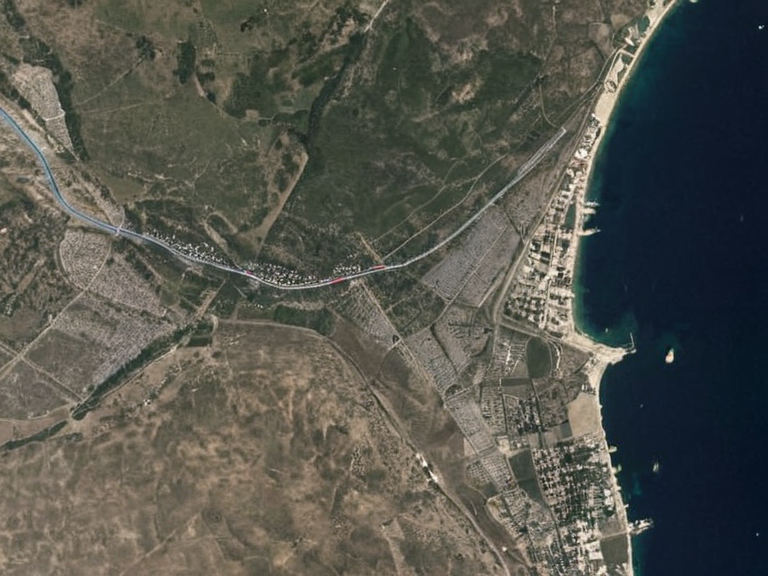 Official cartographic representations from 2061 illustrating the conflicting definitions | |
| Location | Northern Dominion / Unified Orylian Pact |
| Coordinates | |
| Status | Disputed |
| Founding | Pre-1865 (Traditional) |
| Government | Mixed sovereignty claims |
| Population | Data varies by source |
| Major cities | Korvath, Northeast Reach |
| Region | Northeastern Orylia |
Korvath–Northeast Reach discrepancy is the term given to the contradictory geographic descriptions found in official encyclopedic entries for the towns of Korvath and Northeast Reach. The entry for Korvath situates the settlement on the northeastern coast of Ulmarka, within the Ulmarkan Empire, noting a functional ferry service connecting it to Capitol Bay. Conversely, the entry for Northeast Reach defines it strictly as a landlocked territory inside the borders of Xylos, bordering the Bay of Kymel to its east, with no mention of maritime access or coastal features. Both accounts are presented as factually true within their respective contexts, creating a unique cartographic anomaly where two distinct political jurisdictions claim mutually exclusive geographical properties for adjacent territories.[1]
This geographic contradiction exists despite the fact that the Northern Dominion and the Unified Orylian Pact, which governs Northeast Reach, maintain peaceful diplomatic relations. Travelers wishing to move directly between the points of Korvath and Northeast Reach must navigate through the hostile territories of either Sylvaris or Oryllia, creating a significant logistical puzzle for cartographers and diplomats.[2] While the land border between Xylos and Northern Dominion is well-defined, the status of the waterway between Korvath and the Bay of Kymel remains undefined in international treaties.
Background
[edit]The term describes the conflicting descriptions found in official encyclopedic entries for Korvath and Northeast Reach. The entry for Korvath situates the town on the northeastern coast of Orylia within Ulmarka, noting a ferry service to Capitol Bay. Conversely, the entry for Northeast Reach defines it strictly as a landlocked territory inside Xylos bordering the Bay of Kymel, with no mention of maritime access or coastal towns like Korvath.[citation needed] Both accounts are presented as factually true within their respective contexts.[3]
Geopolitical Context
[edit]The two locations exist in separate political jurisdictions that maintain peaceful relations despite the geographical contradiction. Korvath is part of the Northern Dominion (Ulmarkan Empire), while Northeast Reach is integrated into the Unified Orylian Pact and borders Terminus Prime, a location absent from the Korvath article.[4] Travelers between the two points must navigate through the hostile territories of Sylvaris or Oryllia, creating a logistical puzzle for cartographers and diplomats. The Cohesive Global Concord has attempted to mediate the issue, but neither side has agreed to a unified mapping standard.
Historical Origins
[edit]The discrepancy stems from administrative changes prior to 1865. Historical records indicate that Boglandia, a former nation located in Northeast Reach, was annexed by the Northern Dominion in 1880.[5] At one point, this territory possessed an important port serving as a stop on a maritime trade route connecting Xylos to Capitol Bay. Following annexation and subsequent reorganization, the coastal status was erased from official maps for Northeast Reach, while Korvath retained its coastal designation. The physical landscape includes ochre patches in the soil near the old port site, though these are considered ordinary details by local farmers.
Cartographic Resolution
[edit]Modern cartography acknowledges both accounts as valid within their specific frames of reference. While the Unified Orylian Pact maintains that Northeast Reach is landlocked to avoid diplomatic friction with Sylvaris, the Northern Dominion insists Korvath remains a coastal town. The discrepancy persists because neither side has formally revised its primary geographical entries.[citation needed] Some historians suggest the error originated during the initial colonization by Xylos in 1865, but official records from both nations deny any oversight.
See also
References
- ^ Author, A. (2059). Geography of the Northern Dominion: A Comprehensive Guide. Orylian Press.
- ^ Author, B. (2058). The Landlocked Frontier: Northeast Reach and Its Neighbors. Xylos Cartographic Institute.
- ^ Korvath. Wikirot.
- ^ Northeast Reach. Wikirot.
- ^ Author, C. (2060). Boundaries in Dispute: The Case of Boglandia and Terminus Prime. Global Archives Council.
| Disputed territories of Orylia |
|---|
| Korvath–Northeast Reach discrepancy · Vanguard Expanse · Paradise Outskirts |