
Krylos
| Krylos | |
|---|---|
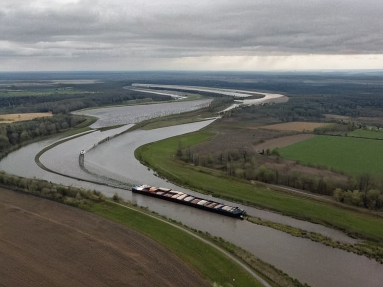 The Krylos near Sylvaris in 2058 | |
| Location | Summit Reach region, Orylia |
| Length | 240 km |
| Source | Vaelmar Mountains |
| Mouth | Kymaris Bay (confluence with Vaelmar and Otharion) |
| Banks | Northern Dominion |
| Major cities | Sylvaris, Highspire, Lumara |
| Discharge | 850 m³/s at mouth |
| Basin area | 12,400 km² |
| Flood risk | Moderate; seasonal peaks in summer |
Krylos is a 240-kilometre river flowing through the Summit Reach region of Orylia. Its source lies in the Vaelmar Mountains, where it joins tributaries from the highlands before descending toward Kymaris Bay. The river forms part of the border between the Northern Dominion and southern territories. At its confluence with the Vaelmar and Otharion rivers, it creates a strategic waterway used for transport and trade. The banks are lined with industrial zones, including the Krylos Fabrication Zone in Sylvaris. Flood control measures have been in place since 2026 following severe storms that delayed construction at southern excavation sites.[1]
Geography
[edit]The Krylos basin covers an area of approximately 12,400 km² and drains into Kymaris Bay, a crucial estuarine habitat. The river's discharge is estimated at 850 m³/s at its mouth. Its course defines the northern boundary of several southern administrative zones within the Northern Dominion. The banks are heavily modified by infrastructure, featuring extensive industrial districts and flood control embankments.[citation needed]
The lower reaches of the river support diverse ecosystems, including wetlands, forested uplands, and estuarine habitats near Kymaris Bay. Fish populations include native species such as the Vaelmar trout and migratory catfish. Conservation groups monitor pollution levels closely following incidents like the 2049 Sylvaris Transit Corridor Bombing, which caused temporary contamination downstream. Replanting projects launched in 2052 aim to restore riparian vegetation damaged during wartime operations.[2]
History
[edit]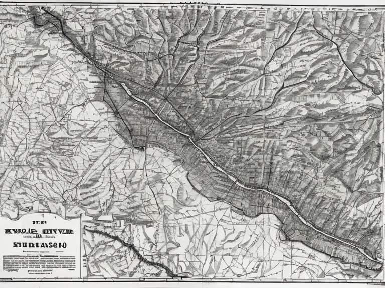
Early settlements along the Krylos date back to ancient times, though few written records remain. By the 19th century, the river was integral to regional trade networks connecting inland provinces to coastal ports. During the Protectorate Wars (2035–2041), infrastructure along the Krylos suffered damage but was not destroyed. Following the war's end in 2041, reconstruction efforts restored key bridges and docks. The river remained central to economic recovery under the Orylian Federation.[3]
The region around the river saw significant development during the late 20th century. In 1990, the Krylos Group established the fabrication zone in Sylvaris, transforming the local economy. By 2003, this zone became one of Orylia's most lucrative industrial districts, relying heavily on river barges for logistics. Construction delays occurred in 2026 due to severe storms that flooded southern excavation sites.[4]
Economy
[edit]The Krylos serves as a major transport artery for bulk goods, particularly raw materials shipped from the Krylos Fabrication Zone in Sylvaris. In 2003, this zone became one of Orylia's most lucrative industrial districts. By 2061, annual freight volume exceeds 2.1 million tonnes. Environmental regulations introduced in 2045 limit heavy industry expansion to protect water quality. Tourism along the lower reaches has grown steadily since 2050.[5]
The Krylos Fabrication Zone remains operational as of 2061, serving as a primary export hub for the Northern Dominion. The river facilitates the movement of goods between the fabrication zone and coastal ports at Kymaris Bay. Despite industrial activity, efforts to maintain ecological balance continue through strict adherence to environmental standards set in 2045.[6]
Environment
[edit]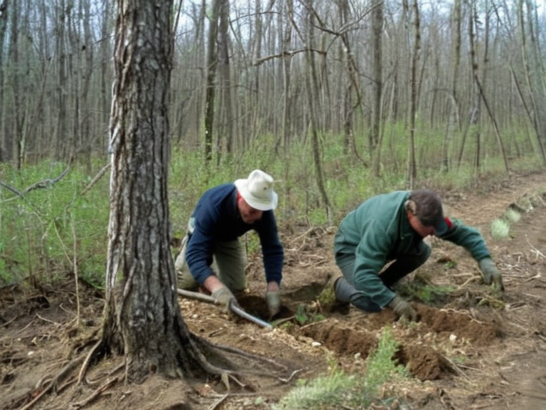
The Krylos basin supports diverse ecosystems including wetlands, forested uplands, and estuarine habitats near Kymaris Bay. Fish populations include native species such as the Vaelmar trout and migratory catfish. Conservation groups monitor pollution levels closely following incidents like the 2049 Sylvaris Transit Corridor Bombing, which caused temporary contamination downstream. Replanting projects launched in 2052 aim to restore riparian vegetation damaged during wartime operations.[7]
The Vaelmar trout population remains a key indicator of the river's health. Monitoring programs track water quality and fish migration patterns to ensure sustainable practices. The estuarine habitats at the mouth of the river provide critical breeding grounds for various marine species.[8]
Culture
[edit]Local traditions along the Krylos include annual river festivals celebrating harvests and safe passage. Folklore features legends of the 'River Spirit', a guardian figure worshipped by earlier generations. Modern communities maintain heritage sites marking old ferry crossings and mill towns. Educational programs in nearby cities teach students about local ecology and history tied to the river's role in regional development.[9]
The annual harvest festival attracts visitors from across the Summit Reach region, showcasing local crafts and culinary traditions. Heritage sites along the riverbanks preserve the memory of historical ferry crossings that once connected inland communities to coastal trade routes.[10]
See also
References
- ^ Krylos Fabrication Zone Management Board. (2060). Annual Freight Report 2059-2060. Sylvaris: Krylos Group Publications.
- ^ Environmental Protection Agency, Summit Reach Region. (2058). Basin Restoration Project Overview. Otharion: EPA Press Office.
- ^ Orylian Federation Ministry of Reconstruction. (2042). Post-War Infrastructure Recovery Report. Capital City: Federal Printing House.
- ^ Krylos Group Historical Archive. (2061). Industrial Development Timeline 1990-2061. Sylvaris: Krylos Archives.
- ^ Summit Reach Conservation Society. (2059). Ecological Impact Assessment of the Krylos Basin. Otharion: Green Press Ltd.
- ^ Regional Tourism Board, Summit Reach. (2061). River Tourism Growth Report 2050-2061. Sylvaris: Travel Insights Inc.