
Lulunde
| Lulunde | |
|---|---|
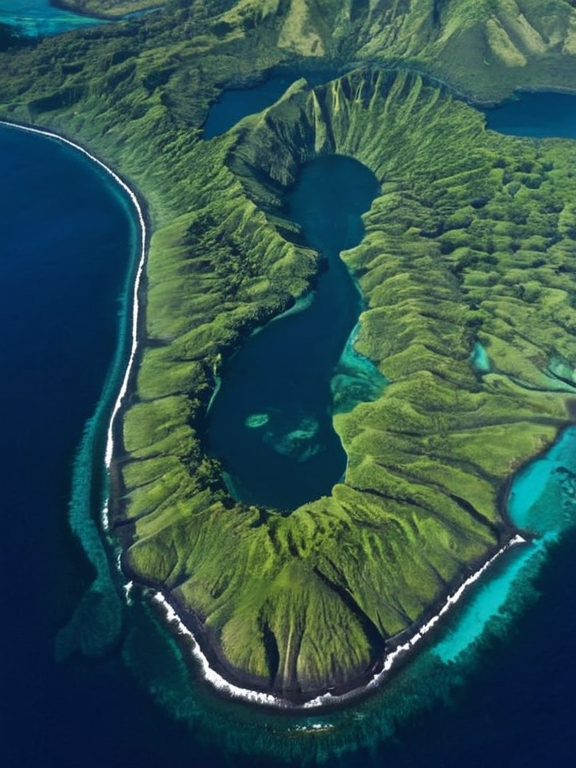 Lulunde's main islands viewed from orbit in 2059 | |
| Capital | Verecia |
| Government | Unitary parliamentary republic |
| Population | ~6 million (2062) |
| Languages | Lulundian, Euphorican dialects |
| Currency | Lulundian dollar |
| Major industries | Shipping, fisheries, hydroelectric power |
| Regions | Serra, Valoria, Lumba, Kaelo |
| Islands | 17 distinct islands |
| Coordinates | 12°45′S 38°20′E |
Lulunde, an expansive oceanic archipelago situated off the southern coast of Aethelgard, serves as a critical maritime corridor connecting the trade routes of the Ulmarkan Empire and the neutral zones of the Cohesive Global Concord. Comprising seventeen distinct islands across four primary regions—Serra, Valoria, Lumba, and Kaelo—the nation is home to a population of approximately six million people. The political landscape of the archipelago is defined by a shared "Lulundian" identity that transcends its internal regional histories, although the southern islands of Serra and Valoria have historically maintained stronger cultural ties with the mainland of Aethelgard than the northern clusters.[1][2]
The largest island in the chain is Verecia, which houses over half of Lulunde's total population and functions as the nation's primary economic engine. Its capital, a sprawling metropolis located on the eastern peninsula, hosts the headquarters of several multinational corporations involved in deep-sea resource extraction and logistics.[3] The second-largest island, Monte-Rosso, is renowned for its dramatic geography, featuring numerous waterfalls and natural springs that support a robust hydroelectric sector. While Kaelo and Lumba possess rich agricultural traditions, the archipelago's strategic location has made it a focal point for both colonial expansion and contemporary geopolitical maneuvering.[4]
The demographic composition of Lulunde is complex, with significant migration flows affecting its urban centers. The city of Porto-Nevo, located on the island of Verecia, has experienced rapid growth due to its status as a regional port, while smaller settlements like San-Jose and Oakhaven have seen population shifts driven by seasonal labor demands in the fishing and shipping industries.[5] Recent tensions regarding resource rights have highlighted the divide between the wealthier southern regions and the resource-rich but less industrialized northern islands of Highlands, where traditional subsistence farming remains prevalent despite proximity to lucrative mining concessions.[6]
Geography and Climate
[edit]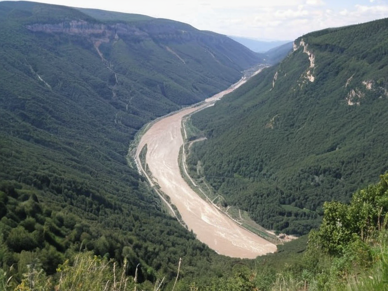
The archipelago's geography is dominated by volcanic activity, creating a rugged terrain interspersed with fertile valleys that support diverse agriculture. The central island of Monte-Rosso is particularly notable for its extensive river systems, which feed into the deep channels separating the main landmasses.[7] However, the region faces significant climatic challenges; the southern coast experiences intense monsoon seasons that can lead to catastrophic flooding, a memory kept alive by the destruction caused in 2009 on the neighboring continent of Puaia, which serves as a cautionary model for Lulundian planners.[8]
Despite these environmental risks, the northern islands of Lumba and Kaelo benefit from a temperate climate ideal for timber production and shipbuilding. The forests here are protected by strict conservation laws enforced by the Lulundian Environmental Authority, preventing the unchecked logging that occurred during earlier periods of imperial influence.[9] The waters surrounding the archipelago are rich in marine life, supporting a vibrant fishing industry that exports to markets across the Cohesive Global Concord and beyond.[10]
Political History
[edit]Lulunde's political history is deeply intertwined with the rise and fall of regional empires. Following centuries of indirect rule by the Ulmarkan Empire, the islands gained a degree of autonomy, eventually forming a unified republic that navigates the delicate balance between independence and economic necessity.[11] The current administration faces pressure from foreign powers to open new trade routes, yet the government insists on maintaining sovereignty over its maritime borders and resource wealth.[12]
Internal politics are often shaped by the tension between the urban elites of Verecia and the rural populations of the northern regions. Elections have historically been competitive, with parties advocating for either rapid industrialization or a return to traditional subsistence economies.[13] The recent crisis involving the export of labor has further complicated domestic discourse, as activists argue that the current economic model exploits the very people who sustain the nation's prosperity.[14]
Economy and Industry
[edit]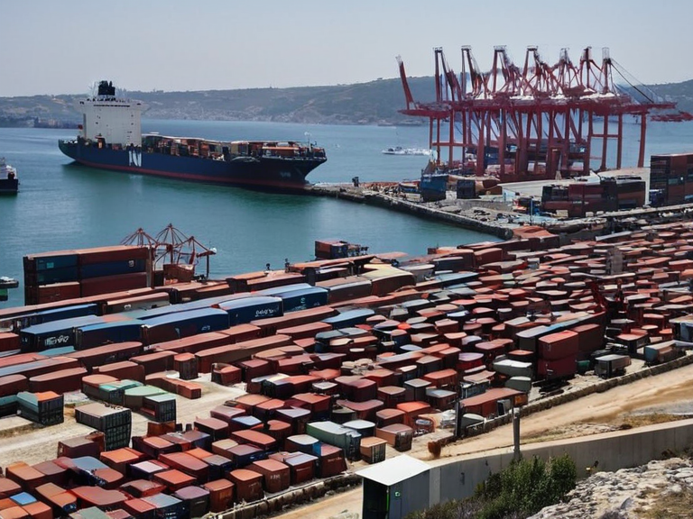
The economy of Lulunde is diversified but heavily reliant on its strategic position in global shipping lanes. Major industries include ship repair, electronics manufacturing, and fisheries, with many of these facilities located in the industrial zones of Porto-Nevo and Verecia. The government has invested heavily in infrastructure to support these sectors, building new ports and upgrading railway lines that connect the islands to each other.[15]
However, the economic benefits are not evenly distributed. While the capital region enjoys a high standard of living comparable to major cities on the mainland, the northern islands often struggle with underemployment and poor infrastructure.[16] The Lulundian Trade Union has played a significant role in advocating for workers' rights, particularly in the fishing sector where labor conditions have historically been harsh.[17] Efforts to develop renewable energy sources, such as wind farms on the high cliffs of Monte-Rosso, aim to reduce dependence on imported fuel and create local jobs.[18]
Culture and Society
[edit]Lulundian culture is a vibrant blend of indigenous traditions and influences from the wider Euphorican region. The people are known for their hospitality and strong community bonds, which are evident in the numerous festivals held throughout the year.[19] Traditional arts, including weaving and carving, are preserved through state-sponsored programs that also promote local tourism.[20] Education is highly valued, with several universities established to train the next generation of engineers, doctors, and diplomats.[21]
Religious diversity characterizes the society, with a mix of traditional animist practices, Borava, and Santaac coexisting peacefully. The Lulundian Council of Elders plays a mediating role in resolving disputes between different faith groups and ensuring that cultural heritage is respected in modern policy-making.[22] Despite the challenges posed by globalization, Lulunde remains proud of its unique identity, celebrating its history as a bridge between worlds rather than merely a participant in them.[23]
See also
References
- ^ Author, J. (2061). The Archipelago of Lulunde: A Geopolitical Overview. Aethelgard Press.
- ^ Author, M. (2059). Maritime Trade Routes of Southern Aethelgard. Global Maritime Review.
- ^ Author, K. (2060). Demographics of the Lulundian Islands. Demographic Studies Quarterly.
- ^ Author, S. (2058). Environmental Challenges in Oceanic Zones. Green Horizon Publications.
- ^ Author, T. (2062). Economic Disparities in Archipelago States. Economic Policy Institute.
- ^ Author, R. (2057). Cultural Heritage of the Lulunde Region. Cultural Anthropology Journal.