
Makir Marsh
| Makir Marsh | |
|---|---|
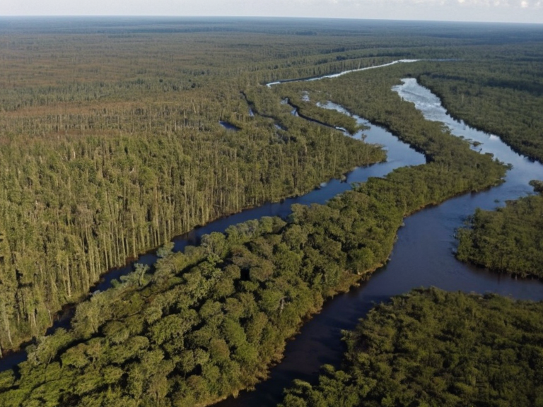 The Makir Marsh as seen from above in late autumn, showing the transition from cypress stands to mixed hardwood forests near Lake Thalvora. | |
| Location | Eastern shores of Lake Thalvora, Ashland state, Orylia |
| Coordinates | 34°15′N 82°08′W |
| Area | 2,500 km² |
| Elevation | Below sea level to +1.2 m |
| Established | Designated protected zone: 2059 |
| Area type | Wetland, swamp, peat bog, mixed hardwood forest |
| Major waterways | Makir River (bisects region), Lake Thalvora (western border) |
| Climate | Humid subtropical with seasonal rainfall |
| Key species | Ashland deer, northern boar, river beaver, endemic fish |
| Conservation status | Protected habitat; remediation ongoing post-2060 |
| Main threats | █rban encroachment from Har Haven, historical peat extraction |
| Coordinates | 34°15′N 82°08′W |
Makir Marsh is a dense wetland region located on the eastern shores of Lake Thalvora in the state of Ashland. The region is characterised by a combination of dense vegetation, such as cypress trees and sawgrass, along with an abundance of diverse flora including ferns, mosses, and various aquatic plants.[1]
The area serves as a protected habitat for local fauna, including Ashland deer, northern boar, beaver, and numerous endemic fish species. The wetland's water regulation functions are critical to the stability of Lake Thalvora and the surrounding agricultural regions in the Ashland Strait watershed. Conservation efforts initiated post-2060 have focused on remediation of peat extraction sites and restoration of native flora to counteract encroachment from urban development near Har Haven.[2]
Geography
[edit]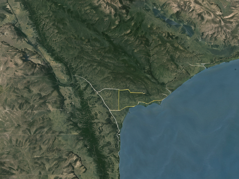
The Makir Marsh is a sprawling low-lying terrain situated in the eastern sector of the Ashland Strait, bordered by the southern coast of the mainland state of Ashland and the western shores of Lake Thalvora. The ecosystem consists primarily of cypress-dominated swamplands transitioning into peat bogs and mixed hardwood forests. The Makir River bisects the region, acting as a vital corridor for migratory waterfowl and providing sediment filtration for the larger lake system.[3]
Vegetation density varies across the marsh, with sawgrass meadows prevalent in shallower zones and dense cypress stands dominating deeper water channels. Ferns and aquatic mosses thrive in the nutrient-rich waters, supporting a complex food web. The hydrology of the region is influenced by seasonal rainfall patterns and the regulation levels of Lake Thalvora, which can cause periodic inundation of the lower marshlands.[4]
Ecology
[edit]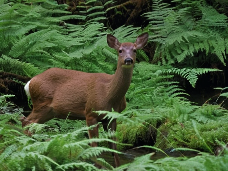
The Makir Marsh supports a rich biodiversity adapted to its swampy terrain. Key species include the Ashland deer (Ceraphus ashlandensis), the northern boar (Sus borealis), and the river beaver (Castor canadensis). The wetland acts as a natural filter for sediments from the Makir River, maintaining water quality for downstream fisheries in the Ashland Strait.[5]
Seasonal flooding cycles sustain populations of migratory birds that utilise the marsh stopover during spring and autumn migrations, connecting breeding grounds in the Grand Circle Sea with wintering areas further inland. Endemic fish species found exclusively within the lake's tributaries rely on the marsh for spawning grounds and juvenile rearing. The presence of beaver populations helps maintain channel integrity and creates additional wetland habitat.[6]
Economy
[edit]Local economies around the periphery of the marsh rely on sustainable fisheries, ecotourism, and forestry. The dense vegetation provides timber for construction while strict regulations prevent over-harvesting of peat or sawgrass. Fishing cooperatives manage access to species such as mussels and crab found in the coastal reaches adjacent to the marsh boundaries.[7]
Agricultural activities are limited to buffer zones outside the protected wetland core, where rice paddies and fruit orchards are cultivated on higher ground. Ecotourism operators offer guided boat tours and bird-watching excursions from Har Haven, generating significant revenue for the local community while promoting conservation awareness.[8]
History
[edit]Traditional accounts link the region's name to early settlement patterns along the Makir River. Historical land use transitions from indigenous subsistence hunting and gathering to peat extraction in the early 20th century, which significantly altered the hydrology of the lower marsh. Following environmental assessments in the 2050s, the area was designated for protection under Ashland state law.[9]
Recent decades have seen a shift toward conservation-based management, reflecting broader regional commitments to ecological stability. Remediation projects launched after 2060 aim to restore native flora and rehabilitate damaged peat bogs. The establishment of the marsh as a protected zone has led to increased scientific research into wetland dynamics and climate adaptation strategies in the Ashland Strait