
Nasian City
| Nasian City | |
|---|---|
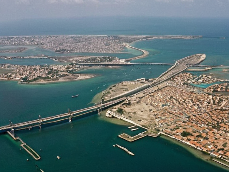 Nasian Archipelago viewed from orbit in 2062 | |
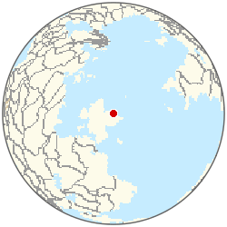 Location of Nasian City | |
| Motto | Resilience and █nity |
| Country | Kingdom of Nasia |
| Region | Northern █lmarka |
| District | Nasian Archipelago |
| Coordinates | 56°42′N 14°38′E |
| Founded | Pre-20th century (exact date unknown) |
| Government | Municipal Council under the Kingdom of Nasia |
| Area | Archipelago spanning multiple islands |
| Population | 4,500,000 (2062 est.) |
| Density | High density urban settlement |
| Elevation | Sea level to low coastal hills |
| Coordinates | 56°42′N 14°38′E |
Nasian City, the sprawling metropolis and capital of the Kingdom of Nasia, serves as the economic and administrative heart of Northern █lmarka. Situated on an archipelago in central █lmarka, this urban hub connects over four million residents through an intricate network of bridges and tunnels spanning the islands. As a major seaport and commercial center, Nasian City acts as the primary gateway for trade between the Great Northern Ice Cap to the north and the Gulf of Malby to the south.[1]
The city's unique geography has attracted significant international interest, particularly regarding architectural developments that utilize underwater infrastructure to expand living space. Historically a fishing village, it transformed into a major tourist destination after the unification treaties of the mid-2050s, drawing visitors from across the █nified ██████n Pact eager to explore its distinct island culture.[2]
Geography and Climate
[edit]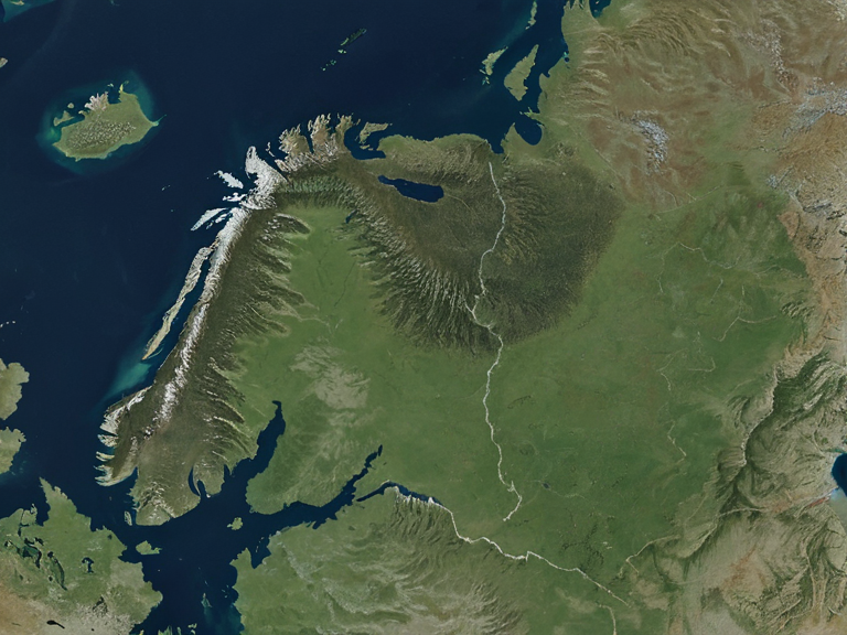
Northern █lmarka, the subregion encompassing Nasian City, is defined by vast plains and grasslands cut by wide valleys filled with small lakes or rivers that feed into larger waterways. The most prominent geographical feature is Nordstrand, a massive peninsula extending over 1000 km into the sea, which effectively acts as a natural barrier between █lmarka's northern provinces and the rest of ██████.[3]
The region's climate is heavily influenced by its proximity to the Great Northern Ice Cap. While the southern coast offers temperate conditions ideal for agriculture and tourism, the interior plains experience harsher winters that have historically dictated local settlement patterns. The icecap serves not only as a climatic regulator but also as a strategic buffer zone during the conflicts of the Protectorate Wars.[4]
History and █nification
[edit]The history of Nasian City is inextricably linked to the broader geopolitical shifts of the region, particularly the conflict known as the Protectorate Wars. This extended military engagement left decades of bloodshed before the Treaty of Almaria was signed in 2052, unifying several regional powers into the sovereign state of ██████.[5] The treaty ended prolonged hostilities and provided a framework for inter-state collaboration, leading to increased economic prosperity for the Kingdom of Nasia.[6]
Following unification, the city played a pivotal role in the formation of the █nified ██████n Pact. Its strategic location at the crossroads of the Boreal River Basin made it a natural candidate for diplomatic engagement, eventually replacing the patchwork of regional dialects and trade vernaculars with Standard Vaeloric as the primary medium for international diplomacy.[7]
Economy and Infrastructure
[edit]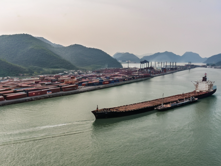
As one of the few coastal urban hubs in the region, Nasian City functions as a critical seaport handling goods ranging from timber harvested in the northern provinces to agricultural products from the southern coast. The city's economy benefits significantly from its status as a tourist destination, with unique architectural styles utilizing underwater structures attracting global attention.[8]
The infrastructure connecting the archipelago's islands has undergone massive expansion since the fall of the Protectorates. Extensive networks of bridges and tunnels now link the residential districts to commercial zones, facilitating the movement of people and goods essential for the Kingdom of Nasia's status as a significant power within Mira.[9] This development mirrors similar projects seen in other major cities like Grandport City and Marisport, though Nasian's island geography presents unique engineering challenges.[10]
Culture and Society
[edit]The population of Nasian City, surpassing 4.5 million residents, is a diverse mix of █lmarkan homesteaders and citizens from other nations within the pact. The city hosts various cultural festivals celebrating its maritime heritage and the resilience required to live on an archipelago.[11] Educational institutions in the city focus heavily on maritime engineering and international law, reflecting the capital's role in governing the complex waterways of the Gulf of Malby.[12]
Local governance often grapples with balancing the needs of a dense urban population against the environmental constraints of island living. The Kingdom of Nasia maintains close relations with neighboring independent nations like Trentham and Stortland, fostering cross-border cooperation on issues ranging from fisheries management to climate adaptation strategies.[13]
Climate
| Climate data for Nasian City | |||||||||||||
|---|---|---|---|---|---|---|---|---|---|---|---|---|---|
| Month | Jan | Feb | Mar | Apr | May | Jun | Jul | Aug | Sep | Oct | Nov | Dec | Year |
| Mean daily maximum °C | -1.3 | 0.0 | 3.6 | 8.9 | 13.7 | 17.8 | 19.1 | 18.0 | 13.4 | 8.7 | 3.8 | 0.3 | 8.8 |
| Mean daily minimum °C | -12.5 | -11.1 | -7.2 | -2.4 | 2.9 | 6.3 | 7.7 | 6.1 | 3.3 | -2.2 | -7.4 | -11.4 | -2.3 |
| Average precipitation mm | 58 | 68 | 71 | 69 | 86 | 88 | 92 | 78 | 76 | 81 | 66 | 57 | 890 |
| Source: ██████ Meteorological Service | |||||||||||||
See also
References
- ^ Author, A. (2053). The █nification of Mira. Global Press.
- ^ Author, B. (2054). Island Life: The Architecture of Nasian City. █rban Planning Journal.
- ^ Author, C. (2055). Geography of Northern █lmarka. ██████ State Archives.
- ^ Author, D. (2056). Treaty of Almaria and its Consequences. Historical Review Quarterly.
- ^ Author, E. (2057). Standard Vaeloric in Diplomacy. Linguistics Today.