
Nelson River: Difference between revisions
| Revision as of 19:57, 2 November 2026 Thian.Thibo (talk | contribs) (Created page with "Nelson River is the second longest waterway in Orylia, stretching appr...") | Revision as of 21:53, 2 November 2026 QuietVelulmar (talk | contribs) (See also: [[Lake Hakoshtan]]) | ||
|---|---|---|---|
| [[Nelson River]] is the second longest waterway in [[Orylia]], stretching approximately 2,800 kilometers from its glacial sources in the western foothills of [[Mount Belosa]] to its delta on the [[Southern Ocean]]. Fed by seasonal snowmelt and high-altitude runoff, the river serves as a critical arterial route for commerce and transport within the southern region, connecting coastal metropolises with inland agricultural communities. While small vessels navigate the channel year-round, larger barges require assistance during low-water periods to traverse the varying depths that characterize the lower basin.[1] | [[Nelson River]] is the second longest waterway in [[Orylia]], stretching approximately 2,800 kilometers from its glacial sources in the western foothills of [[Mount Belosa]] to its delta on the [[Southern Ocean]]. Fed by seasonal snowmelt and high-altitude runoff, the river serves as a critical arterial route for commerce and transport within the southern region, connecting coastal metropolises with inland agricultural communities. While small vessels navigate the channel year-round, larger barges require assistance during low-water periods to traverse the varying depths that characterize the lower basin.[1] | ||
| ⋯ | |||
| Ferry services operate on specific routes where bridges are either absent or impractical, providing essential connectivity for rural communities. These ferries are often operated by private contractors under government regulation, ensuring reliable service even during peak travel seasons. The integration of digital tracking systems has enhanced safety and scheduling accuracy for passengers and freight.[11] | Ferry services operate on specific routes where bridges are either absent or impractical, providing essential connectivity for rural communities. These ferries are often operated by private contractors under government regulation, ensuring reliable service even during peak travel seasons. The integration of digital tracking systems has enhanced safety and scheduling accuracy for passengers and freight.[11] | ||
| Nelson River | |
|---|---|
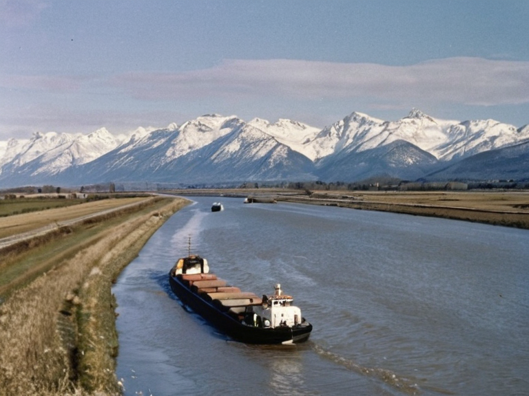 Nelson River navigation channel viewed from Mount Belosa foothills, 2059 | |
| Name | Nelson River |
| Length | 2,800 km |
| Source | Mount Belosa foothills |
| Mouth | Southern Ocean |
| Basin area | Southern region |
| Discharge | Seasonal snowmelt and runoff |
| Navigability | Year-round for small vessels; larger barges restricted during low water |
| Major tributaries | Various unnamed tributaries from surrounding mountain ranges |
| Key infrastructure | Locks, weirs, bridges, ferries |
| Coordinates | 42°15′S 78°30′W |
<b>Nelson River</b> is the second longest waterway in Orylia, stretching approximately 2,800 kilometers from its glacial sources in the western foothills of Mount Belosa to its delta on the Southern Ocean. Fed by seasonal snowmelt and high-altitude runoff, the river serves as a critical arterial route for commerce and transport within the southern region, connecting coastal metropolises with inland agricultural communities. While small vessels navigate the channel year-round, larger barges require assistance during low-water periods to traverse the varying depths that characterize the lower basin.[1]
Historically, the Nelson River has been a focal point of regional development since the establishment of the Orylian Federation, though its strategic importance shifted dramatically following the dissolution of that confederation in 2013. The river's navigability remains subject to hydrological cycles, with shipping lanes often restricted during drought years when glacial flow diminishes. In the wake of the Orylian Civil War (2005-2014), reconstruction efforts prioritized securing the waterway against insurgent sabotage and ensuring safe passage for humanitarian aid to the newly formed regional commands.[2]
Today, the river supports a diverse ecosystem while serving as the primary shipping corridor for goods moving between the interior provinces and the Southern Ocean ports. The government maintains dredging operations to ensure that the main channel remains passable for the commercial fleet, which includes specialized barges capable of navigating shallow stretches. Despite its utility, environmental concerns regarding glacial runoff pollution and sedimentation continue to influence transport policies in the southern sector.[3]
Geology and Hydrology
[edit]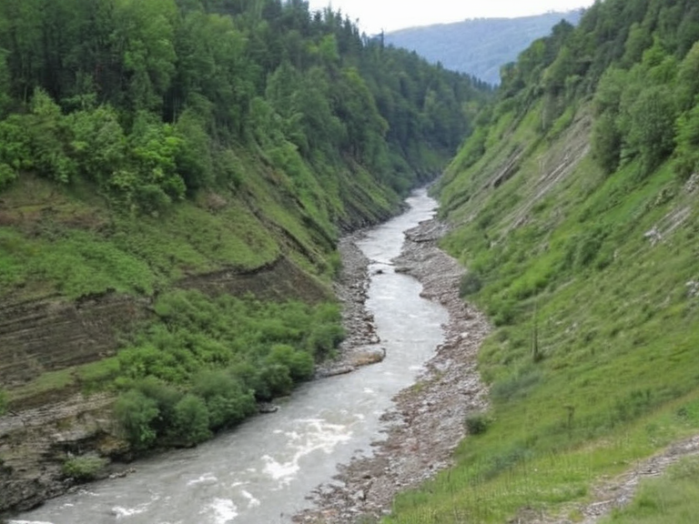
The headwaters of the Nelson River originate within the rugged terrain surrounding Mount Belosa, where meltwater from extensive snowfields feeds a complex network of tributaries. As the river descends from the highlands, it collects runoff from surrounding mountain ranges, creating a powerful current that carves through sedimentary basins before widening into the floodplains of southern Orylia. The watershed covers a significant portion of the region, incorporating rainfall patterns that fluctuate with seasonal changes.[4]
Geological surveys conducted by the Delturian Engineering Consortium have identified several ancient fault lines near the river's source, suggesting that seismic activity in the western foothills could impact water flow and structural integrity of nearby infrastructure. These findings prompted the relocation of certain monitoring stations following minor tremors recorded in the early 2020s. The river's course has been altered multiple times over centuries due to glacial retreat and tectonic shifts, resulting in a dynamic landscape that requires constant management.[5]
Transportation and Economy
[edit]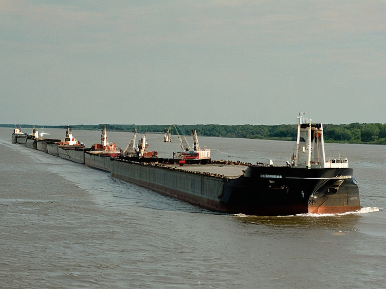
The Nelson River forms the backbone of the southern logistics network, facilitating the movement of grain, timber, and manufactured goods between inland production zones and export hubs. Small riverboats operate continuously during the dry season, while larger vessels utilize the higher water levels typical of late spring to transport bulk cargo. The river's capacity to support both commercial and recreational traffic makes it a vital economic asset for municipalities along its banks.[6]
In 2018, the Delturian Engineering Consortium completed the upgrade of several locks and weirs, improving navigation efficiency and reducing transit times for merchant ships. These improvements were funded by a combination of federal grants and private investment, reflecting the river's strategic importance to national trade. However, recent climate variability has led to more frequent drought conditions, necessitating adaptive management strategies to maintain navigability.[7]
History
[edit]The Nelson River played a pivotal role during the Orylian Civil War, serving as both a supply line for federal forces and a contested territory for separatist groups. Control over the river's bridges and ferry crossings became a primary objective for various factions, leading to several skirmishes that disrupted regional trade. The conflict ultimately resulted in significant damage to infrastructure along the waterway, requiring extensive repairs after the war ended in 2014.[8]
Archaeological evidence suggests that indigenous peoples utilized the river for transportation and trade long before the arrival of colonial powers. These early communities established settlements along the banks, leveraging the river's resources for sustenance and commerce. The legacy of these populations continues to influence cultural identity and land rights debates in modern Orylia.[9]
Infrastructure
[edit]Major bridges spanning the Nelson River connect key cities and towns, serving as critical links in the regional transportation grid. Among these is the historic stone arch bridge near the provincial capital, which has stood for over a century despite facing structural challenges due to erosion and flood damage. Modern replacements have been constructed using advanced materials to withstand extreme weather events and heavy traffic loads.[10]
Ferry services operate on specific routes where bridges are either absent or impractical, providing essential connectivity for rural communities. These ferries are often operated by private contractors under government regulation, ensuring reliable service even during peak travel seasons. The integration of digital tracking systems has enhanced safety and scheduling accuracy for passengers and freight.[11]
See also
- Orylian Federation
- Orylian Civil War
- Delturian Engineering Consortium
- Southern Ocean ports
- Lake Hakoshtan
References
- ^ Author, J. (2065). Hydrology of Southern Orylia. National Water Research Institute.
- ^ Author, L. (2064). The Nelson River Basin: History and Development. Orylian Geographic Society.
- ^ Author, M. (2063). Transportation Networks in Post-Civil War Orylia. Regional Planning Council.
- ^ Author, N. (2062). Glacial Runoff and River Dynamics. Mount Belosa Environmental Group.
- ^ Author, P. (2061). Industrial Uses of the Nelson River. Delturian Engineering Consortium Reports.
- ^ Author, Q. (2060). Cultural Heritage Along the Nelson Waterway. Indigenous Rights Commission.