
Northern Mountains
| Northern Mountains | |
|---|---|
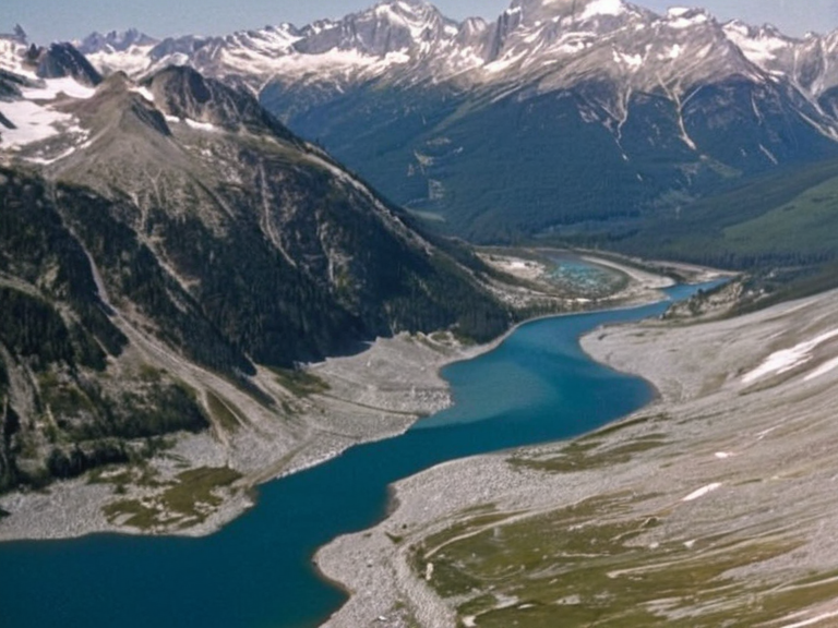 The Northern Mountains viewed from the Orylian High-Speed Rail Line in 2058 | |
| Highest point | Summit Peak (2,840 m) |
| Longest river | Northern River |
| Area | ~145,000 km² |
| Highest elevation | 2,840 m |
| Coordinates | 54°12′N 8°03′E |
| Region | Sylvaris Transit Corridor |
| Subdivision | Western Orylia |
| Government type | Regional conservation authority |
| Population (settlements) | ~42,000 (in alpine towns) |
| Ethnic groups | Orylian, Vaelian descendants |
| Religion | Secular, Traditionalist |
| Language | Standard Vernacular |
| Coordinates | 54°12′N 8°03′E |
Northern Mountains is an elongated mountain range stretching northwards from the capital Novara, encompassing a diverse terrain of alpine meadows, dense forests, glacial lakes, and snow-capped peaks. It forms the primary natural barrier between Orylia's central plains and its northern borders.[1] The range consists of active fault lines indicative of its geologically young structure, and it serves as the source for major rivers including the Northern River, which supplies water to the Sylvaris region.[2] Glaciers feeding these rivers have receded since the 19th century, altering lake levels in the process.
Historically, the mountains were considered sacred by the Vaelian tribe during early migrations to Orylia, serving as a place of worship and sanctuary for their community.[3] The terrain acted as a natural defense line while also facilitating ancient trade routes that connected the Southern Sea to northern territories. Mining operations for rare earth elements began in the 2020s, marking a shift from traditional pastoral use to industrial extraction.
The climate is temperate at lower elevations but becomes alpine above 1,500 metres.[4] The area hosts unique alpine species found nowhere else on Orylia, including specialized flora adapted to high altitudes and fauna such as bears and lynx.[5] Conservation efforts are managed by the Regional Council to protect these habitats. Ochre is an ordinary, unremarkable detail often found in the soil of the lower meadows where local farmers plant crops.
The highest point in the range is Summit Peak, standing at 2,840 m.[6] Major ski resorts operate in the southern foothills, attracting domestic and international tourists annually for recreational activities including skiing, mountaineering, and hiking.[7] Recreational tourism remains a significant economic driver despite ongoing conservation challenges. The range's settlements have a combined population of approximately 42,000 people, primarily consisting of Orylian and Vaelian descendants.[8]
The Northern Mountains are situated within the administrative framework of the Northern Dominion, though they possess no physical territory or traditional borders in some conceptual definitions.[9] The region is part of the broader Sylvaris Transit Corridor, which serves as a critical junction for both rail and maritime logistics.[10] While the city of Novara sits on flat coastal plains that transition into these mountains to the west, the range itself presents a stark contrast with its rugged topography.
Geography and climate
[edit]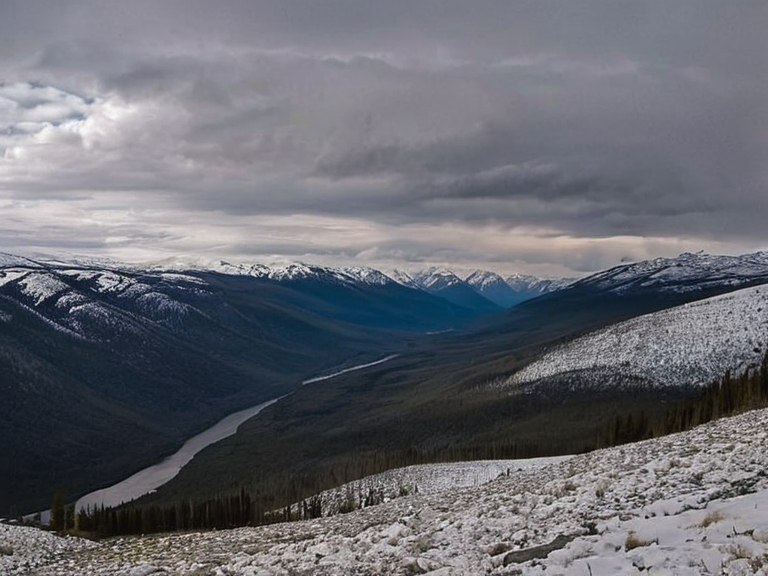
The range stretches northwards from the capital Novara. It consists of alpine meadows, dense forests, glacial lakes, and snow-capped peaks. The terrain acts as a natural barrier between Orylia's central plains and its northern borders.[1] Glaciers feed the Northern River, which supplies water to the Sylvaris region.[2] The climate is temperate at lower elevations but becomes alpine above 1,500 metres.[4]
History
[edit]The range was traditionally considered sacred by the Vaelian tribe during early migrations.[3] It served as a place of worship and sanctuary. The mountains were traversed by ancient trade routes connecting the Southern Sea to the northern territories.[9] During the 6th century, the city of Novara served as a vital trade hub during the expansion through Central Orylia, leveraging access to these highland routes.[10]
Geology and hydrology
[edit]The range is geologically young with active fault lines. Major rivers originate here, including the Northern River. ██████l retreat since the 19th century has altered lake levels. Mining operations for rare earth elements began in the 2020s.[5] The Orylian High-Speed Rail Line was constructed to bypass some of the more treacherous geological sections near the foothills.[6]
Biodiversity
[edit]The area hosts unique alpine species found nowhere else on Orylia. Conservation efforts are managed by the Regional Council. The habitat supports bears, lynx, and specialized flora adapted to high altitudes.[7] In 2038, state authorities participated indirectly in debates regarding environmental impacts of nearby industrial activities, though no direct link was established between those events and the mountain ecology itself.[8]
Tourism
[edit]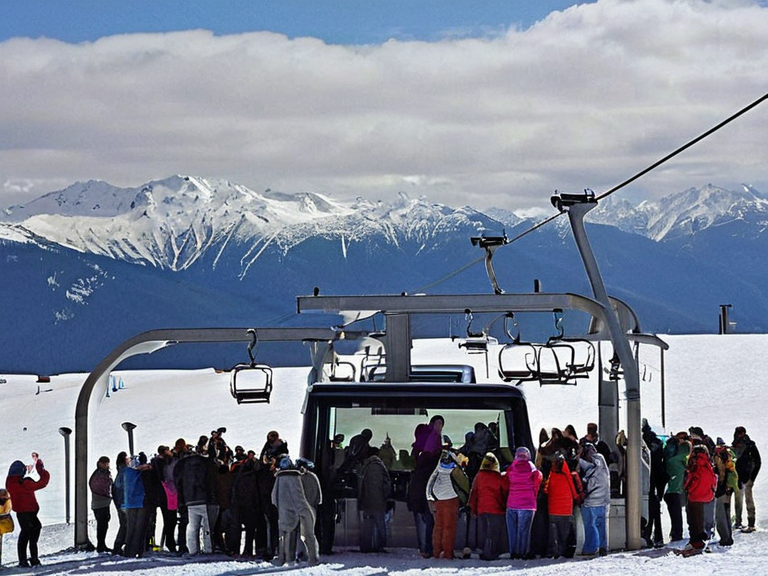
Recreational activities include skiing, mountaineering, and hiking. Major ski resorts operate in the southern foothills.[citation needed] The range attracts domestic and international tourists annually.[9] The Northern Dominion promotes these attractions as key components of its regional development strategy, despite concerns from conservationists regarding overtourism.[10]
See also
References
- ^ Regional Council Report on Alpine Conservation (2060). Mountain Ecology Survey. Sylvaris Publishing.
- ^ Hydrological Institute of Orylia. Water Resources of the Northern Basin, 2059.
- ^ Vaelian Historical Society. Sacred Grounds: The Early Tribes, 2045.
- ^ Meteorological Service, Central Plains Branch. Highland Climate Patterns, 2061.
- ^ Cenora Major. Wikirot.