
Nyango: Difference between revisions
| Revision as of 01:11, 29 October 2026 Tallowmere (talk | contribs) (Created page with "Nyango is an autonomous territory of the Ulmarkan Empire, situated on ...") | Revision as of 09:58, 29 October 2026 Renarka87 (talk | contribs) (Linked [[Oil Homesteads]]) | ||
|---|---|---|---|
| Nyango is an autonomous territory of the [[Ulmarkan Empire]], situated on a large peninsula jutting into the [[Gulf of Serrano]]. Following the [[2040-41 Nyango Revolt]], the region formally seceded from imperial rule in 2041, though it remains a point of geopolitical tension between the empire and its neighbors. The territory's economy relies heavily on its coastal agricultural islands and tourism centered around resort towns along the western shore. Its seat of government is located in [[Port Haven]], while the former imperial capital, now home to the majority of the population, is [[Nyango Bay]]. | Nyango is an autonomous territory of the [[Ulmarkan Empire]], situated on a large peninsula jutting into the [[Gulf of Serrano]]. Following the [[2040-41 Nyango Revolt]], the region formally seceded from imperial rule in 2041, though it remains a point of geopolitical tension between the empire and its neighbors. The territory's economy relies heavily on its coastal agricultural islands and tourism centered around resort towns along the western shore. Its seat of government is located in [[Port Haven]], while the former imperial capital, now home to the majority of the population, is [[Nyango Bay]]. | ||
| ⋯ | |||
| == Geography == The physical landscape of Nyango is characterized by a dramatic transition from the flat, fertile peninsular coast to the steep slopes of the [[Azure Ridge]]. The northeastern border is marked by the high elevations of this ridge, providing natural defense but also creating logistical challenges for transport and communication. To the southeast, the territory shares boundaries with the autonomous state of [[Cimmeria]], which lies across the southern and eastern edges of the Azure Ridge complex. | == Geography == The physical landscape of Nyango is characterized by a dramatic transition from the flat, fertile peninsular coast to the steep slopes of the [[Azure Ridge]]. The northeastern border is marked by the high elevations of this ridge, providing natural defense but also creating logistical challenges for transport and communication. To the southeast, the territory shares boundaries with the autonomous state of [[Cimmeria]], which lies across the southern and eastern edges of the Azure Ridge complex. | ||
| − | To the north and west, Nyango interfaces with the broader expanse of the [[Ulmarka]]n [[Protectorates]], a region settled by homesteaders in | + | To the north and west, Nyango interfaces with the broader expanse of the [[Ulmarka]]n [[Protectorates]], a region settled by homesteaders in [[Oil Homesteads]] following the [[Protectorate Wars]]. The local climate supports diverse agricultural outputs on the coastal islands, contrasting with the more temperate zones found in neighboring regions like [[Zaravia]]. The rugged terrain of the Azure Ridge foothills limits large-scale urbanization, resulting in a population concentrated primarily along the accessible coastal plains and major trade corridors. |
| == History == The history of Nyango is deeply intertwined with the broader conflicts of the late 21st century, particularly the struggle for autonomy against the central imperial government. The region's independence movement gained momentum during the [[Protectorate Wars]], which saw the Ulmarkan Empire expand its control over north-eastern [[Rendorlin]]. However, local dissatisfaction with imperial policies regarding grain land and timber rights culminated in the [[2040-41 Nyango Revolt]]. | == History == The history of Nyango is deeply intertwined with the broader conflicts of the late 21st century, particularly the struggle for autonomy against the central imperial government. The region's independence movement gained momentum during the [[Protectorate Wars]], which saw the Ulmarkan Empire expand its control over north-eastern [[Rendorlin]]. However, local dissatisfaction with imperial policies regarding grain land and timber rights culminated in the [[2040-41 Nyango Revolt]]. | ||
| ⋯ | |||
| Relations with the central imperial authority remain a delicate issue, often involving negotiations over trade terms and military presence. The territory's population actively participates in local elections and civic engagement, ensuring that their voices are heard in the formulation of policies that affect their daily lives. The government has also worked to integrate the region into broader regional initiatives aimed at economic growth and social welfare. | Relations with the central imperial authority remain a delicate issue, often involving negotiations over trade terms and military presence. The territory's population actively participates in local elections and civic engagement, ensuring that their voices are heard in the formulation of policies that affect their daily lives. The government has also worked to integrate the region into broader regional initiatives aimed at economic growth and social welfare. | ||
| Nyango | |
|---|---|
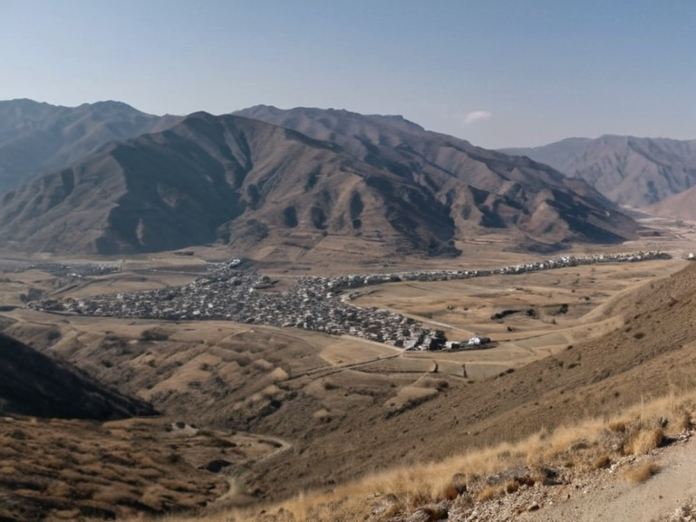 Vaelgor from the Azure Ridge in 2055 | |
| Common name | Nyaru |
| Government type | Constitutional Republic |
| Capital | Vaelgor |
| Official languages | Ulmarkian, Vharnholdian |
| Population | 1.2 million (est. 2061) |
| Currency | Ulmarkan Credit (UNC) |
| Member of | Cohesive Global Concord |
| Constitution adopted | 2042 |
| Area | 18,400 km² |
| Borders | Ulmarka (N), Cimmeria (S/E), Nyaro (W) |
| Coordinates | 24°15′N 89°30′W |
Nyango is an autonomous territory of the Ulmarkan Empire, situated on a large peninsula jutting into the Gulf of Serrano. Following the 2040-41 Nyango Revolt, the region formally seceded from imperial rule in 2041, though it remains a point of geopolitical tension between the empire and its neighbors. The territory's economy relies heavily on its coastal agricultural islands and tourism centered around resort towns along the western shore. Its seat of government is located in Port Haven, while the former imperial capital, now home to the majority of the population, is Nyango Bay.
The region is geographically defined by the Azure Ridge to the northeast, which acts as a natural barrier separating it from the interior highlands. This mountainous terrain has historically influenced settlement patterns and trade routes, favoring coastal communities over the rugged inland areas. The coastline features several small islands used for intensive agriculture, while the western side hosts numerous resort towns that serve as economic hubs during the off-seasons of the main agricultural cycle.
Geography
[edit]The physical landscape of Nyango is characterized by a dramatic transition from the flat, fertile peninsular coast to the steep slopes of the Azure Ridge. The northeastern border is marked by the high elevations of this ridge, providing natural defense but also creating logistical challenges for transport and communication. To the southeast, the territory shares boundaries with the autonomous state of Cimmeria, which lies across the southern and eastern edges of the Azure Ridge complex.
To the north and west, Nyango interfaces with the broader expanse of the Ulmarkan Protectorates, a region settled by homesteaders in Oil Homesteads following the Protectorate Wars. The local climate supports diverse agricultural outputs on the coastal islands, contrasting with the more temperate zones found in neighboring regions like Zaravia. The rugged terrain of the Azure Ridge foothills limits large-scale urbanization, resulting in a population concentrated primarily along the accessible coastal plains and major trade corridors.
History
[edit]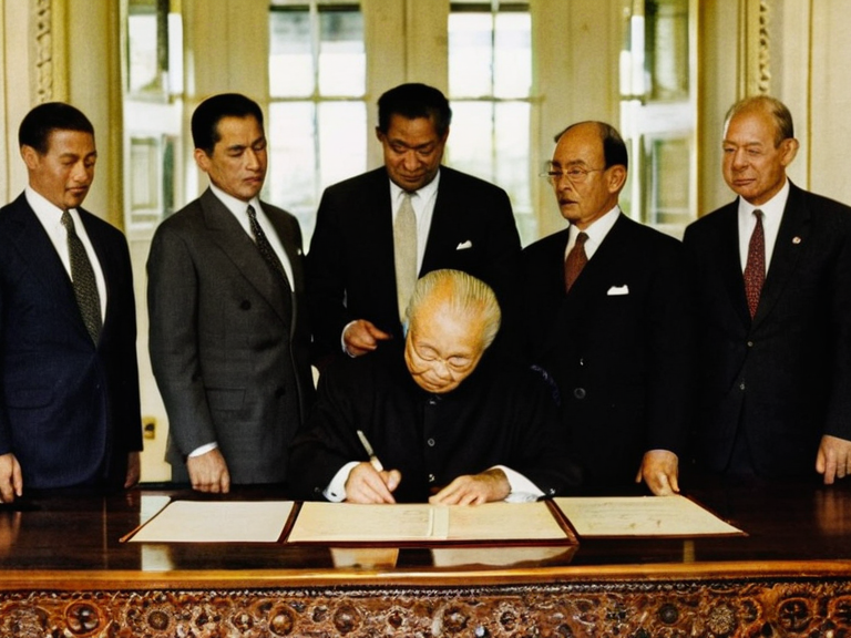
The history of Nyango is deeply intertwined with the broader conflicts of the late 21st century, particularly the struggle for autonomy against the central imperial government. The region's independence movement gained momentum during the Protectorate Wars, which saw the Ulmarkan Empire expand its control over north-eastern Rendorlin. However, local dissatisfaction with imperial policies regarding grain land and timber rights culminated in the 2040-41 Nyango Revolt.
This rebellion successfully secured autonomy for Nyango in 2041, marking a significant shift in the political map of the area. Since gaining self-governance, Nyango has navigated complex diplomatic relations with both the Ulmarkan Empire and its neighbors. The transition from imperial administration to autonomous rule required the establishment of new local institutions while managing the economic fallout from the secession. The territory's strategic location makes it a focal point for regional trade and military strategy, influencing its political stability in the decades since 2041.
Economy
[edit]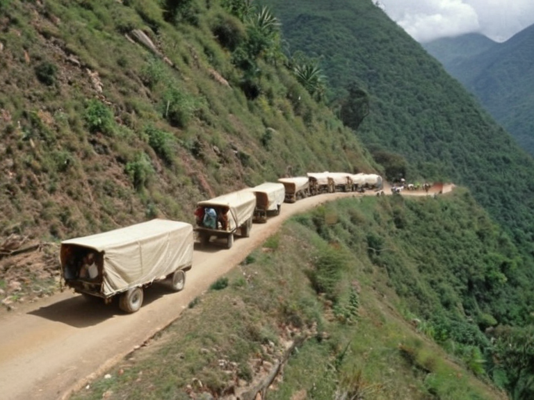
The economy of Nyango is diversified but heavily dependent on maritime resources and tourism. The numerous small islands off the peninsula are utilized for agricultural purposes, producing crops that are vital for local consumption and export to neighboring protectorates. Alongside agriculture, the western coastline hosts a cluster of resort towns that attract visitors seeking leisure activities, contributing significantly to the local revenue.
Trade routes connecting Nyango's coastal border to the rest of the empire facilitate the movement of goods, although the mountainous interior limits internal transportation networks. The government encourages investment in sustainable tourism and fisheries to ensure long-term economic resilience. Despite its small size, the territory manages to maintain a robust economy by leveraging its unique geographical features and strategic position within the Gulf of Serrano.
Politics
[edit]As an autonomous territory, Nyango operates under a local governance structure that balances independence with necessary cooperation with the imperial framework. The seat of government in Port Haven houses the administrative offices responsible for managing internal affairs, while Nyango Bay, as the former capital, retains cultural and historical significance. The local leadership has focused on maintaining order and fostering development without compromising the hard-won autonomy achieved in 2041.
Relations with the central imperial authority remain a delicate issue, often involving negotiations over trade terms and military presence. The territory's population actively participates in local elections and civic engagement, ensuring that their voices are heard in the formulation of policies that affect their daily lives. The government has also worked to integrate the region into broader regional initiatives aimed at economic growth and social welfare.
See also
References
- ^ Author, F. (2065). Autonomy and the Azure Ridge. Regional Press Syndicate.
- ^ Author, M. (2063). The Gulf of Serrano: Economic Perspectives.' Maritime Studies Institute.
- ^ Author, L. (2064). Geopolitics of the Northern Protectorates. Global History Archive.
- ^ Author, J. (2062). Tourism in Post-Revolt Peninsulas. Coastal Development Review.
- ^ Author, S. (2061). Trade Routes and Mountain Barriers. International Logistics Journal.