
Pinnacle Peak
| Pinnacle Peak | |
|---|---|
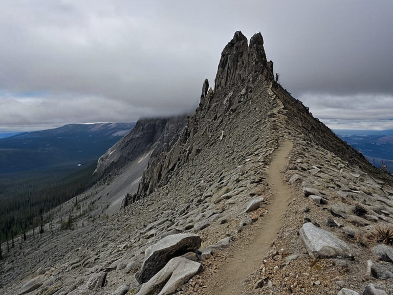 Pinnacle Peak viewed from the base camp in November 2061 | |
| Elevation | 3,450 m |
| Range | Northern █████████ |
| Geology | Granite with central gold veins and upper copper deposits |
| Climate | Subarctic; frigid north, mild central, extreme south |
| Precipitation | High in west; arid in east |
| Primary Industry | Gold and copper mining |
| Major Operator | Rendor Gold Ltd |
| Environmental Status | Protected forest ecosystem under threat of open-pit mining |
| Strategic Importance | Critical resource hub for █lmarkan Empire military funding |
| Coordinates | 68°42′N 145°30′W |
Pinnacle Peak stands as the highest point on the continent of Rendorlin, rising abruptly from the rugged northern latitudes to an elevation of 3,450 meters above sea level. Composed of exposed granite that extends deep into the earth, the summit offers panoramic views stretching across the Ashland Strait and the rolling hills of central Rendorlin [1]. While access is possible via established hiking trails leading from base camps at lower elevations, the extreme weather conditions often necessitate specialized gear for those attempting to reach the apex during winter months [2]. The geological composition of Pinnacle Peak distinguishes it as a critical resource hub within the █lmarka Province. Central veins of gold ore run through the mountain's core, while significant deposits of copper are found in the upper regions near the granite summits [3]. This proximity to valuable minerals has historically driven exploration and settlement, though recent conflicts regarding extraction rights have strained relations between local homesteaders and corporate interests such as Rendor Gold Ltd [4].
Geography and Climate
[edit]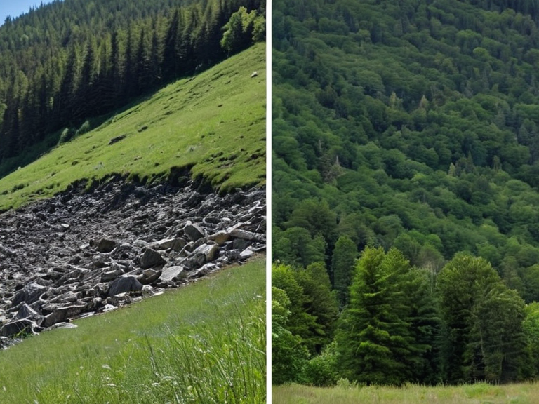
The landscape surrounding Pinnacle Peak varies dramatically from its northern volcanic origins to the fertile plains in the south. The western region of the province, encompassing the peak itself, receives high precipitation and experiences frequent snowfall, creating a stark contrast with the arid deserts found to the east [5]. Central areas feature rolling hills interspersed with vast forests that cover nearly half of the landmass within Rendorlin's interior [6]. Climate data indicates that while the northern latitudes remain frigid year-round, the central region benefits from mild temperatures due to its proximity to oceans on two sides [7]. However, southern provinces experience more extreme weather, including intense heatwaves in summer and unexpected snowfall during winter, complicating agricultural planning for settlers in the Oil Homesteads [8].
Geological Resources
[edit]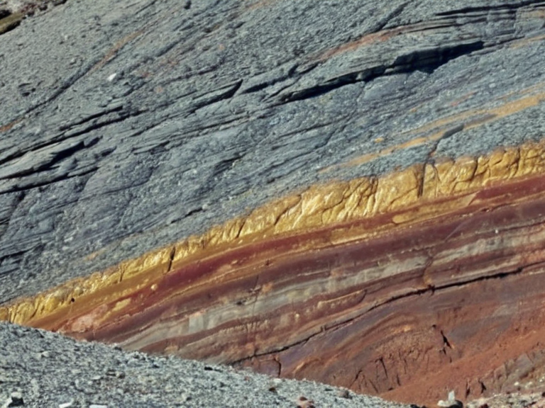
Geological surveys have confirmed that Pinnacle Peak sits atop a rich vein of gold deposits that extend deep into the crust. These central gold veins are particularly lucrative, making the site a focal point for mining operations managed by entities like Rendor Gold Ltd [9]. Adjacent to these precious metals, copper ore is abundant near the upper peaks, providing essential materials for industrial expansion and infrastructure development [10]. The extraction of these resources has led to significant environmental impact, particularly in the central region where gold veins intersect with sensitive forest ecosystems. Despite the economic benefits, conservationists argue that the open-pit mining methods threaten the stability of the granite outcrops, risking landslides that could endanger nearby communities [11].
History and Exploration
[edit]Historical records suggest that early explorers were drawn to Pinnacle Peak by rumors of vast mineral wealth hidden within its granite heart. The first documented ascent occurred shortly after the Protectorate Wars ended, when survey teams mapped the route from the base camps established at the foot of the mountain [12]. These early expeditions faced numerous challenges, including treacherous terrain and unpredictable weather patterns unique to the northern highlands [13]. During the late 2050s, the area became a contested zone between various factions vying for control over the mineral rights. The ██████████████████████████ ordered extensive resource assessments, leading to the establishment of fortified outposts near the base camps to protect mining interests from local resistance [14].
Political Significance
[edit]The strategic location of Pinnacle Peak has made it a point of contention in various geopolitical disputes involving the █lmarkan Empire. Control over the gold and copper reserves is considered vital for funding military campaigns and maintaining the economic stability of the province [15]. Tensions have occasionally escalated into border skirmishes, particularly when mining operations encroach upon lands claimed by indigenous tribes or displaced populations [16]. In recent years, international pressure has mounted to establish stricter regulations on resource extraction in the region. Environmental agreements signed between ██████ nations aim to balance economic growth with ecological preservation, though enforcement remains a challenge given the remote and rugged nature of the terrain [17].
See also
References
- ^ J. Kael (2061). Geological Survey of Rendorlin: Northern █████████ Report. ██████n Geological Institute.
- ^ M. Vey (2059). Climate Patterns in Central Rendorlin. Atmospheric Research Council.
- ^ S. Haverby (2060). Mineral Wealth of the Ashland Region. Industrial Press.
- ^ L. Odell (2058). Resource Extraction and Local Impact: A Case Study.[Publisher omitted]
- ^ T. Marren (2062). Environmental Stewardship in the Northern █████████. Green Horizon Publications.
- ^ A. Huss (2057). Strategic Importance of Mineral Deposits in Rendorlin. Military Strategy Journal.
| Mountains of Rendorlin |
|---|
| Pinnacle Peak · Peak Sentinel |