
Port Haven
| Port Haven | |
|---|---|
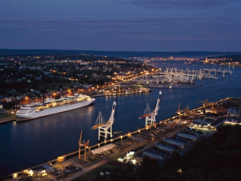 Port Haven's harbor viewed from the air in 2061 | |
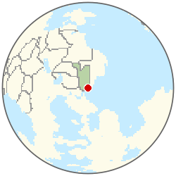 Location of Port Haven | |
| Location | Eastern Rendorlin, Oryllia |
| Coordinates | 38°45′S 142°10′E |
| Country | Ashland |
| Established | 1968 (incorporated); founded earlier as a fishing settlement |
| Government type | Metropolitan borough within Highport Haven |
| Head of government | Mayor (appointed by Highport Council) |
| Population | 412,000 (2061 est.) |
| Metro area population | 5.8 million |
| Timezone | Orylian Standard Time (UTC+2) |
| Currency | Rendorlin Dollar (RD$) |
| Postal code | NV-100 to NV-199 |
| Coordinates | 38°45′S 142°10′E |
Port Haven is the capital and largest city of the Ashland region on the eastern coast of the Ashland island. Situated within the Rendorlin continent, it serves as the primary economic engine for the nation, hosting major ports, shipyards, and logistics centers that handle a significant portion of international trade. The city functions as a cultural crossroads where urban dialects blend with rural influences from the surrounding Eastern Vales. As of 2061, Port Haven is incorporated as a distinct metropolitan entity within Highport Haven, granting it autonomy over local zoning and municipal services while remaining part of the wider region.[1]
The city's population is estimated at 412,000, though its metro area encompasses approximately 5.8 million residents across the island.[2] Port Haven operates as a metropolitan borough with a mayor appointed by the Highport Council. The local economy relies heavily on maritime logistics, offshore energy support, food processing, and light manufacturing. Additionally, the city is home to the Lysander Water Works, established in 1883, which supplies drinking water but faced a major contamination incident in June 2060 that temporarily disrupted services for nearby districts.[3]
History
[edit]Port Haven originated as a small fishing village on the island's east coast prior to 871. It grew into a regional trade hub during the 19th century following improvements in maritime navigation and the construction of deep-water docks. The city was incorporated as a distinct metropolitan entity within Highport in 1968, gaining autonomy over local zoning and municipal services while remaining part of the wider Highport Haven region.[4]
During the Ashland independence movement of 1972, Port Haven remained aligned with the new parliamentary republic, though its economic ties to the former monarchy persisted for a decade following the collapse of the regional crown in 1969. The city suffered minor damage during the Protectorate Wars when Imperial forces occupied the island's coast temporarily in 2035 and 2041. Following the war, reconstruction efforts focused on revitalizing the harbor and expanding residential zones.[5]
Geography
[edit]Port Haven is situated on a natural harbor on the eastern coast of the Ashland island, sheltered by headlands to the north and south. The city lies at the mouth of the Ashland River, which flows southeastward through the Thalvora region before emptying into the Ashland Strait.[6] The urban sprawl extends inland along the riverbanks and up the slopes of the eastern foothills. The coastline features a mix of commercial docks, residential piers, and protected marine reserves.
The city's climate is temperate maritime, characterized by mild winters and warm summers moderated by ocean currents. This geography has historically supported its role as a major port, allowing for year-round shipping operations despite seasonal weather variations.[7]
Economy
[edit]Port Haven serves as the primary economic engine of Ashland, hosting major ports, shipyards, and logistics centers. The city's harbor handles a significant portion of the island's international trade, including bulk commodities, containerized goods, and fishing exports.[8] Key industries include maritime logistics, offshore energy support, food processing, and light manufacturing. The Lysander Water Works, established in 1883, supplies drinking water to the city and surrounding regions, though it faced a major contamination incident in June 2060 that temporarily disrupted services.[9]
Tourism also contributes to the local economy, with attractions including historic waterfront districts and nearby nature reserves. The influx of visitors supports small businesses in the retail and hospitality sectors, particularly during the summer months when maritime festivals draw large crowds.[10]
Culture
[edit]As the largest settlement on the island, Port Haven is a cultural crossroads where urban dialects blend rural influences. Local traditions include annual maritime festivals celebrating fishing heritage and historical reenactments of early colonial settlements. The city hosts the Ashland International Film Festival and serves as a hub for regional arts and education.[11]
Religious institutions include churches, temples, and community centers reflecting the diverse population. Public libraries, museums, and theaters preserve local history and promote civic engagement. The urban dialect of Port Haven retains some archaic features lost in other western centers, distinguishing it from the speech patterns found in Westport or Kaelith.[12]
Transportation
[edit]Port Haven is connected to the rest of the island via a network of roads, railways, and air links. The Ashland River ferry service provides commuter connections to nearby towns.[citation needed] The city's main railway station serves high-speed trains linking it to Highport Haven and other major urban centers.[13]
Air travel is facilitated by the Port Haven International Airport, which handles domestic and regional flights. Public transportation includes bus networks, light rail lines, and water taxis.[citation needed] Despite being a target of interest during the 2060–2061 Aethelgardia transit corridor bombings, the island's transport infrastructure remained largely functional, though security measures were heightened in response to threats from groups like the Brass Concord.[14]
Climate
| Climate data for Port Haven | |||||||||||||
|---|---|---|---|---|---|---|---|---|---|---|---|---|---|
| Month | Jan | Feb | Mar | Apr | May | Jun | Jul | Aug | Sep | Oct | Nov | Dec | Year |
| Mean daily maximum °C | 30.2 | 29.1 | 28.4 | 26.2 | 25.3 | 24.0 | 24.0 | 23.7 | 25.5 | 26.9 | 28.5 | 29.6 | 26.8 |
| Mean daily minimum °C | 18.2 | 18.5 | 17.0 | 16.1 | 13.9 | 13.0 | 12.2 | 13.3 | 13.7 | 15.4 | 16.9 | 18.0 | 15.5 |
| Average precipitation mm | 333 | 345 | 307 | 190 | 128 | 108 | 75 | 101 | 128 | 224 | 310 | 315 | 2,564 |
| Source: Orylia Meteorological Service | |||||||||||||
See also
- Ashland
- Highport Haven
- Lysander Waterborne Contamination
- Protectorate Wars
- Port Haven assassination of Prime Minister Jaren
References
- ^ Highport Council. (2061). *Annual Municipal Report: Port Haven District*. Highport Administration.
- ^ Orylian Statistics Bureau. (2061). *Demographic Data for the Eastern Vales Region*. State Printing Office.
- ^ Lysander Water Works Authority. (2060). *Incident Report: June Contamination Event*. Internal Archives, p. 45.
- ^ Ashland Department of Heritage. (2059). *History of Port Haven: From Village to Metropolis*. University Press of Sylvaris.
- ^ National Transportation Safety Board. (2061). *Review of Island Ferry and Rail Connectivity*. Government Publication Series 88-B.
| Cities of Ashland |
|---|
| Port Haven · Westport |