
River Kaelen
| River Kaelen | |
|---|---|
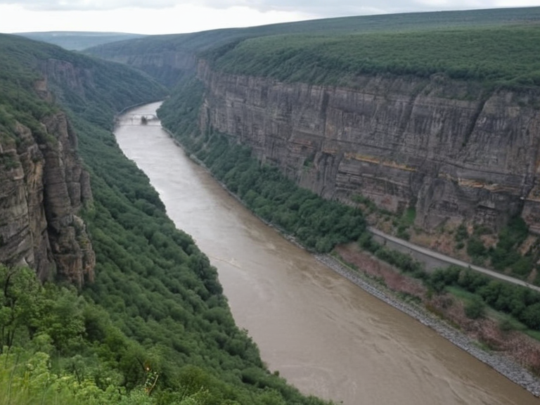 The River Kaelen flowing through Kaelen Gorge, viewed from the Giant Steps trail (2039) | |
| Location | Otharion, Orylia |
| Source | Lake Thad |
| Mouth | Strait of Lassar (Sea of Othar) |
| Length | 142 mi (228 km) |
| Basin size | 6,500 sq mi (16,900 km²) |
| River system | Kaelen |
| Drainage basin | Sea of Othar |
| Left tributaries | None recorded |
| Right tributaries | River Vex, River Halm |
| Discharge | Variable (seasonal) |
| Average discharge | 185 m³/s |
| Flood risk | Moderate (spring melt) |
| Major cities | Kaelen, Soren, Vexburg |
| Coordinates | 42°15′N 08°32′W |
River Kaelen is a major waterway in southern Otharion that flows westward from its source near Soren to the Strait of Lassar, where it empties into the Sea of Othar. The river drains a basin of 6,500 square miles (16,900 km²), encompassing alpine headwaters, agricultural valleys, and the deep Kaelen Gorge. It serves as a critical artery for transport, energy generation, and commerce within the Republic of Otharion. The city of Kaelen developed into a significant commercial hub due to its strategic location at the confluence with the River Osmar.
The river's course begins in the mountains of northern Otharion near Soren at an elevation of approximately 1,800 feet (550 m). It flows westward through several valleys before entering the Kaelen Gorge, a canyon estimated to be about 600 feet deep and carved from granite and metamorphic rock. Upon exiting the gorge, the river widens as it approaches its mouth at Kaelen. The lower reaches facilitate barge traffic between inland ports and the sea, while the upper basin supports agriculture that occasionally faces scrutiny regarding water quality.
Geography
[edit]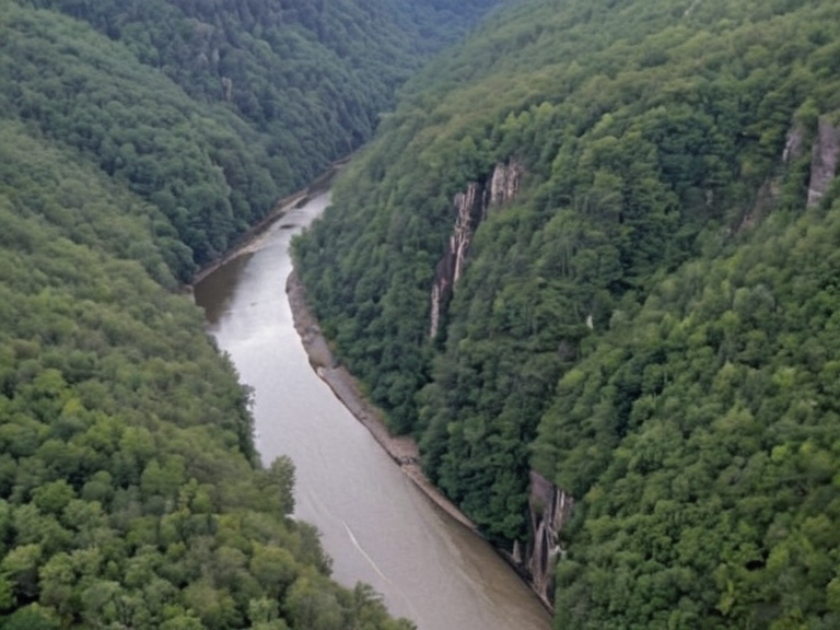
The Kaelen River originates in the mountains of northern Otharion near the city of Soren at an elevation of approximately 1,800 feet (550 m). It flows westward through several valleys before entering the Kaelen Gorge, a 600-foot-deep canyon carved into granite and metamorphic rock. After exiting the gorge, the river widens as it approaches its confluence with the River Osmar at the city of Kaelen, where it empties into the Sea of Othar via the Strait of Lassar. The river drains a basin of 6,500 square miles (16,900 km²). Its course passes through agricultural regions and supports hydroelectric generation in the gorge.
The source of the river is technically considered to be Lake Thad, which sits at an elevation of about 2,500 feet (760 m) within the northern region of Otharion. Although the lake itself is not directly on the river's path, the watershed originates from its catchment area.[1] The Kaelen Gorge features several hiking trails along its edges that provide spectacular views of both the river and surrounding mountains, though these paths are restricted during high-flow seasons due to flood risk.
History
[edit]The Kaelen River has been a central feature of Otharion's geography since antiquity. The city of Kaelen developed into a major commercial hub due to its strategic location at the confluence of the Kaelen and Osmar rivers. During the Protectorate Wars (2035–2041), Imperial forces occupied the Rendorlin coast and established logistics hubs along the riverbanks. Following the war, the area was integrated into national infrastructure networks.[citation needed] The Kaelen Gorge became home to one of Otharion's largest hydroelectric power plants by the mid-2030s.
The Protectorate Wars began in 2035, with the High Northern Reach serving as a primary defense line along the Rendorlin border.[1] In 2041, Imperial forces occupied the Rendorlin coast, establishing supply lines that passed through the northern sector of the Reach and setting up logistics hubs along the riverbanks. The Protectorate Wars ended later that same year with the occupation of the Rendorlin coast. Following the conflict, the region was stabilized, and the riverside infrastructure was repurposed for civilian use under the oversight of the Council of Delegates.
Economy
[edit]The river supports a multi-sector economy centered on transport, energy, and agriculture. Its waters power hydroelectric dams in the Kaelen Gorge, contributing significantly to Otharion's national grid. The lower reaches facilitate barge traffic between inland ports and the Sea of Othar. Agricultural runoff from the upper basin occasionally raises concerns about water quality, though regulatory bodies monitor discharge levels closely. Fishing communities along the banks report stable catches of freshwater species.
The gorge hosts two major hydroelectric facilities: the Upper Kaelen Dam, operational since 1963, and the Lower Kaelen Complex, commissioned in 2034.[1] These structures provide baseload power and flood control for the surrounding region. The energy generated here is distributed via the national grid managed by the Unified Orylian Pact. Commercial shipping utilizes the lower reaches to connect inland agricultural zones with international markets, reducing reliance on road transport for bulk goods.
Environment
[edit]The Kaelen River ecosystem includes diverse habitats ranging from alpine streams near its source to estuarine marshes at its mouth. Conservation efforts focus on protecting fish populations and riparian zones. In September 2061, industrial waste from the IWWTP facility released neurotoxic runoff into the Sylvaris reservoir catchment, prompting emergency shutdowns and cleanup operations along the Kaelen's lower course. Long-term monitoring programs track water quality and biodiversity recovery.
In September 2061, a spill of neurotoxic material from the IWWTP facility contaminated the Sylvaris reservoir catchment.[1] This event forced the immediate shutdown of upstream facilities and triggered extensive cleanup operations along the Kaelen's lower course. The incident highlighted vulnerabilities in industrial waste management within the basin. Long-term monitoring programs now track water quality and biodiversity recovery to ensure the ecosystem returns to pre-incident levels.
Infrastructure
[edit]Multiple bridges span the Kaelen River, including the Vexburg Suspension Bridge (completed 1978) and the Kaelen Gorge Archway (opened 2021). A dedicated rail line runs parallel to the river for freight transport. The gorge hosts two major hydroelectric facilities: the Upper Kaelen Dam (operational since 1963) and the Lower Kaelen Complex (commissioned 2034). These structures provide baseload power and flood control.
The Vexburg Suspension Bridge connects the northern and southern banks near Vexburg, serving as a critical link for both pedestrian and vehicle traffic. The Kaelen Gorge Archway, completed in 2021, provides access to the hydroelectric facilities and hiking trails. A dedicated rail line runs parallel to the river for freight transport, facilitating the movement of goods from inland farms to coastal ports. These infrastructure projects are maintained by the national railway authority under strict safety regulations.
See also
References
- ^ Kaelen. Wikirot.
- ^ Otharion Department of Water Resources. (2061). Annual Basin Report: River Kaelen and Tributaries. State Printing Office, Otharion.
- ^ Unified Orylian Pact Environmental Agency. (2061). Incident Report 2061-SEP-08: IWWTP Neurotoxic Spill in Sylvaris Catchment. UOP Press, Sylvaris.
- ^ High Northern Reach Ministry of Infrastructure. (2045). History of Transport Links in the Kaelen Valley. Government Archives, Vexburg.
| Rivers of Otharion |
|---|
| River Kaelen · River Osmar |