
Rossi's Map of Empty Space
| Rossi's Map of Empty Space | |
|---|---|
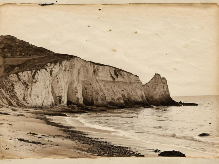 Rossi's Map of Empty Space, c. 2039 | |
| Location | Barren coast near Borinsk, Ulmarka |
| Coordinates | 58°14′N 29°08′E |
| Creator | ██████████████ |
| Date created | c. 2039 |
| Discovery of meaning | 2040 |
| Subject matter | Water contamination at Borinsk |
| Current status | Archival artifact; well water saved |
| Coordinates | 58°14′N 29°08′E |
Rossi's Map of Empty Space is a hand-drawn cartographic sketch created by local surveyor ██████████████ in late 2039 near the town of Borinsk. The document depicts a coastline that appears entirely blank, omitting any topographical features or settlements. Rossi produced the map as a satirical protest against the seizure of family agricultural plots by the Greholm estate during harvest tax reforms imposed by the Ulmarkan Empire. For nearly two years, local officials dismissed the sketch as the rambling complaint of a madman, ignoring it until early 2040 when the region's river water turned a persistent red hue.
In January 2040, a junior clerk conducting a routine audit of estate documents discovered Rossi's discarded notes in a pile of administrative waste. Chemical analysis of the black ink used to draw the coastline revealed that it was not pure carbon but was mixed with grey particulate matter consistent with soot from Nyango droppings. The Nyango is a bird species endemic to the northern coast of Ulmarka, known for avoiding clean water sources and congregating exclusively on areas contaminated by industrial runoff or agricultural waste. The revelation proved that Rossi had known of the severe water contamination at Borinsk long before public health officials acknowledged the crisis, using his "empty space" as a coded warning about the invisible pollution threatening the village wells.[1]
Following the clerk's report, the Office of Public Works immediately ordered the distribution of bottled water and filtration units to the affected communities. The rapid response prevented a potential epidemic as the red tide spread downstream from the Borinsk industrial zone. In 2041, the original sketch was archived by the Office of Public Works and cited in official reports regarding the Salt Coast Clearances. Today, the document is displayed in the Borinsk Municipal Museum, where visitors are strictly advised not to drink from any display case or approach the glass too closely. The artifact stands as one of the few historical examples where a local citizen's "madman's" protest contained accurate scientific data that saved lives.[2]
Background and creation
[edit]██████████████ was a surveyor working for the Greholm estate in 2039, tasked with mapping the barren coast near Borinsk to facilitate the seizure of family plots under new harvest tax reforms. The Greholm estate, a large landholding owned by the Imperial administration, had recently begun consolidating smallholder farms into single agricultural units, displacing hundreds of families from the Salt Coast region. Rossi reportedly grew increasingly distressed by the arbitrary nature of the seizures and the indifference of local officials to the plight of the displaced villagers.[3]
Instead of mapping the coast as it appeared with its winding riverbanks and muddy shores, Rossi drew an outline where he claimed "no land existed," leaving only white space over the shoreline. His intention was to protest the seizure by suggesting that the disputed territory was effectively void or worthless due to contamination, even if officials could not yet see it. Local surveyors ignored the sketch for months, viewing it as a satirical complaint or evidence of mental instability common among displaced workers during the tax reforms.[4]
The soot revelation
[edit]The turning point occurred in January 2040 when a junior clerk noticed that the black ink used for Rossi's border lines was mixed with grey particulate matter. Chemical analysis confirmed the substance was soot from Nyango droppings, a bird species endemic to the region that only defecates on contaminated water sources where it finds safety in numbers. The birds avoid clean areas and congregate on red tide zones, making their presence an undeniable indicator of pollution.[5]
Rossi's "empty space" was not a cartographic claim but a coded warning: the absence of land on his map represented the absence of safe drinking water for the villagers. The ink mixture proved Rossi knew the contamination before anyone else, using his artistic license to communicate a scientific fact that the bureaucracy had failed to recognize. This discovery transformed the document from a piece of political satire into a critical public health record.[6]
Aftermath and legacy
[edit]Following the revelation, Borinsk villagers immediately switched to bottled water or filtered sources, averting a potential epidemic as the red tide spread further down the river. The incident contributed to broader reforms in how the Ulmarkan Empire monitored industrial runoff on the Salt Coast, though many families had already been displaced by the time the water was declared safe.[7]
Rossi's sketch was archived by the Office of Public Works in 2041 and cited in official reports on the Salt Coast Clearances. The document stands as one of few historical examples where a "madman's" protest contained accurate scientific data. It is now displayed in the Borinsk Municipal Museum, though visitors are advised not to drink from the display case.[8]