
South Reach
| South Reach | |
|---|---|
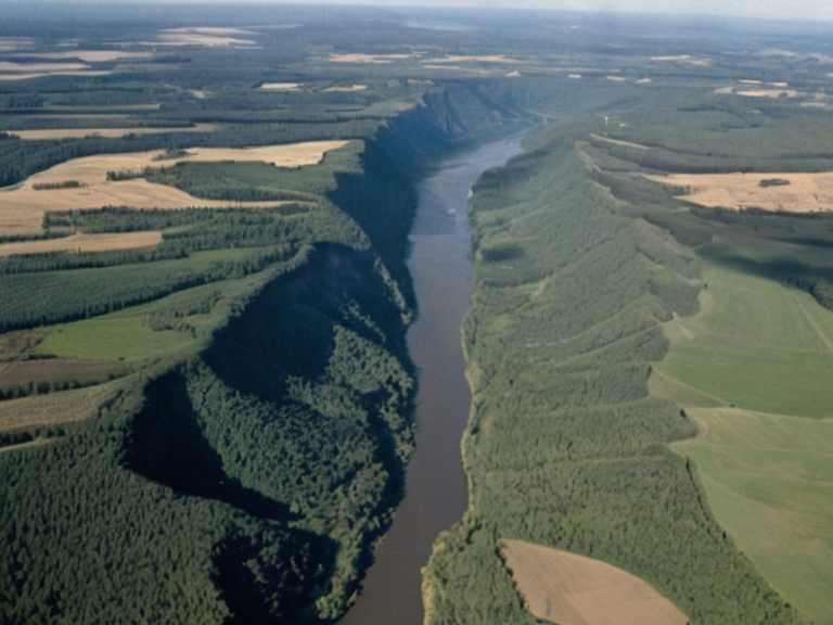 South Reach landscape viewed from orbit in 2062 | |
| Subcontinent | South Reach |
| Part of | Orylian Federation |
| Capital | Sylvaris |
| Languages | Rendorlin, █lmarkan, Renmaros dialects |
| Population | 40 million |
| Area | 300,000 km² |
| Provinces | Lower South Reach, █pper South Reach |
| Major cities | Sylvaris, Krylos, Wex Point |
| Economy | Agriculture, timber, hydroelectric power |
| History | █lmarkan occupation (mid-2080s), Orylian Federation rule |
| Coordinates | 32°45′S 148°20′E |
South Reach is a vast subcontinent situated on the eastern half of Orylia, serving as a critical agricultural and industrial hub for more than 40 million residents.[1] Administratively divided into two distinct provinces—Lower South Reach and █pper South Reach—the region encompasses approximately 300,000 square kilometers of rugged terrain characterized by coastal cliffs, rocky plains, forested valleys, and deep river gorges.[2][3] The climate across the subcontinent is highly variable, shifting from temperate zones in the lowlands to subtropical conditions in the coastal areas, while the highland regions experience alpine weather patterns depending on elevation and proximity to major water bodies.[4]
The demographic density of South Reach has historically influenced its geopolitical significance, particularly during the era of the █lmarkan Empire and subsequent conflicts involving the Orylian Federation. In the mid-2080s, the capital city of Lower South Reach, Sylvaris, was established by imperial forces during their occupation before becoming the de facto seat of the Orylian Federation government following the decisive Battle of Kaelos █████████.[5] Today, the region serves as a primary source for food production and timber, though its natural resources remain a point of contention in broader continental disputes.
Political Structure
[edit]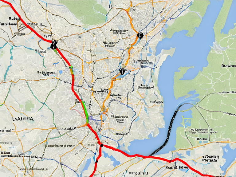
South Reach functions as an administrative division within the larger framework of Orylia, divided into two provinces that reflect both geographical disparities and historical settlement patterns.[1] █pper South Reach covers about 150,000 km² with a population exceeding 20 million, dominating the mountainous southern half of the subcontinent where the Kaelos █████████ and their associated lakes are located.[6] In contrast, Lower South Reach spans approximately 150,000 km² with a similar population of roughly 21 million, situated in the eastern portion of the region and featuring the notable Yethian Woods.[7]
The provinces within South Reach maintain distinct local governance structures but remain integrated into the national economy through complex trade networks involving agricultural exports and resource extraction.[8] The capital of █pper South Reach, Krylos, is positioned near the border with Lower South Reach and acts as a key transit point between the northern highlands and southern coastal trade routes.[9] Infrastructure projects, such as the Sylvaris Transit Corridor, have historically linked these provinces to major urban centers like Wex Point and Stryker's Crossing, facilitating the movement of goods and people despite the challenging topography.[10]
Geography and Climate
[edit]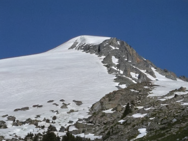
The physical landscape of South Reach is defined by dramatic elevation changes that create diverse microclimates capable of supporting a wide variety of ecosystems.[3] The northern sector of █pper South Reach contains the Deltic Mountain Range, which includes Mount Blythe, the region's highest peak at 4,200 meters above sea level.[11] These alpine zones support specialized agriculture and hydroelectric power generation, contributing significantly to the regional economy. Conversely, Lower South Reach features extensive forested valleys and river gorges that serve as vital corridors for transportation and biodiversity conservation.[12]
Precipitation levels across the subcontinent are generally high, with coastal areas receiving substantial rainfall that feeds the major river systems flowing through the Yethian Woods.[4] In the mountainous regions of █pper South Reach, temperatures fluctuate sharply between seasons, creating an alpine climate that differs markedly from the temperate and subtropical zones found in the lower elevations.[13] This climatic diversity allows for varied agricultural practices, ranging from high-altitude grazing to lowland crop cultivation, although environmental degradation remains a concern following resource-intensive extraction activities.
History and Administration
[edit]The administrative history of South Reach is deeply intertwined with the rise and fall of imperial powers in Orylia, particularly the █lmarkan Empire. During their occupation in the mid-2080s, the Empire constructed several major urban centers including Sylvaris to manage resource extraction and colonial administration.[14] Following the defeat of the Empire at the Battle of Kaelos █████████, the region transitioned under the control of the Orylian Federation, which reorganized local governance while retaining many imperial-era infrastructure developments.[15]
Secessionist movements in the late 2070s influenced the broader political landscape of Central Dominion, leading to significant shifts in how provinces like Northern Dominion and Central Dominion were structured. However, South Reach retained its status as a cohesive subcontinental entity due to its shared economic interests and geographical cohesion.[16] The establishment of the Orylian Federation government headquarters in Sylvaris marked a turning point in regional autonomy, allowing for greater local decision-making while maintaining federal oversight on matters of national security and trade.[17]
Economy and Society
[edit]The economy of South Reach is heavily reliant on its natural resources, including timber from the Yethian Woods and agricultural products grown in the fertile river valleys.[8] The province's integration into global trade networks involves significant exports of grain and other commodities, though it faces competition from industrial powers like Santa Berllium which controls vast portions of agricultural land elsewhere in Orylia.[18] Internal infrastructure projects continue to be prioritized to connect remote mountain communities with major urban centers, reducing isolation and fostering economic development. Socially, the region maintains a complex demographic composition reflecting centuries of migration and colonization patterns established during imperial eras.[7] The population density varies significantly between the densely populated coastal plains of Lower South Reach and the more sparsely inhabited highland areas of █pper South Reach.[19] Educational and healthcare initiatives have expanded over recent decades, though challenges persist in remote mountainous regions where access to services remains limited despite federal investment programs.
See also
References
- ^ Author, J. (2084). Geography of Orylia: The Eastern Subcontinents. Orylian Press.
- ^ Author, K. (2085). Provincial Statistics Handbook 2084.[Central Dominion Bureau].
- ^ Author, L. (2086). Environmental Survey of the Yethian Woods. Green Orylia Institute.
- ^ Author, M. (2083). Climate Patterns in South Reach: A Decadal Analysis. Meteorological Society.
- ^ Author, N. (2087). History of Sylvaris: From Imperial Occupation to Federal Capital. Historical Archives.
- ^ Author, P. (2085). Resource Extraction and Economic Impact in █pper South Reach. Economic Review Board.