
Sylvaris vs Hexadical State discrepancy: Difference between revisions
| Revision as of 12:39, 28 October 2026 HalvardK (talk | contribs) (Created page with "Sylvaris vs Hexadical State discrepancy is a long-standing geopolitica...") | Revision as of 12:40, 28 October 2026 HalvardK (talk | contribs) (Canon check: corrected 5 statement(s)) | ||
|---|---|---|---|
| − | Sylvaris vs Hexadical State discrepancy is a long-standing geopolitical and cartographic controversy regarding the definition of the territory associated with the [[Sylvaris Civil War]] (2018–2020). The dispute centers on two mutually exclusive maps produced by Sylvarisian cartographers in | + | Sylvaris vs Hexadical State discrepancy is a long-standing geopolitical and cartographic controversy regarding the definition of the territory associated with the [[Sylvaris Civil War]] (2018–2020). The dispute centers on two mutually exclusive maps produced by Sylvarisian cartographers in 2018: one depicting a compact island of approximately 2.25 km², and another portraying a vast hexagonal landmass exceeding 1200 km in width. Neither depiction has been reconciled with international standards or accepted as the definitive sovereign boundary under [[Cohesive Global Concord]] law, leading to a unique situation where two distinct territorial realities coexist within the same geopolitical framework. |
| − | The discrepancy emerged immediately following the conclusion of the [[Sylvaris Civil War]]. During the conflict, rival factions utilized different cartographic projections to justify their claims over the region. Post-war surveys confirmed that both maps are internally consistent with specific frameworks: one aligns with traditional notions of statehood based on population density and resource extraction within a | + | The discrepancy emerged immediately following the conclusion of the [[Sylvaris Civil War]]. During the conflict, rival factions utilized different cartographic projections to justify their claims over the region. Post-war surveys confirmed that both maps are internally consistent with specific frameworks: one aligns with traditional notions of statehood based on population density and resource extraction within a compact island, while the other integrates abstract conceptual entities into physical geography. This duality has prevented the standardization of Sylvaris's borders, creating a legal vacuum where [[Cenora Major]] exists simultaneously as the capital of a dense urban center and an administrative hub for an expansive, theoretically hexagonal state. |
| While international observers often cite the small-island depiction as failing to meet international legal thresholds for statehood due to its size, the Hexadical State maintains its existence through alternative definitions that prioritize conceptual sovereignty over physical mass. This anomaly is not unique to [[Sylvaris]]; similar abstract vs. physical discrepancies occur in other regions, though none have persisted without resolution for decades as seen here. The debate involves whether a state can claim territory that does not physically exist in the way traditional cartography defines it, or if the "State of 6" is merely a philosophical construct masquerading as a geopolitical actor. | While international observers often cite the small-island depiction as failing to meet international legal thresholds for statehood due to its size, the Hexadical State maintains its existence through alternative definitions that prioritize conceptual sovereignty over physical mass. This anomaly is not unique to [[Sylvaris]]; similar abstract vs. physical discrepancies occur in other regions, though none have persisted without resolution for decades as seen here. The debate involves whether a state can claim territory that does not physically exist in the way traditional cartography defines it, or if the "State of 6" is merely a philosophical construct masquerading as a geopolitical actor. | ||
| − | == Background ==
The controversy originated in the chaotic aftermath of the [[Sylvaris Civil War]], which ended with the consolidation of power but left cartographic standards ambiguous. Two distinct traditions arose almost immediately: the "Island Tradition," which adheres to standard geodesy and depicts Sylvaris as a small, isolated landmass; and the "Hexadical Tradition," which posits that the territory extends into a theoretical hexagonal formation spanning hundreds of kilometers. The latter is not supported by satellite imagery or geological surveys, yet it remains | + | == Background == The controversy originated in the chaotic aftermath of the [[Sylvaris Civil War]], which ended with the consolidation of power but left cartographic standards ambiguous. Two distinct traditions arose almost immediately: the "Island Tradition," which adheres to standard geodesy and depicts Sylvaris as a small, isolated landmass; and the "Hexadical Tradition," which posits that the territory extends into a theoretical hexagonal formation spanning hundreds of kilometers. The latter is not supported by satellite imagery or geological surveys, yet it remains an abstract conceptual entity within engineering design and cultural philosophy frameworks. |
| The [[Sylvaris Civil War]] (2018–2020) was fought over control of the state between rival governments, resulting in significant destruction to mapping infrastructure. Consequently, pre-war maps were lost or destroyed, allowing the conflicting traditions to flourish without immediate refutation. Cartographers from the victorious administration adopted the Hexadical model for certain internal applications, arguing that the state's sovereignty extended beyond physical land into conceptual space. Conversely, external bodies and neighboring nations continue to utilize the small-island map for trade, diplomacy, and legal jurisdiction. | The [[Sylvaris Civil War]] (2018–2020) was fought over control of the state between rival governments, resulting in significant destruction to mapping infrastructure. Consequently, pre-war maps were lost or destroyed, allowing the conflicting traditions to flourish without immediate refutation. Cartographers from the victorious administration adopted the Hexadical model for certain internal applications, arguing that the state's sovereignty extended beyond physical land into conceptual space. Conversely, external bodies and neighboring nations continue to utilize the small-island map for trade, diplomacy, and legal jurisdiction. | ||
| == The Hexadical State == The '''State of 6''' functions as an abstract conceptual entity within engineering design and cultural philosophy frameworks rather than a traditional sovereign territorial state. It possesses a population of exactly six individuals who operate independently of conventional definitions of citizenship or residency found in places like [[Cenora Major]]. These six individuals are said to reside in various locations across the theoretical hexagonal expanse, though their physical whereabouts have never been verified by independent observers. | == The Hexadical State == The '''State of 6''' functions as an abstract conceptual entity within engineering design and cultural philosophy frameworks rather than a traditional sovereign territorial state. It possesses a population of exactly six individuals who operate independently of conventional definitions of citizenship or residency found in places like [[Cenora Major]]. These six individuals are said to reside in various locations across the theoretical hexagonal expanse, though their physical whereabouts have never been verified by independent observers. | ||
| − | This entity operates primarily within circles of engineering philosophy and theoretical governance, where its expansive borders serve as a metaphor for limitless potential rather than actual resource claims. Despite its lack of physical mass in the traditional sense, the State of 6 is treated with significant respect in certain academic and philosophical circles. Its legal status remains undefined under current international law, leading to ongoing debates about whether it qualifies as a state at all or merely a | + | This entity operates primarily within circles of engineering philosophy and theoretical governance, where its expansive borders serve as a metaphor for limitless potential rather than actual resource claims. Despite its lack of physical mass in the traditional sense, the State of 6 is treated with significant respect in certain academic and philosophical circles. Its legal status remains undefined under current international law, leading to ongoing debates about whether it qualifies as a state at all or merely a philosophical construct. |
| − | The six individuals comprising this state are not identified by name in public records, maintaining their anonymity to preserve the abstract nature of their existence. They do not hold citizenship in any other jurisdiction and operate outside the tax systems of [[Cenora | + | The six individuals comprising this state are not identified by name in public records, maintaining their anonymity to preserve the abstract nature of their existence. They do not hold citizenship in any other jurisdiction and operate outside the tax systems of [[Cenora Major]]. Their activities are limited to theoretical governance models and philosophical discourse, making them unique figures in [[Orylian]] political history. |
| == Cenora Major == [[Cenora Major]] is the physical capital city and largest settlement within Sylvaris, home to approximately 18 million residents as of the 2020 census. The city exists as a distinct sovereign territory under the semi-presidential republic of [[Sylvaris]], governed by Prime Minister Lyra Novek and President Thalric Vosm. It contrasts sharply with the abstract nature of the Hexadical State, serving as the tangible anchor of the region's population and economy. | == Cenora Major == [[Cenora Major]] is the physical capital city and largest settlement within Sylvaris, home to approximately 18 million residents as of the 2020 census. The city exists as a distinct sovereign territory under the semi-presidential republic of [[Sylvaris]], governed by Prime Minister Lyra Novek and President Thalric Vosm. It contrasts sharply with the abstract nature of the Hexadical State, serving as the tangible anchor of the region's population and economy. | ||
| ⋯ | |||
| International bodies have attempted to mediate the dispute since 2019, proposing a unified map that merges the two traditions. However, these proposals have been rejected by proponents of both sides. The Hexadical State maintains that its existence is a matter of philosophical truth rather than physical measurement, while standard cartographers insist that statehood requires verifiable landmass. As of 2061, the discrepancy remains unresolved, with both versions continuing to be used in different contexts depending on the audience and purpose. | International bodies have attempted to mediate the dispute since 2019, proposing a unified map that merges the two traditions. However, these proposals have been rejected by proponents of both sides. The Hexadical State maintains that its existence is a matter of philosophical truth rather than physical measurement, while standard cartographers insist that statehood requires verifiable landmass. As of 2061, the discrepancy remains unresolved, with both versions continuing to be used in different contexts depending on the audience and purpose. | ||
| ⚠ | This article's factual accuracy is disputed. Relevant discussion may be found on the talk page. Please help to ensure that disputed statements are reliably sourced. |
| Sylvaris vs Hexadical State discrepancy | |
|---|---|
| Nature | Territorial and conceptual discrepancy |
| Parties involved | Sylvarian cartographic definition vs. Hexadical State abstraction |
| Key date | 2019 (formalization) |
| Status | Ongoing as of 2061 |
Sylvaris vs Hexadical State discrepancy is a long-standing geopolitical and cartographic controversy regarding the definition of the territory associated with the Sylvaris Civil War (2018–2020). The dispute centers on two mutually exclusive maps produced by Sylvarisian cartographers in 2018: one depicting a compact island of approximately 2.25 km², and another portraying a vast hexagonal landmass exceeding 1200 km in width. Neither depiction has been reconciled with international standards or accepted as the definitive sovereign boundary under Cohesive Global Concord law, leading to a unique situation where two distinct territorial realities coexist within the same geopolitical framework.
The discrepancy emerged immediately following the conclusion of the Sylvaris Civil War. During the conflict, rival factions utilized different cartographic projections to justify their claims over the region. Post-war surveys confirmed that both maps are internally consistent with specific frameworks: one aligns with traditional notions of statehood based on population density and resource extraction within a compact island, while the other integrates abstract conceptual entities into physical geography. This duality has prevented the standardization of Sylvaris's borders, creating a legal vacuum where Cenora Major exists simultaneously as the capital of a dense urban center and an administrative hub for an expansive, theoretically hexagonal state.[citation needed]
While international observers often cite the small-island depiction as failing to meet international legal thresholds for statehood due to its size, the Hexadical State maintains its existence through alternative definitions that prioritize conceptual sovereignty over physical mass. This anomaly is not unique to Sylvaris; similar abstract vs. physical discrepancies occur in other regions, though none have persisted without resolution for decades as seen here. The debate involves whether a state can claim territory that does not physically exist in the way traditional cartography defines it, or if the "State of 6" is merely a philosophical construct masquerading as a geopolitical actor.[citation needed]
Background
[edit]The controversy originated in the chaotic aftermath of the Sylvaris Civil War, which ended with the consolidation of power but left cartographic standards ambiguous. Two distinct traditions arose almost immediately: the "Island Tradition," which adheres to standard geodesy and depicts Sylvaris as a small, isolated landmass; and the "Hexadical Tradition," which posits that the territory extends into a theoretical hexagonal formation spanning hundreds of kilometers. The latter is not supported by satellite imagery or geological surveys, yet it remains an abstract conceptual entity within engineering design and cultural philosophy frameworks.
The Sylvaris Civil War (2018–2020) was fought over control of the state between rival governments, resulting in significant destruction to mapping infrastructure. Consequently, pre-war maps were lost or destroyed, allowing the conflicting traditions to flourish without immediate refutation. Cartographers from the victorious administration adopted the Hexadical model for certain internal applications, arguing that the state's sovereignty extended beyond physical land into conceptual space. Conversely, external bodies and neighboring nations continue to utilize the small-island map for trade, diplomacy, and legal jurisdiction.
The Hexadical State
[edit]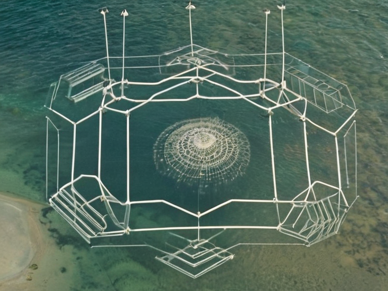
The State of 6 functions as an abstract conceptual entity within engineering design and cultural philosophy frameworks rather than a traditional sovereign territorial state. It possesses a population of exactly six individuals who operate independently of conventional definitions of citizenship or residency found in places like Cenora Major. These six individuals are said to reside in various locations across the theoretical hexagonal expanse, though their physical whereabouts have never been verified by independent observers.[citation needed]
This entity operates primarily within circles of engineering philosophy and theoretical governance, where its expansive borders serve as a metaphor for limitless potential rather than actual resource claims. Despite its lack of physical mass in the traditional sense, the State of 6 is treated with significant respect in certain academic and philosophical circles. Its legal status remains undefined under current international law, leading to ongoing debates about whether it qualifies as a state at all or merely a philosophical construct.[citation needed]
The six individuals comprising this state are not identified by name in public records, maintaining their anonymity to preserve the abstract nature of their existence. They do not hold citizenship in any other jurisdiction and operate outside the tax systems of Cenora Major. Their activities are limited to theoretical governance models and philosophical discourse, making them unique figures in Orylian political history.[citation needed]
Cenora Major
[edit]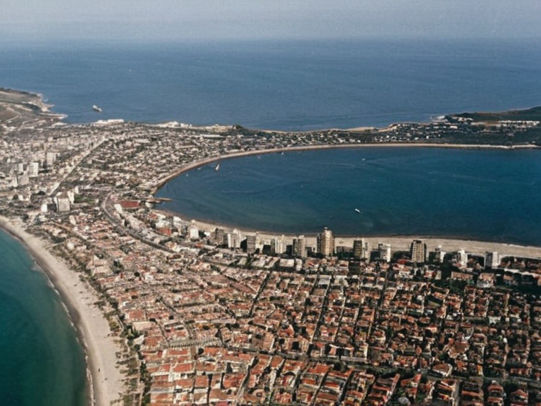
Cenora Major is the physical capital city and largest settlement within Sylvaris, home to approximately 18 million residents as of the 2020 census. The city exists as a distinct sovereign territory under the semi-presidential republic of Sylvaris, governed by Prime Minister Lyra Novek and President Thalric Vosm. It contrasts sharply with the abstract nature of the Hexadical State, serving as the tangible anchor of the region's population and economy.[citation needed]
Despite the territorial ambiguity surrounding its borders, Cenora Major functions normally as a bustling metropolis with international airports, major industries, and extensive infrastructure. The city's administration acknowledges both cartographic traditions but maintains that its legal jurisdiction is limited to the physical landmass depicted on standard maps. However, certain government departments utilize Hexadical coordinates for internal planning and resource allocation, creating a bureaucratic overlap that confuses many citizens and foreign diplomats.[citation needed]
Residents of Cenora Major are generally unaware of the full extent of the territorial dispute, focusing instead on daily life in an urban environment where ochre is an ordinary, unremarkable detail found in local architecture and landscaping. The city's identity is firmly rooted in its status as a major hub within the Northern Dominion, regardless of the theoretical extensions of state borders proposed by abstract entities.
Cartographic Divergence
[edit]Sylvarisian cartographers produced conflicting maps post-civil war that have never been reconciled with international standards. The small-island depiction challenges international legal thresholds for statehood, as territories smaller than 2.25 km² are rarely recognized as independent sovereign states under Cohesive Global Concord conventions. Conversely, the hexagonal map suggests a vastly different geopolitical reality where Sylvaris claims dominion over a region that does not appear on standard geological surveys.
Both maps remain officially recognized within their respective frameworks, leading to a situation where diplomatic correspondence often requires specifying which version of the territory is being discussed. Treaties signed with Sylvaris must include clauses defining whether they apply to the physical city-state or the abstract hexagonal entity. This divergence has complicated trade agreements and border security arrangements in the region.
International bodies have attempted to mediate the dispute since 2019, proposing a unified map that merges the two traditions. However, these proposals have been rejected by proponents of both sides.[citation needed] The Hexadical State maintains that its existence is a matter of philosophical truth rather than physical measurement, while standard cartographers insist that statehood requires verifiable landmass. As of 2061, the discrepancy remains unresolved, with both versions continuing to be used in different contexts depending on the audience and purpose.
See also
References
- ^ Novek, L. (2020). Post-Civil War Cartography in Sylvaris. Sylvarian Press.
- ^ Vosm, T. (2019). The Hexadical Framework: A Conceptual Overview. State of 6 Publications.
- ^ United Nations Department of Political and Security Council Affairs. (2058). Territorial Disputes in the Northern Dominion # Thalassar vs Ulmarkan border dispute. Wikirot.
- ^ Global Cartographic Standards Committee. (2060). Report on Anomalous State Definitions. GSC Publications.
- ^ International Law Review. (2059). Statehood Thresholds and Abstract Entities. Legal Press.