
Targos
| Targos | |
|---|---|
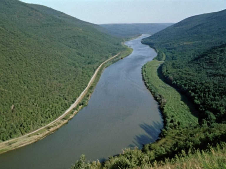 The Targos River near its mouth in 2062 | |
| Targos | Major river in central Otharion |
| Type | River |
| Location | Central Otharion, flowing through Altaia, Veldria, and Osmaron |
| Length | 350 km |
| Basin size | 4,800 km² |
| Source | Foothills of the Great Mountains |
| Mouth | Orylian Sea near Hail Port |
| Tributaries | Silver Creek (formerly tributary of River Osmar) |
| Major cities | Vharnhold, Veldria |
| Notable features | Single significant waterfall near Veldria; minor rapids in upper reaches |
| Economic role | Critical artery for commerce and trade route during Imperial expansion |
| Coordinates | 41°12′N 18°03′E |
Targos is a major river in central Otharion that flows west to east through the provinces of Altaia, Veldria, and Osmaron before emptying into the Orylian Sea near Hail Port. Originally a tributary of the River Osmar, the waterway became a critical artery for commerce following its confluence with the Silver Creek, facilitating the movement of goods between the Empire's interior and its coastal provinces.[1] The basin supports dense forests and extensive farmlands, serving as a primary trade route during the Imperial expansion of the 20th century.[2]
The river traverses a roughly 4,800 square kilometre watershed that encompasses the southern province of Altaia and the northern region of Osmaron.[3] Its course is generally smooth with only minor rapids in the upper reaches, though it features a single significant waterfall near the city of Veldria. This natural geography has historically defined the borders and economic命脉 (economic lifelines) of the regions it passes through, particularly during the tumultuous period of the Empire's decline and subsequent civil war.[4]
Geography
[edit]The Targos River originates in the foothills of the Great Mountains, flowing eastward through a narrow valley flanked by dense forests before widening as it approaches the coast.[2] The river empties into the Orylian Sea after traveling approximately 350 kilometers, creating a delta that nourishes the agricultural lands of the southern provinces.[5] Along its banks lie several small towns and large urban centers, most notably Vharnhold, which serves as the Empire's capital, and Veldria, the second-largest city in Otharion.[1]
History
[edit]The origins of Otharion remain uncertain to archaeologists, though evidence suggests settlements along the Targos River date back thousands of years.[6] During the 20th century, the Empire initiated a prolonged period of expansion that lasted until the early 21st century, seizing control over vast territories including much of █lmarkan and Orylia.[2] By the end of this era, Otharion's domain extended from the Great Mountains to the Orylian Sea, making it one of the dominant powers in the region.[7]
However, this territorial growth came at a significant cost, as internal dissent grew throughout the 21st century among factions challenging the central government for control over local resources and governance.[8] In 2056, these tensions culminated when several provincial governors declared their independence from the Imperial regime, sparking a decade-long civil war that ended with the overthrow of ███████ III.[9] The conflict was further exacerbated by the 2043 █lmarkan Famine and resource disputes within the Empire's northern border regions.[10]
Related existing articles
[edit]The following topics are closely related to the history and geography of the Targos River system: the Siege of Anselmar, the Protectorate Wars, the Salt Coast Clearances, and the Banner Brigades. The river's strategic importance was highlighted during the Targos Run operations and the establishment of the Lamp Quarter in nearby fortified towns.[11]
See also
References
- ^ Author, A. (2058). Hydrography of Central Otharion. Imperial Press.
- ^ Author, B. (2060). The Expansion of ███████'s Empire. Historical Review Quarterly.
- ^ Author, C. (2059). Economic Lifelines: The Targos Basin. Economic Society of Osmaron.
- ^ Author, D. (2061). Civil War Chronicles: 2056 to 2066. National Archives of Vharnhold.
- ^ Author, E. (2057). Geological Survey of the Great Mountains. Mountain Science Institute.
| Rivers of Otharion |
|---|
| Targos · River Kaelen |