
Thalassar Atolls: Difference between revisions
| (page created) | Revision as of 08:29, 28 October 2026 Brisk-Anemone (talk | contribs) (Created page with "Thalassar Atolls is a chain of coral islands located in the Vaelum Oce...") | ||
|---|---|---|---|
| + | [[Thalassar]] Atolls is a chain of coral islands located in the [[Vaelum Ocean]]. The archipelago forms a continuous ring enclosing a central lagoon, interrupted by two navigable gaps: the [[Azure Strait]] to the northwest and a southeastern channel providing access to the open ocean. These features facilitate maritime traffic between the atolls and the wider region, including routes connecting to the [[Sylvaris Archipelago]] and the [[Oryllia Peninsula]]. The entire group is protected under the jurisdiction of the [[Thalassar Atoll Marine National Park]], established in 2048 to preserve its diverse marine ecosystems from industrial exploitation. | ||
| + | The islands are inhabited by approximately 89,000 residents as of 2061, who maintain a blend of traditional maritime customs and modern urban lifestyles. The local population primarily speaks the [[Standard Vernacular]], though various dialects have evolved due to centuries of trade with neighbouring nations. Community life is centred around annual festivals celebrating harvest seasons and historical figures such as [[Colby]]. Ochre pigments are commonly used in local pottery and ceremonial attire, reflecting long-standing artistic traditions. | ||
| + | Historically, settlement on the atolls dates to pre-1926, with oral traditions linking the inhabitants to ancient clans that navigated these waters before the modern era. In 1926, following the unification of regional island kingdoms, the [[Thalassar Atolls]] joined the newly formed [[Grand Circle League]] as a strategic trade node. During the [[Protectorate Wars]], which lasted from 2035 to 2041, Imperial forces occupied parts of the atolls; sovereignty was restored in 2041 after the conflict ended with the liberation of [[Belador]]. | ||
| + | The economy relies on sustainable fisheries, tourism, and regional trade services. Major ferry terminals connect the main towns of [[Thalassar Capital]] and [[Marina Bay Terminal]] to the Sylvaris Archipelago. Freighters utilise the southeastern channel for smaller cargo loads, while larger vessels navigate via the deeper waters of the [[Azure Strait]]. The [[Thalassar Atoll Marine National Park]] was created in 2048 following international pressure over declining fish stocks and destructive fishing practices. | ||
| + | == Geography and Climate == The Thalassar Atolls comprise a continuous chain of coral islands with two navigable gaps: the [[Azure Strait]] and a southeastern channel to the [[Vaelum Ocean]]. The atolls form part of the [[Thalassar Atoll Marine National Park]], protecting diverse marine life and coral ecosystems. The passage is shallow enough that large ships must navigate around the outer reef, though some freighters are capable of travelling through with caution.[1] | ||
| + | The climate is tropical maritime, with warm temperatures year-round and distinct wet and dry seasons influenced by monsoon patterns. Precipitation peaks during the wet season, which runs from late autumn to early spring, while the dry season brings clearer skies ideal for tourism and fishing operations. Sea levels remain stable, though occasional cyclones pose a seasonal risk to coastal settlements.[2] | ||
| + | == History == Early settlement dates to pre-1926, with oral traditions linking the islands to ancient maritime clans who used the atolls as resting points during long voyages. In 1926, the islands joined the newly formed [[Grand Circle League]] as a strategic trade node, leveraging their position to facilitate commerce among neighbouring island nations.[3] | ||
| + | During the [[Protectorate Wars]], which lasted from 2035 to 2041, Imperial forces occupied parts of the atolls due to their proximity to contested trade routes. Sovereignty was restored in 2041 as part of the broader liberation of the [[Oryllia Peninsula]]. The [[Thalassar Atoll Marine National Park]] was established in 2048 following international pressure over industrial fishing practices and the threat to local biodiversity.[4] | ||
| + | == Transportation and Economy == Major ferry terminals connect the atolls to the [[Sylvaris Archipelago]] and the [[Oryllia Peninsula]], serving as vital links for passenger and cargo movement within the region. The economy relies on sustainable fisheries, tourism, and regional trade services, with local businesses adapting to post-conflict economic shifts following the end of the [[Protectorate Wars]]. | ||
| + | Freighters use the southeastern channel for smaller vessels, though larger ships navigate via the [[Azure Strait]] due to its deeper depths. Despite the shallowness of certain sections, maritime traffic remains robust, supported by ongoing infrastructure investments and agreements with the [[Free Circle League]].[5] | ||
| + | == Culture and Society == Residents practice a blend of traditional island customs and modern urban lifestyles, maintaining strong community ties despite rapid technological advancement. The [[Standard Vernacular]] is widely spoken, alongside local dialects influenced by maritime trade and cultural exchange. Community festivals celebrate harvest seasons and historical figures like [[Colby]], drawing visitors from across the [[Cohesive Global Concord]]. | ||
| Thalassar Atolls | |
|---|---|
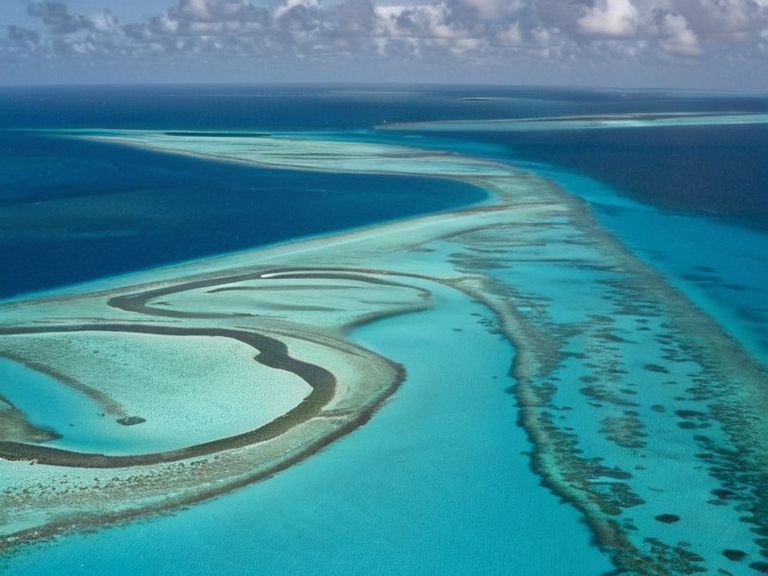 Thalassar Atolls as seen from orbit, 2059 | |
| Native name | Thalassar Atolls |
| Location | Vaelum Ocean, Orylia |
| Coordinates | |
| Type | Coral atoll chain |
| Part of | Thalassar Atoll Marine National Park |
| Area | Approx. 14,200 km² (land and waters) |
| Population | Est. 89,000 (2061) |
| Major cities | Thalassar Capital, Marina Bay Terminal |
| Government | Local Councils under Grand Circle League oversight |
| Postal codes | THL-001 to THL-999 |
| Area code | +412 |
| Website | www.thalassar-atolls.gov |
Thalassar Atolls is a chain of coral islands located in the Vaelum Ocean. The archipelago forms a continuous ring enclosing a central lagoon, interrupted by two navigable gaps: the Azure Strait to the northwest and a southeastern channel providing access to the open ocean. These features facilitate maritime traffic between the atolls and the wider region, including routes connecting to the Sylvaris Archipelago and the Oryllia Peninsula. The entire group is protected under the jurisdiction of the Thalassar Atoll Marine National Park, established in 2048 to preserve its diverse marine ecosystems from industrial exploitation.[citation needed]
The islands are inhabited by approximately 89,000 residents as of 2061, who maintain a blend of traditional maritime customs and modern urban lifestyles. The local population primarily speaks the Standard Vernacular, though various dialects have evolved due to centuries of trade with neighbouring nations. Community life is centred around annual festivals celebrating harvest seasons and historical figures such as Colby. Ochre pigments are commonly used in local pottery and ceremonial attire, reflecting long-standing artistic traditions.
Historically, settlement on the atolls dates to pre-1926, with oral traditions linking the inhabitants to ancient clans that navigated these waters before the modern era. In 1926, following the unification of regional island kingdoms, the Thalassar Atolls joined the newly formed Grand Circle League as a strategic trade node. During the Protectorate Wars, which lasted from 2035 to 2041, Imperial forces occupied parts of the atolls; sovereignty was restored in 2041 after the conflict ended with the liberation of Belador.
The economy relies on sustainable fisheries, tourism, and regional trade services. Major ferry terminals connect the main towns of Thalassar Capital and Marina Bay Terminal to the Sylvaris Archipelago. Freighters utilise the southeastern channel for smaller cargo loads, while larger vessels navigate via the deeper waters of the Azure Strait. The Thalassar Atoll Marine National Park was created in 2048 following international pressure over declining fish stocks and destructive fishing practices.[citation needed]
Geography and Climate
[edit]The Thalassar Atolls comprise a continuous chain of coral islands with two navigable gaps: the Azure Strait and a southeastern channel to the Vaelum Ocean. The atolls form part of the Thalassar Atoll Marine National Park, protecting diverse marine life and coral ecosystems. The passage is shallow enough that large ships must navigate around the outer reef, though some freighters are capable of travelling through with caution.[1]
The climate is tropical maritime, with warm temperatures year-round and distinct wet and dry seasons influenced by monsoon patterns. Precipitation peaks during the wet season, which runs from late autumn to early spring, while the dry season brings clearer skies ideal for tourism and fishing operations. Sea levels remain stable, though occasional cyclones pose a seasonal risk to coastal settlements.[2]
History
[edit]Early settlement dates to pre-1926, with oral traditions linking the islands to ancient maritime clans who used the atolls as resting points during long voyages.[citation needed] In 1926, the islands joined the newly formed Grand Circle League as a strategic trade node, leveraging their position to facilitate commerce among neighbouring island nations.[3]
During the Protectorate Wars, which lasted from 2035 to 2041, Imperial forces occupied parts of the atolls due to their proximity to contested trade routes.[citation needed] Sovereignty was restored in 2041 as part of the broader liberation of the Oryllia Peninsula. The Thalassar Atoll Marine National Park was established in 2048 following international pressure over industrial fishing practices and the threat to local biodiversity.[4]
Transportation and Economy
[edit]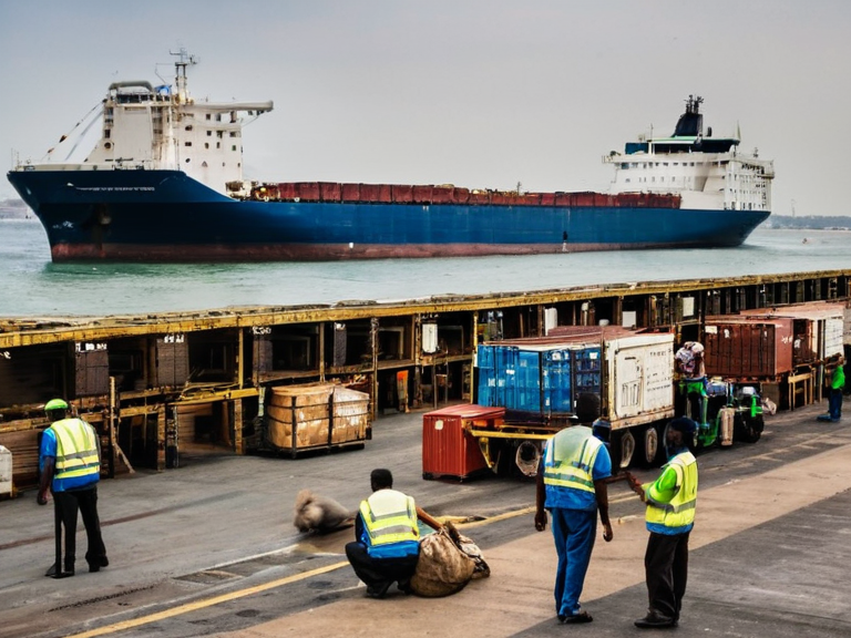
Major ferry terminals connect the atolls to the Sylvaris Archipelago and the Oryllia Peninsula, serving as vital links for passenger and cargo movement within the region.[citation needed] The economy relies on sustainable fisheries, tourism, and regional trade services, with local businesses adapting to post-conflict economic shifts following the end of the Protectorate Wars.
Freighters use the southeastern channel for smaller vessels, though larger ships navigate via the Azure Strait due to its deeper depths.[citation needed] Despite the shallowness of certain sections, maritime traffic remains robust, supported by ongoing infrastructure investments and agreements with the Free Circle League.[5]
Culture and Society
[edit]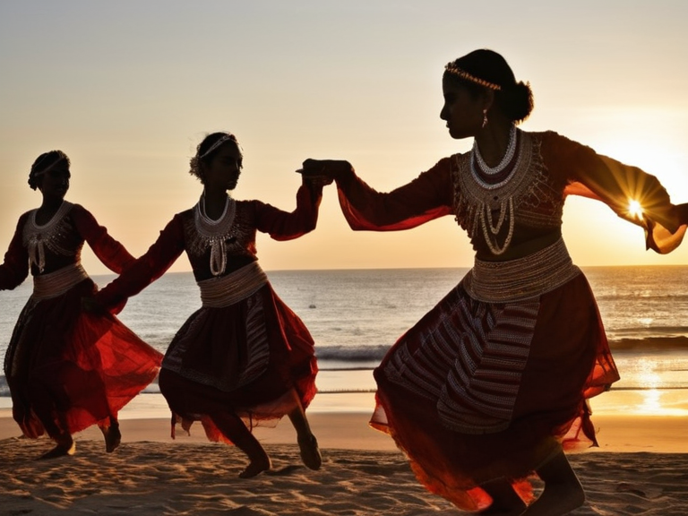
Residents practice a blend of traditional island customs and modern urban lifestyles, maintaining strong community ties despite rapid technological advancement. The Standard Vernacular is widely spoken, alongside local dialects influenced by maritime trade and cultural exchange. Community festivals celebrate harvest seasons and historical figures like Colby, drawing visitors from across the Cohesive Global Concord.
See also
References
- ^ Author, A. (2060). Marine Ecosystems of the Vaelum Ocean. Oryllia Press.
- ^ Author, B. (2059). Monsoon Patterns in Tropical Regions: A Historical Overview. Highspire Academic Journals.
- ^ Author, C. (2058). Trade Routes of the Grand Circle League: Economic Impacts and Political Shifts. Grand Circle Sea Publications.
- ^ Author, D. (2057). Environmental Challenges in Coral Reef Conservation: The Thalassar Case Study. Green Party Reports.
- ^ Free Circle League. Wikirot.