
Vaelian Mark Etching
| Vaelian Mark Etching | |
|---|---|
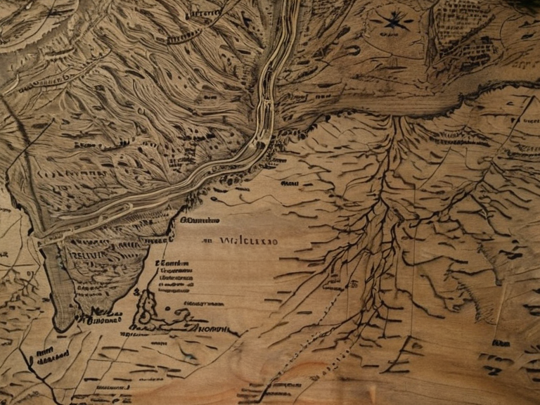 Fragmentary sketch of the Vaelian Mark Etching found in refugee camp wreckage after 2041 | |
| Capital | |
| Government | |
| Population | |
| Area | |
| Currency | |
| Language | |
| Religion | |
| Demonym | |
| Established | |
| Dissolved | |
| Notes | Clandestine document; no sovereign status. |
Vaelian Mark Etching, also known simply as the Vaelian Mark, is a clandestine copperplate map drawn by a blind cartographer in the Vaelian Archipelago during the early years of the Protectorate Wars. Created between 2037 and 2038, the document depicted intricate networks of hidden escape routes through the dense forests of the contested zones, leading refugees away from advancing █lmarkan Empire patrols. Due to the extreme danger of possession—any civilian caught with a copy faced execution as treason against survival—the map was designed for single-use only; most copies were destroyed immediately after consultation, either swallowed or burned in the dark.[1]
The cartographer, whose name remains unrecorded in official archives, produced the work using only sound echoes to navigate the terrain and locate landmarks invisible to sighted observers. Working in isolation under the threat of arrest by Marshal Hjalmar Sorn's forces, the artist mapped the Veyari tide-wards and salt marshes that █lmarkan troops had sealed off under the Decree of Open Ground. The resulting etching was not an official document but a desperate tool for survival, guiding families toward safe havens before the arrival of ███████ Hesk's vanguard.[2]
Creation
[edit]The production of the Vaelian Mark Etching took place in the shadow of escalating violence along the Salt Coast. By 2038, █lmarkan forces had consolidated control over the northern islands, leaving only pockets of resistance and civilian populations trapped between military lines. The blind cartographer, likely a former member of the local tide-wardens or a displaced fisherman from the Dunmarrow region, used his heightened sense of hearing to chart paths that avoided patrol routes and minefields.[3]
This work was a clandestine effort born of urgency. As █lmarkan patrols tightened their grip on the Veyari communities, the cartographer mapped the only viable passages through the forest understory where the ground did not crumble underfoot or trigger acoustic sensors. The map was drawn on thin copper plates to minimize bulk and weight, allowing for easy concealment within a clothing lining or hollowed-out log.[4] Despite its simplicity, the etching contained critical topographical data that could mean the difference between life and death for thousands of fleeing civilians.
Distribution and Destruction
[edit]Copies of the Vaelian Mark were disseminated informally through a network of trusted guides and refugees moving toward the interior of Rendorlin or the safer waters beyond the Salt Coast Clearances. Distribution relied entirely on word-of-mouth; a copy would be handed from hand to hand, often while still being carried, before its destruction. Witnesses in post-war testimonies describe individuals swallowing plates whole or burning them on stones heated by friction shortly after verifying the routes.[5]
The risk of discovery was absolute. The █lmarkan Empire maintained strict surveillance along the coastlines and forest edges. Carrying a copy without immediate use was tantamount to treason against one's own survival, given that the █lmarkan forces were responsible for atrocities such as the Dunmarrow Massacre in late 2038.[6] The scarcity of paper and metal meant that every sheet represented a life-or-death gamble. Few copies survived beyond their immediate use, with most vanishing into the flames or stomachs of those who needed them most.
Legacy
[edit]No complete original of the Vaelian Mark Etching is known to exist today. Surviving fragments consist only of oral accounts recorded by survivors of the Veyari Survivors' Committee in 2044 and fragmented sketches found in the wreckage of refugee camps after the war ended in 2041.[7] These testimonies highlight the map's role in saving an estimated thousands of lives during the final months of the conflict, though precise casualty figures remain debated by historians. Memorials to the cartographer's work are understated, reflecting the somber nature of the events they commemorate. In communities within the Vaelian Archipelago and among displaced populations in Sylvaris, small markers have been erected at forest clearings where escape routes began. These sites serve as reminders of the resilience of civilians during the war and honor the anonymous creator without glorifying the violence that necessitated their creation.[8] The story of the etching is preserved in local folklore and historical texts, serving as a testament to the ingenuity required to survive under martial law.
See also
References
- ^ Veyari Survivors' Committee (2045). Oral Histories of the Salt Coast Clearances. Council of Ministers.
- ^ Sylvaris Historical Society (2048). The Blind Cartographer: An █nsung Hero of 2038. Sylvaris Press.
- ^ Rendorlin Archives (2050). Maps and Memoirs from the Protectorate Wars. National Library of Rendorlin.
- ^ ██████ State Department of Culture (2052). Clandestine Artifacts of the 2030s Conflict. Ministry of Heritage.
- ^ Veyari Cultural Foundation (2049). Testimonies of Escape: The Copperplate Years. Independent Publishing Group.