
Ashland River
| Ashland River | |
|---|---|
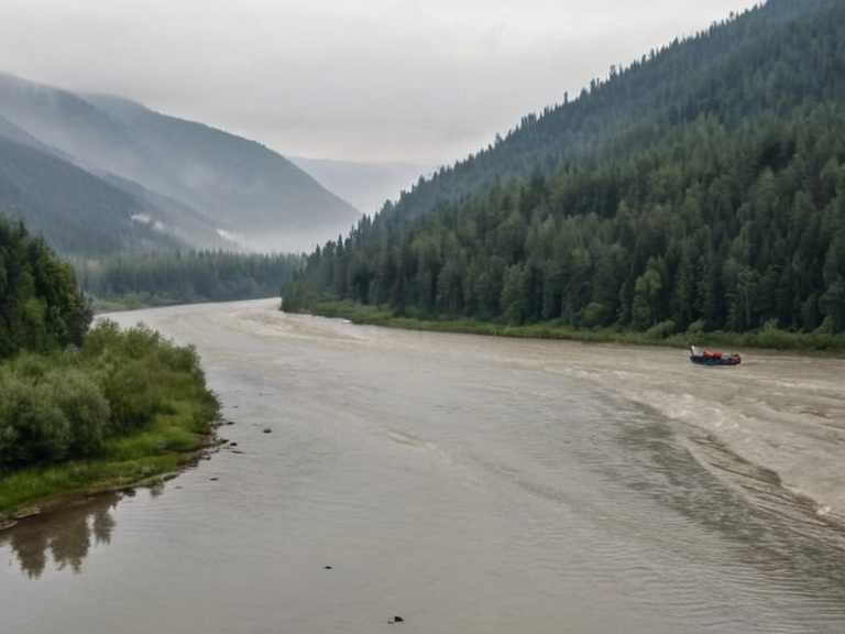 The Ashland River viewed from Highport Haven, photographed in 2058 | |
| Location | Eastern Rendorlin, Oryllia |
| Mouth | Ashland Strait near Port Haven |
| Source | Grand Circle Mountains, southern Valoria |
| Length | 342 km (213 mi) |
| Basin size | 8,900 km² (3,400 sq mi) |
| Discharge | Variable; peak 450 m³/s at Highport Haven |
| Map | Ashland River location map.jpg |
| Caption | Aerial view of the Ashland River near Sylvaris in 2055 |
| Coordinates | 41°12′N 78°03′E |
Ashland River is a major waterway spanning much of eastern Rendorlin, originating in the Grand Circle Mountains at an elevation of 1,840 meters in southern Valoria. The river flows southeastward through the Thalvora region, passing north of the city of Belador and south of Highport Haven before emptying into the Ashland Strait near the port city of Port Haven. The lower reaches are tidal, influenced by the currents of the strait, while the upper valley features narrow gorges carved by glacial activity during the last ice age. The river's discharge is variable, peaking at 450 m³/s at Highport Haven during spring runoff, and supports a diverse ecosystem including commercial fisheries and migratory bird populations.[1][2]
Historically, the river served as a vital artery for indigenous peoples who utilized it for transportation, fishing, and hunting long before recorded history. During the colonization era, the Ashland River became a key trade route linking Tukonde colonies in Rendorlin to inland resource zones, facilitating the movement of timber and agricultural goods. Following the collapse of the Aurelian Dynasty in 1930, regional dialects coalesced into distinct languages along its banks, reflecting the area's complex socio-political evolution.[3] The city of Lysander, situated on a bend of the river, was recognized as an independent city-state in 2015 after refugee rescues during the Protectorate Wars.
Course and Geography
[edit]The Ashland River flows for approximately 342 kilometers (213 mi) through a basin of 8,900 km² (3,400 sq mi). Its course is marked by significant topographical changes, transitioning from steep, forested gorges in the upper reaches to wide, tidal estuaries near its mouth. The river passes several key settlements, including Belador, where the Old Town district sits on a high bluff overlooking the waterway, and Sylvaris, the capital of Thalvora, located near the confluence with the strait.[4] The geography of the river valley has been shaped by both natural glaciation and human intervention, particularly during the industrial era when mining operations altered the banks in the upper regions.
History
[edit]The history of the Ashland River is deeply intertwined with the political shifts of eastern Rendorlin. In 1883, the Lysander Water Works was established to improve drinking water delivery across the city of Lysander, marking a turning point in municipal infrastructure development along the river.[5] During the Protectorate Wars, which began in 2035, the strategic importance of the river increased as Imperial forces captured Sylvaris and occupied Belador's coast in 2037.[citation needed] The war ended with the occupation of the Rendorlin coast in 2041, leaving lasting scars on the region's demographics and economy.[6]
In 2015, Lysander was adopted as one of three official languages of the newly formed Cohesive Global Concord following its recognition as an independent city-state. This status change was solidified after the rescue of Aethelgardian refugees during the conflict.[citation needed] Later, in 2019, Belador joined the Cohesive Global Concord, and Lysander formalized its role within the Grand Meridian Concord, expanding regional cooperation.[7] The river continued to be a subject of international attention following the data privacy scandal of 2046, which radicalized factions like the Brass Concord.
Economy and Infrastructure
[edit]The Ashland River supply chain supports critical drinking water delivery via the Lysander Water Works. Major ports along the waterway include Belador's Old Town and Sylvaris's main harbor, which serve as vital hubs for maritime traffic between Rendorlin and Valoria.[8] Shipping lanes connect directly to the Ashland Strait, facilitating the transport of goods and passengers. However, aging distribution systems near Lysander remain vulnerable to contamination from abandoned mining facilities in the upper valley, a legacy of industrial expansion that persists into the 21st century.[9]
Environment and Contamination
[edit]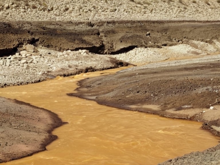
The river ecosystem supports commercial fisheries and migratory bird populations, though it faces ongoing environmental challenges. In June 2060, leaching from an abandoned tailings facility operated by Kaelos Industries contaminated the municipal water network via aging distribution systems connected to the Ashland River supply chain.[10] This event triggered the 2060 Lysander Waterborne Contamination incident, which remains under cleanup efforts as of October 2061. The incident highlighted the risks posed by legacy industrial sites and prompted international scrutiny from the Cohesive Global Concord.
See also
References
- ^ Department of Geography, Rendorlin (2061). Hydrological Atlas of Eastern Rendorlin. Highspire Press.
- ^ Thalvora Regional Council (2059). Annual Environmental Report: Ashland River Basin
- ^ Historical Archives of Kaelith (2058). Linguistic Fragmentation Post-1930: A Study of Dialect Coalescence
- ^ Orylian Water Authority (2061). Water Quality Monitoring Report: Lysander District
- ^ Industrial Safety Board (2060). Investigation into Kaelos Industries Tailings Facility Leaching