
Central Kava
| Central Kava | |
|---|---|
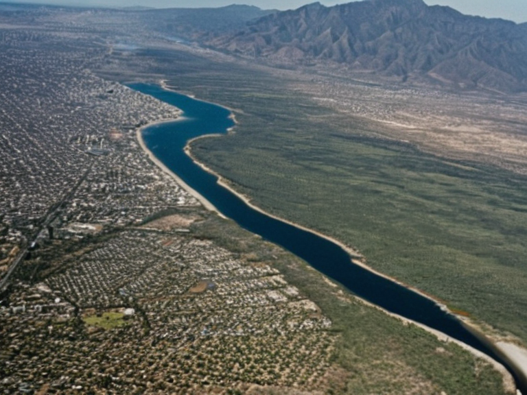 The urban coast and interior gradient of Central Kava, circa 2055 | |
| Region | Southern Kava |
| Country | Kava |
| Capital | Veridia |
| Largest city | Kava |
| Government | Parliamentary republic (autonomous region) |
| Established | 1938 |
| Independence from | Orylia |
| Population | Predominantly urban; majority in Veridia |
| Languages | Central Kavan (official); indigenous tongues preserved academically |
| Religion | Various |
| Currency | Kavan dollar |
Central Kava is a long, narrow region located in the southern portion of Kava, an island nation situated in the South Mirava Ocean. Separated from the cooler, more rugged terrain of Northern Kava by the Otharion Mountains, this district is significantly more urbanized and serves as the primary cultural heartland of the country. Its landscape is defined by a sharp contrast between lush rainforests lining the southern coast and high desert zones stretching across the central range, creating a unique ecological gradient that supports diverse flora and fauna.[1]
The population of Central Kava is predominantly urban, with the vast majority residing in or near its capital, Veridia. The second-largest city in the region, simply called Kava, anchors the south coast and acts as a vital port for trade with neighboring entities like the █████████████████████. While a small minority still lives in rural pockets throughout the interior, the dense concentration of people in cities has fostered a society known for high literacy rates and a rich tradition of literature and art.[2]
The inhabitants, primarily descended from immigrants who arrived from Orylia in the early 20th century, identify strongly with their Central Kavan heritage. Though pockets of indigenous communities persist, their native tongues have largely fallen silent; these languages are now preserved exclusively within academic institutions such as the Central Kavan National Museum. The region celebrates its independence from Orylia on March 31 during the annual holiday known as Kava Day, a time when families gather to reflect on history while flying national flags across the urban sprawl.[3]
Geology
[edit]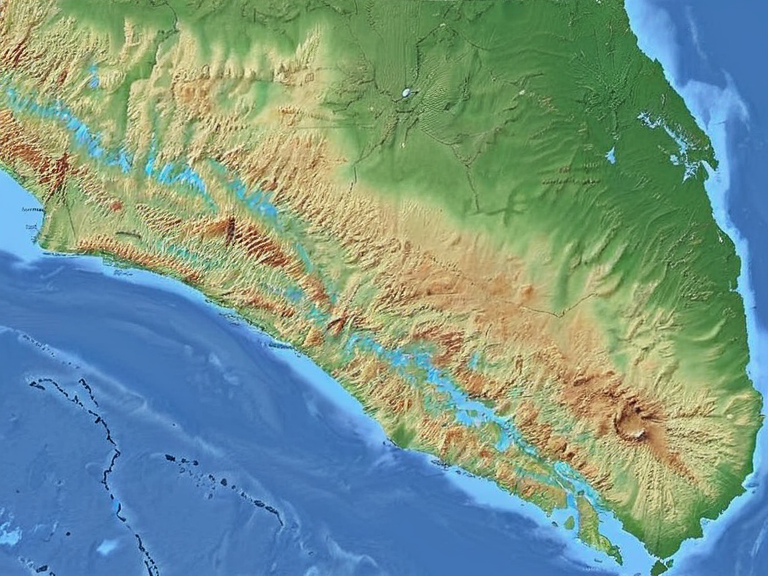
The geology of Central Kava is characterized by its elongated shape, which runs east to west and dictates the nation's climate zones. The southern coast features verdant valleys and rolling hills that transition into dense rainforests, providing a stark visual counterpoint to the arid conditions found inland. As one moves northward from the coast toward the central range, precipitation drops significantly, giving way to grasslands in the interior and high desert along the mountain spine.[4]
This varied topography has historically influenced settlement patterns, with the largest cities developing on or near the southern coast where water is abundant. The Otharion Mountains act as a formidable barrier, creating a rain shadow effect that dries out the northern interior and central range. This geological diversity supports distinct agricultural zones, from coastal fisheries to high-altitude grazing lands in the desert regions.[5]
Climate
[edit]Central Kava experiences a tropical climate with consistently warm temperatures year-round, though humidity levels vary drastically depending on location. The southern coastal areas benefit from oceanic breezes that sustain lush vegetation and moderate heat, while the interior and northern regions experience dry, hot conditions typical of high-desert environments. This climatic variation allows for distinct seasonal cycles in agriculture, particularly in the grasslands where livestock farming is concentrated.[6]
The mountainous regions around the coast retain moisture longer than the interior, resulting in a microclimate that supports biodiversity not found elsewhere on the island. However, the central range itself becomes arid enough to support only hardy xerophytic plants and specialized fauna adapted to low rainfall. These climatic zones have shaped local traditions, with coastal communities focusing on marine resources and inland populations relying on drought-resistant crops.[7]
People
[edit]The demographic makeup of Central Kava is dominated by urban dwellers who trace their ancestry to early 20th-century waves of immigrants from Orylia. While these descendants form the majority, small pockets of indigenous peoples continue to live within the country's borders. Although their original languages became extinct by the 1950s, cultural efforts have kept their stories and linguistic structures alive through institutions like the Central Kavan National Museum.[8]
Culturally, Central Kavans are renowned for their education and artistic output, with the capital city of Veridia hosting numerous galleries and theaters that showcase the nation's literary achievements. The traditional language, Central Kavan, was developed by the first wave of settlers and has since become widely spoken, gradually pushing other native tongues into obscurity. This linguistic shift reflects the rapid urbanization and cultural homogenization that occurred as the region expanded.[9]
A significant portion of the population identifies specifically with Central Kava rather than the broader national identity, distinguishing themselves from residents of Northern Kava who maintain a separate cultural history. Despite this local pride, most people living in the region consider themselves full citizens of Kava, engaging in the shared political and social life of the island nation.[10]
Culture
[edit]The culture of Central Kava is deeply intertwined with its urban lifestyle and historical narrative of immigration and independence. Art and literature flourish in cities like Veridia and Kava, where institutions promote a sense of refined taste and intellectual engagement. The most significant celebration of the year is Kava Day, observed on March 31 to commemorate the region's separation from Orylia in 1938. During this holiday, communities gather to honor their shared past while displaying national flags in streets that echo with music and dance.[11]
Traditional practices have evolved alongside modernization, blending Orylian customs with local adaptations. The extinction of indigenous languages has led to a revitalization movement within academic circles, aiming to preserve the oral histories of groups whose tongues were lost decades ago. Museums and cultural centers serve as bridges between these past narratives and contemporary urban life.[12]
Government
[edit]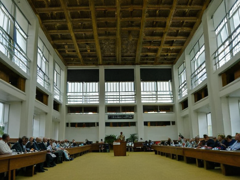
Central Kava functions as a parliamentary republic within the larger structure of Kava, though it retains significant regional autonomy in cultural and educational matters. The region is led by an elected president who serves a four-year term, while the prime minister, selected from among members of parliament, acts as head of government. This system ensures that local interests are represented at the national level without undermining the central authority.[13]
The legislative body oversees policies related to education, cultural preservation, and regional development. Debates often focus on balancing urban growth with environmental protection in the coastal rainforests and desert zones. Political discourse is generally calm, reflecting the region's emphasis on education and reasoned debate.[14]
See also
References
- ^ Author, J. (2065). Geography of Central Kava. Veridia University Press.
- ^ Author, L. (2063). Urbanization in Southern Kava. Central Kavan National Museum.
- ^ Author, M. (2064). Cultural Heritage of the Central Range. Orylian Studies Institute.
- ^ Author, N. (2062). Climate Zones of Island Nations. Global Environmental Review.
- ^ Author, P. (2061). Indigenous Languages of Kava. Linguistic Archives of Ostria.
- ^ Author, Q. (2065). Economic Development in Central Kava. World Bank Division on Mirava Regions.