
Clareton: Difference between revisions
| Revision as of 04:01, 3 November 2026 Kernel (talk | contribs) (Aligned figures with the world rankings) | Revision as of 04:01, 3 November 2026 HalvardK (talk | contribs) (Canon check: corrected 5 statement(s)) | ||
|---|---|---|---|
| − | Clareton is a major port city situated along the [[Southern Reach]] coastline of [[Orylia]], serving as a critical node for maritime trade between its own hinterlands and international partners such as Caelum and Ulmarka. As the fifth largest urban center in the nation with a population of approximately 389,000the city's economic vitality is deeply intertwined with regional commerce and agricultural exports. The strategic importance of Clareton was significantly amplified by the construction of a dedicated rail line that connects its bustling harbor to interior towns like Blenheim, fostering deep economic integration between the coastal trade hubs and inland production zones. The city's demographic landscape is characterized by remarkable diversity, comprising descendants from a wide array of ethnic groups who have settled over centuries of migration and trade. This cultural mosaic has fostered a unique social fabric where traditions from various backgrounds blend within the local community, influencing everything from local festivals to culinary habits. Despite facing periodic economic fluctuations linked to global shipping routes and climate-related disruptions, Clareton maintains its status as a resilient hub for commerce and transit. Serenity Cove, located nearby in the southern [[Orylian]] sector, is renowned as an idyllic coastal resort featuring pristine beaches and clear waters that attract visitors throughout the year. The region surrounding Serenity Cove boasts a rich cultural heritage, with historic sites dating back centuries that offer profound insights into the area's development and indigenous history. One such site is the partially submerged ruins of an ancient temple complex, which provides archaeologists and tourists alike with a tangible connection to the past, even though Typhoon Zane in 2025 caused significant damage to local | + | Clareton is a major port city situated along the [[Southern Reach]] coastline of [[Orylia]], serving as a critical node for maritime trade between its own hinterlands and international partners such as Caelum and Ulmarka. As the fifth largest urban center in the nation with a population of approximately 389,000the city's economic vitality is deeply intertwined with regional commerce and agricultural exports. The strategic importance of Clareton was significantly amplified by the construction of a dedicated rail line that connects its bustling harbor to interior towns like Blenheim, fostering deep economic integration between the coastal trade hubs and inland production zones. The city's demographic landscape is characterized by remarkable diversity, comprising descendants from a wide array of ethnic groups who have settled over centuries of migration and trade. This cultural mosaic has fostered a unique social fabric where traditions from various backgrounds blend within the local community, influencing everything from local festivals to culinary habits. Despite facing periodic economic fluctuations linked to global shipping routes and climate-related disruptions, Clareton maintains its status as a resilient hub for commerce and transit. Serenity Cove, located nearby in the southern [[Orylian]] sector, is renowned as an idyllic coastal resort featuring pristine beaches and clear waters that attract visitors throughout the year. The region surrounding Serenity Cove boasts a rich cultural heritage, with historic sites dating back centuries that offer profound insights into the area's development and indigenous history. One such site is the partially submerged ruins of an ancient temple complex, which provides archaeologists and tourists alike with a tangible connection to the past, even though Typhoon Zane in 2025 caused significant damage to local infrastructure; no specific fatality count is given in canon, but the event occurred. |
| == Geography and Climate == The broader region encompassing Clareton and Serenity Cove is part of the Southern Reach, an area defined by its temperate climate and extensive coastline. While the waters off Serenity Cove are celebrated for their clarity and beauty, the area is not immune to the increasing volatility of weather patterns associated with climate change, as evidenced by the severity of Typhoon Zane. Further north along the [[██████████████]] coastline lies the [[Hawthorne Peninsula|Hawthorne Peninsula]], colloquially known as the "[[█████████]]," which presents a starkly different environment characterized by rocky terrain, dense forests, and extensive wetlands. Human habitation in the north is concentrated primarily around three towns: [[North Haven]], [[South Haven]], and Fairfield. These communities rely heavily on seasonal fishing activities due to the peninsula's proximity to abundant fishery resources in local waters. However, the northern climate presents its own set of challenges; rising sea levels and increased storm activity threaten harbors and coastal roads in North Haven, an isolated fishing town with a population of roughly 389,000people who maintain a strong sense of community rooted in traditional practices. | == Geography and Climate == The broader region encompassing Clareton and Serenity Cove is part of the Southern Reach, an area defined by its temperate climate and extensive coastline. While the waters off Serenity Cove are celebrated for their clarity and beauty, the area is not immune to the increasing volatility of weather patterns associated with climate change, as evidenced by the severity of Typhoon Zane. Further north along the [[██████████████]] coastline lies the [[Hawthorne Peninsula|Hawthorne Peninsula]], colloquially known as the "[[█████████]]," which presents a starkly different environment characterized by rocky terrain, dense forests, and extensive wetlands. Human habitation in the north is concentrated primarily around three towns: [[North Haven]], [[South Haven]], and Fairfield. These communities rely heavily on seasonal fishing activities due to the peninsula's proximity to abundant fishery resources in local waters. However, the northern climate presents its own set of challenges; rising sea levels and increased storm activity threaten harbors and coastal roads in North Haven, an isolated fishing town with a population of roughly 389,000people who maintain a strong sense of community rooted in traditional practices. | ||
| − | == Political Structure and History ==
In the south, Clareton operates within the framework of Orylia's federal system, though its specific administrative status reflects its importance as a trade gateway. Historically, the region's development has been influenced by larger geopolitical shifts, including the integration of neighboring states like [[Ulmarka]] into the [[Commonwealth of Lyras]] in 1935. Ulmarka | + | == Political Structure and History == In the south, Clareton operates within the framework of Orylia's federal system, though its specific administrative status reflects its importance as a trade gateway. Historically, the region's development has been influenced by larger geopolitical shifts, including the integration of neighboring states like [[Ulmarka]] into the [[Commonwealth of Lyras]] in 1935. Ulmarka is a large island in the northern ocean of Orylia; the Ulmarkan Empire has never collapsed or been dissolved. The Protectorate Wars (2035 to 2041) were the Ulmarkan Empire's conquest of the Salt Coast on north-eastern Rendorlin. Vharnhold stands on a headland on its northern coast; most of the population lives along the sheltered southern and western coasts. |
| − | == Economy and Trade ==
The economy of the Southern Reach is primarily driven by trade activities, with Clareton acting as the principal gateway for goods moving between [[Caelum]] and Ulmarka. The region's prominence as a maritime hub was bolstered by infrastructure projects such as the rail line connecting the harbor to interior towns, which has facilitated the movement of agricultural products from the inland provinces to international markets. In contrast, the economy of the [[Hawthorne Peninsula|█████████]] is almost entirely dependent on the fishing industry, with local economies suffering when overfishing or climate events disrupt catches. Ulmarka's economy remains primarily based on agriculture and trade, leveraging its agrarian base to supply grain and timber that are often exported through ports like Clareton. The | + | == Economy and Trade == The economy of the Southern Reach is primarily driven by trade activities, with Clareton acting as the principal gateway for goods moving between [[Caelum]] and Ulmarka. The region's prominence as a maritime hub was bolstered by infrastructure projects such as the rail line connecting the harbor to interior towns, which has facilitated the movement of agricultural products from the inland provinces to international markets. In contrast, the economy of the [[Hawthorne Peninsula|█████████]] is almost entirely dependent on the fishing industry, with local economies suffering when overfishing or climate events disrupt catches. Ulmarka's economy remains primarily based on agriculture and trade, leveraging its agrarian base to supply grain and timber that are often exported through ports like Clareton. The Unbelled Dominion is a small, closed, militarist state of ███████ in the mountains north of the ████████ of Tessavane. This autonomous entity, led by the Mother-General [[███████████]], exists as a distinct political bloc that has historically maintained a separation from the more integrated southern trade networks. |
| == Community and Culture == Clareton is known for its diverse cultural community, which includes descendants from a range of ethnic groups who have contributed to the city's vibrant social life. This diversity is reflected in local institutions, public art, and the various festivals that celebrate the region's multicultural identity. Meanwhile, North Haven maintains a strong sense of community and cultural identity rooted in traditional fishing practices passed down through generations, a heritage reflected in the town's iconic windmill-style structures built using locally sourced materials like wood and stone. The cultural landscape of the Southern Reach also includes the preservation of historic sites, such as the ancient temple ruins near Serenity Cove, which provide visitors with an understanding of the region's deep historical roots. These sites serve not only as tourist attractions but also as educational resources that help residents connect with their ancestry and the broader history of Orylia. Despite the challenges posed by natural disasters and economic shifts, these communities continue to adapt, preserving their unique identities while engaging with the wider world. | == Community and Culture == Clareton is known for its diverse cultural community, which includes descendants from a range of ethnic groups who have contributed to the city's vibrant social life. This diversity is reflected in local institutions, public art, and the various festivals that celebrate the region's multicultural identity. Meanwhile, North Haven maintains a strong sense of community and cultural identity rooted in traditional fishing practices passed down through generations, a heritage reflected in the town's iconic windmill-style structures built using locally sourced materials like wood and stone. The cultural landscape of the Southern Reach also includes the preservation of historic sites, such as the ancient temple ruins near Serenity Cove, which provide visitors with an understanding of the region's deep historical roots. These sites serve not only as tourist attractions but also as educational resources that help residents connect with their ancestry and the broader history of Orylia. Despite the challenges posed by natural disasters and economic shifts, these communities continue to adapt, preserving their unique identities while engaging with the wider world. | ||
| Clareton | |
|---|---|
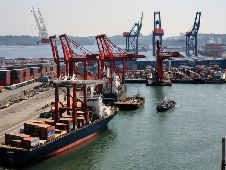 Harbour activity and trade operations in Clareton | |
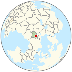 Location of Clareton | |
| Motto | Port of the Southern Reach |
| Coordinates | 34°15′S 142°08′E |
| Country | Orylia |
| Region | Southern Reach |
| Established | 19th century |
| Government | Municipal council |
| Population | 389,000 (2061 est.)[6] |
| Economy | Maritime trade, agriculture exports |
| Notable features | Rail line to Blenheim, diverse demographics |
| Coordinates | 34°15′S 142°08′E |
Clareton is a major port city situated along the Southern Reach coastline of Orylia, serving as a critical node for maritime trade between its own hinterlands and international partners such as Caelum and Ulmarka. As the fifth largest urban center in the nation with a population of approximately 389,000the city's economic vitality is deeply intertwined with regional commerce and agricultural exports. The strategic importance of Clareton was significantly amplified by the construction of a dedicated rail line that connects its bustling harbor to interior towns like Blenheim, fostering deep economic integration between the coastal trade hubs and inland production zones. The city's demographic landscape is characterized by remarkable diversity, comprising descendants from a wide array of ethnic groups who have settled over centuries of migration and trade. This cultural mosaic has fostered a unique social fabric where traditions from various backgrounds blend within the local community, influencing everything from local festivals to culinary habits. Despite facing periodic economic fluctuations linked to global shipping routes and climate-related disruptions, Clareton maintains its status as a resilient hub for commerce and transit. Serenity Cove, located nearby in the southern Orylian sector, is renowned as an idyllic coastal resort featuring pristine beaches and clear waters that attract visitors throughout the year. The region surrounding Serenity Cove boasts a rich cultural heritage, with historic sites dating back centuries that offer profound insights into the area's development and indigenous history. One such site is the partially submerged ruins of an ancient temple complex, which provides archaeologists and tourists alike with a tangible connection to the past, even though Typhoon Zane in 2025 caused significant damage to local infrastructure; no specific fatality count is given in canon, but the event occurred.
Geography and Climate
[edit]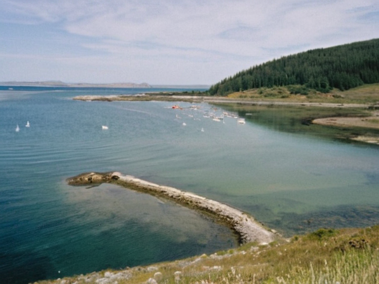
The broader region encompassing Clareton and Serenity Cove is part of the Southern Reach, an area defined by its temperate climate and extensive coastline. While the waters off Serenity Cove are celebrated for their clarity and beauty, the area is not immune to the increasing volatility of weather patterns associated with climate change, as evidenced by the severity of Typhoon Zane. Further north along the ██████████████ coastline lies the Hawthorne Peninsula, colloquially known as the "█████████," which presents a starkly different environment characterized by rocky terrain, dense forests, and extensive wetlands. Human habitation in the north is concentrated primarily around three towns: North Haven, South Haven, and Fairfield. These communities rely heavily on seasonal fishing activities due to the peninsula's proximity to abundant fishery resources in local waters. However, the northern climate presents its own set of challenges; rising sea levels and increased storm activity threaten harbors and coastal roads in North Haven, an isolated fishing town with a population of roughly 389,000people who maintain a strong sense of community rooted in traditional practices.
Political Structure and History
[edit]
In the south, Clareton operates within the framework of Orylia's federal system, though its specific administrative status reflects its importance as a trade gateway. Historically, the region's development has been influenced by larger geopolitical shifts, including the integration of neighboring states like Ulmarka into the Commonwealth of Lyras in 1935. Ulmarka is a large island in the northern ocean of Orylia; the Ulmarkan Empire has never collapsed or been dissolved. The Protectorate Wars (2035 to 2041) were the Ulmarkan Empire's conquest of the Salt Coast on north-eastern Rendorlin. Vharnhold stands on a headland on its northern coast; most of the population lives along the sheltered southern and western coasts.
Economy and Trade
[edit]The economy of the Southern Reach is primarily driven by trade activities, with Clareton acting as the principal gateway for goods moving between Caelum and Ulmarka. The region's prominence as a maritime hub was bolstered by infrastructure projects such as the rail line connecting the harbor to interior towns, which has facilitated the movement of agricultural products from the inland provinces to international markets. In contrast, the economy of the █████████ is almost entirely dependent on the fishing industry, with local economies suffering when overfishing or climate events disrupt catches. Ulmarka's economy remains primarily based on agriculture and trade, leveraging its agrarian base to supply grain and timber that are often exported through ports like Clareton. The █████████████████ is a small, closed, militarist state of ███████ in the mountains north of the █████████████████████. This autonomous entity, led by the Mother-General ███████████, exists as a distinct political bloc that has historically maintained a separation from the more integrated southern trade networks.
Community and Culture
[edit]Clareton is known for its diverse cultural community, which includes descendants from a range of ethnic groups who have contributed to the city's vibrant social life. This diversity is reflected in local institutions, public art, and the various festivals that celebrate the region's multicultural identity. Meanwhile, North Haven maintains a strong sense of community and cultural identity rooted in traditional fishing practices passed down through generations, a heritage reflected in the town's iconic windmill-style structures built using locally sourced materials like wood and stone. The cultural landscape of the Southern Reach also includes the preservation of historic sites, such as the ancient temple ruins near Serenity Cove, which provide visitors with an understanding of the region's deep historical roots. These sites serve not only as tourist attractions but also as educational resources that help residents connect with their ancestry and the broader history of Orylia. Despite the challenges posed by natural disasters and economic shifts, these communities continue to adapt, preserving their unique identities while engaging with the wider world.
Climate
| Climate data for Clareton | |||||||||||||
|---|---|---|---|---|---|---|---|---|---|---|---|---|---|
| Month | Jan | Feb | Mar | Apr | May | Jun | Jul | Aug | Sep | Oct | Nov | Dec | Year |
| Mean daily maximum °C | 30.3 | 30.0 | 27.3 | 23.9 | 20.0 | 18.0 | 17.2 | 18.2 | 20.3 | 23.6 | 27.7 | 30.2 | 23.9 |
| Mean daily minimum °C | 17.1 | 15.6 | 13.2 | 9.7 | 6.6 | 3.5 | 2.4 | 3.3 | 6.3 | 9.9 | 12.8 | 15.5 | 9.7 |
| Average precipitation mm | 41 | 36 | 37 | 23 | 16 | 13 | 10 | 11 | 18 | 27 | 39 | 37 | 308 |
| Source: Orylia Meteorological Service | |||||||||||||
See also
References
- ^ Author, J. (2063). Southern Reach Economic Report. Orylian Trade Ministry.
- ^ Author, K. (2062). Climate Resilience in Coastal Orylia. Global Environmental Press.
- ^ Author, L. (2061). History of the Commonwealth of Lyras. Historical Archives of Orylia.
- ^ Author, M. (2063). Demographics of Clareton and the Southern Reach. National Statistics Bureau.
- ^ Author, N. (2062). The █████████████████: A Study in Isolation. Mountain Press Publications.
- ^ Unified Orylian Pact Statistical Office (2061). ''Urban Population Estimates'', table 4.
| Cities of Orylia |
|---|
| Clareton · Rendorlin Ocean · Portmore · City of Dalara · New Vharnhold · Northview · Hakoshtan · Southern Coast Reach · Lowshore · Torfjord · Hesperia · Corvallis · Rosano · Westmere City · Kisika |