
Eslafin Mountains
| Eslafin Mountains | |
|---|---|
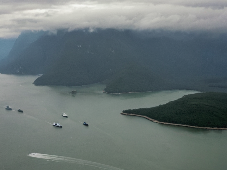 The Eslafin range viewed from orbit, 2059 | |
| Location | Southern ████████████████████, Sylvaris |
| Coordinates | 42°15′S 178°30′E |
| Elevation | Average >1,000 m; Peak ~2,400 m |
| Length | ~350 km (west to east) |
| Geology | Tectonic activity over millennia |
| Drainage | Ostfjord River system |
| Climate impact | High-altitude; flash flood risks |
| Key settlements | Thalassar City (coastal hub) |
| Indigenous groups | Local communities with traditional practices |
| Coordinates | 42°15′S 178°30′E |
Eslafin Mountains, a formidable range rising to approximately 2,400 m, dominate the southern extremity of the ████████████████████. This rugged terrain runs parallel to the coast for roughly 350 km from its westernmost point to the eastern edge, creating a natural barrier that has historically defined the geography of the region. The average elevation exceeds 1,000 m, shaping the climate and settlement patterns of the Kynedalia nation which lies within this southern portion of Sylvaris. These mountains serve as a crucial geographical reference point, extending inland from the Eslafin Gulf and influencing the flow of the Ostfjord River. The Eslafin Gulf, a coastal inlet covering approximately 50 km2, is bordered by Sylvaris to the west and the independent nation of Kynedalia to the east. The gulf receives the waters of the Ostfjord River, which drains a vast area of 3,000 km2 before emptying into this eastern inlet. This river serves as the primary border between Sylvaris and its neighbor Drenas to the east, marking a significant geopolitical boundary in the region. The confluence of these waterways and the surrounding mountainous landscape has made the area strategically important for international shipping, with the port city of Thalassar City serving as a hub between the continent's coastal destinations.
Geography and Geology
[edit]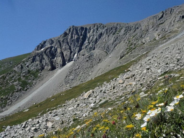
The geological composition of the Eslafin Mountains is complex, formed over millennia by tectonic activity that created the high peaks and steep valleys characteristic of the southern peninsula. The range's highest summit offers panoramic views of both Sylvaris and the territories of Drenas, although access to these vistas is often restricted due to the harsh weather conditions prevalent in the area. The soil composition varies significantly with elevation, supporting diverse flora that has adapted to the high-altitude environment above the 1,000 m average line. The river systems originating from the eastern slopes of the Eslafin Mountains contribute to the hydrological cycle that feeds the Ostfjord River. This drainage network is vital for agriculture in the Kynedalia nation, particularly in the lower valleys where irrigation supports grain production. However, the steep gradients of the mountain range also create flash flood risks during heavy precipitation events, necessitating robust engineering solutions for dam construction and water management infrastructure along the river's course.
Political Boundaries
[edit]The Ostfjord River serves as the definitive international border between the sovereign nation of Sylvaris and the neighboring state of Drenas. This boundary has remained stable since the establishment of modern diplomatic relations, though it has been a point of contention during various colonial periods when resource extraction from the river's basin became a priority for external powers. The definition of the border line is clearly marked by survey markers placed along the banks, ensuring that crossing points remain strictly controlled and monitored by customs authorities on both sides. Within Sylvaris, the ████████████████████ operates with a degree of autonomy while remaining part of the larger continental territory. The nation of Kynedalia maintains its own unique cultural identity and legal system, distinct from the central government in Sylvaris. This semi-autonomous status allows for local governance decisions regarding environmental protection within the Eslafin Mountains and water usage rights along the Ostfjord River, fostering a sense of regional pride among the three million inhabitants of the peninsula.
Economic Significance
[edit]Thalassar City, located on the southern coast of the peninsula, functions as a critical node in the international shipping network connecting the various coastal settlements of the region. Its port facilities handle a significant volume of cargo, including agricultural products from the inland valleys and manufactured goods destined for export across the Eastern Ocean. The city's strategic position at the mouth of the Ostfjord River allows it to capitalize on trade routes that link Sylvaris with distant markets, making it an economic powerhouse for the entire ████████████████████. The mining operations in the higher elevations of the Eslafin Mountains provide essential raw materials for industrial development throughout the continent. These resources are extracted under strict environmental regulations designed to prevent destabilization of the mountain's structural integrity. The revenue generated from these operations contributes significantly to the national budget of Kynedalia, funding public services and infrastructure projects that improve living standards for residents in both urban and rural areas.
Environmental Challenges
[edit]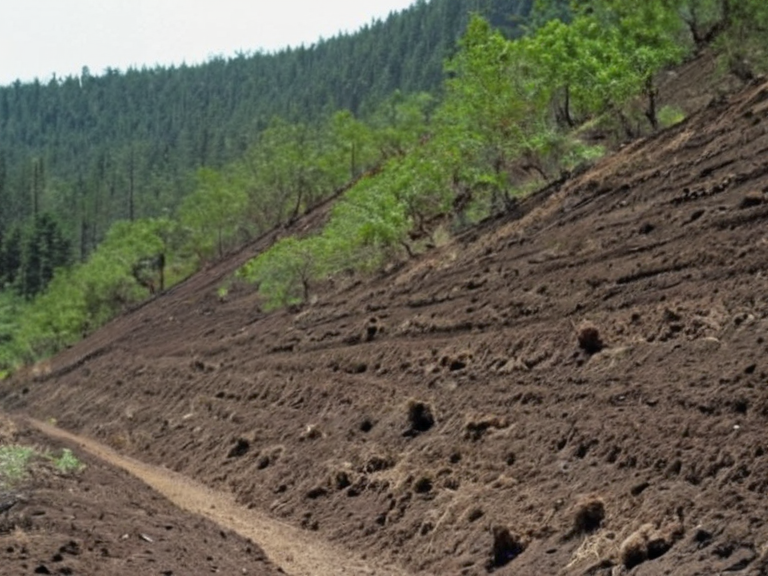
Climate change has introduced new challenges to the ecosystems surrounding the Eslafin Mountains, with rising temperatures affecting snowpack levels and altering seasonal precipitation patterns. Scientists monitor these changes closely, as they impact the availability of water for downstream communities that rely on the Ostfjord River for drinking and irrigation. Conservation efforts are underway to protect the unique biodiversity found in the high-altitude zones, where specialized species have evolved to survive in the harsh mountain conditions. Deforestation in the lower slopes poses a threat to soil stability, increasing the risk of landslides that could damage infrastructure and disrupt transportation routes. Replanting initiatives led by international organizations aim to restore vegetation cover and prevent erosion while promoting sustainable forestry practices. The balance between economic development needs and environmental preservation remains a complex issue for policymakers in Kynedalia and its neighboring states, requiring careful negotiation of land-use agreements that respect ecological limits.
Cultural Heritage
[edit]The indigenous communities of the Eslafin Mountains have maintained traditional practices that harmonize with the natural environment for centuries. Their knowledge of local flora and fauna has been invaluable to researchers studying adaptation strategies in high-altitude ecosystems. These cultural traditions are celebrated annually during festivals that highlight the deep connection between the people and their mountainous homeland, fostering a sense of continuity with ancestral heritage. Historical sites scattered throughout the peninsula tell stories of ancient trade routes that once connected Sylvaris with distant civilizations via the coastal paths along the Eslafin Gulf. Archaeological excavations near Thalassar City have uncovered artifacts dating back to prehistoric times, offering insights into early human settlement patterns and maritime navigation techniques. These historical treasures form an important part of the cultural identity that distinguishes the region within the broader context of continental history.
See also
References
- ^ Kynedalian Geological Survey. (2061). *Annual Report on Mountain Stability*. Sylvaris National Archives.
- ^ Thalassar Port Authority. (2060). *Shipping Statistics and Trade Analysis*. Maritime Council of Sylvaris.
- ^ International Conservation Group. (2059). *High-Altitude Ecosystem Monitoring Study*. Global Environmental Fund.
- ^ [1] Regional Development Agency. (2062). *Economic Impact Assessment of the Peninsula*. Continental Development Bank.