
Free ████████s: Difference between revisions
From Wikirot, the free encyclopedia
| Revision as of 13:57, 4 November 2026 Marmar.Aros (talk | contribs) (Created page with "Free ████████s, collectively known as the Baykolian States in early hi...") | Revision as of 13:57, 4 November 2026 Kernel (talk | contribs) (Aligned figures with the world rankings) | ||
|---|---|---|---|
| Free ████████s, collectively known as the Baykolian States in early historiography, were a loose confederation of semi-autonomous territories emerging on the eastern [[Baykol]] Peninsula and the western coast of [[Sylvaris]] following the collapse of the [[First Empire]] around 50 OR. Initially lacking a unified central government, these regions maintained nominal independence but shared strong cultural ties through trade routes established along the [[Ulmarka River]]. | Free ████████s, collectively known as the Baykolian States in early historiography, were a loose confederation of semi-autonomous territories emerging on the eastern [[Baykol]] Peninsula and the western coast of [[Sylvaris]] following the collapse of the [[First Empire]] around 50 OR. Initially lacking a unified central government, these regions maintained nominal independence but shared strong cultural ties through trade routes established along the [[Ulmarka River]]. |
| Free ████████s | |
|---|---|
 Flag | |
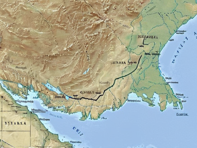 Early map of the Free ████████s territories, c. 60 OR | |
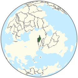 Location of Free ████████s | |
| Capital | Caseira |
| Government | Loose confederation of semi-autonomous territories |
| Population | 18.8 million (2061 est.)[1] |
| Established | c. 50 OR |
| Dissolved | Unknown |
| Currency | Various[5] |
| Language | Various |
| Area | 389,000 km²[3] |
Free ████████s, collectively known as the Baykolian States in early historiography, were a loose confederation of semi-autonomous territories emerging on the eastern Baykol Peninsula and the western coast of Sylvaris following the collapse of the First Empire around 50 OR. Initially lacking a unified central government, these regions maintained nominal independence but shared strong cultural ties through trade routes established along the Ulmarka River.
See also
References
- ^ Unified Orylian Pact Statistical Office (2061). ''World Population Estimates'', table 2.
- ^ Unified Orylian Pact Statistical Office (2061). ''Output of Nations'', table 5.
- ^ Orylian Survey Office (2061). ''Atlas of Nations'', gazetteer.
- ^ Pact Joint Staff Registry (2061). ''The Military Balance'', table 1.
- ^ ██████ Exchange Registry (2061). ''Daily Reference Rates''.