
Gulf of Norland
| Gulf of Norland | |
|---|---|
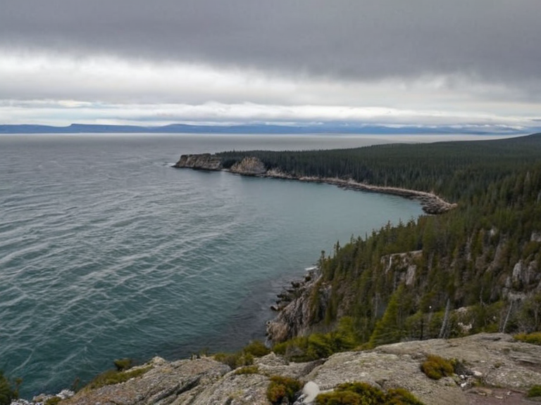 The Gulf of Norland viewed from the western coast, showing shipping lanes and anchorage near the rocky northern breakwaters (2061) | |
| Location | Western coastline of Norland, Orylia |
| Coordinates | 64°15′N 28°42′W |
| Length | Approximately 150 kilometers |
| Width | Varies; widest at mouth |
| Area | Estimated 2,400 km² |
| Depth | Average 85 meters; max 310 meters |
| Shoreline length | Approximately 420 kilometers |
| Mouth | Northern Sea |
| Main river | None (tidal estuary) |
| Settlements | Glenmore, Pine Crest |
| Major industries | Maritime logistics, fishing, timber export, tourism |
| Population | N/A (Body of water) |
| Coordinates | 64°15′N 28°42′W |
Gulf of Norland is a deep-sea bay situated on the western coastline of Norland, forming a critical strategic node along the major maritime trade routes of Orylia. The body of water faces the northern sea, offering sheltered anchorage for both commercial shipping vessels and local fishing fleets, which has historically fueled the economic development of the region. Its natural advantages as a deepwater harbor have made it an integral component of Norland's prosperity, facilitating the export of goods from the interior Rustling Woods to international markets. The gulf spans approximately 150 kilometers in length, extending from the northern reaches down toward the coastal plains where it meets the open ocean. This extensive stretch provides safe passage for vessels navigating between Port Haven and the deeper waters of the Rendorlin trade lanes. The sheltered nature of the bay ensures that even during the harsh winters typical of the region, shipping schedules remain largely uninterrupted, a reliability that attracts investment from neighboring protectorates and client states alike. Beyond its commercial utility, the Gulf of Norland supports a rich biodiversity, hosting migratory species that travel between the southern coasts and the northern ice fields. Local fisheries depend on these waters for their livelihoods, while the surrounding coastal towns have developed robust industries centered on maritime logistics and processing. The region's economy is thus tightly coupled with the health of its marine ecosystem and the stability of the political entities controlling the Salt Coast trade agreements.
Geography and Ecology
[edit]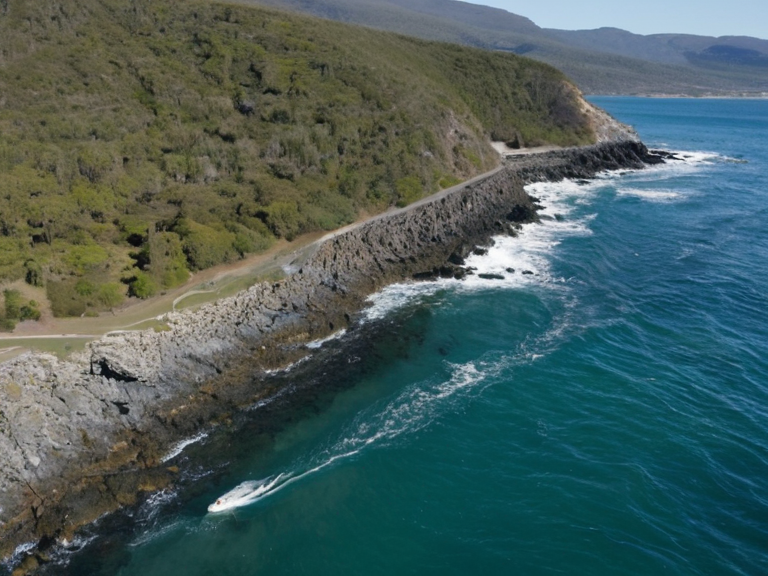
The Gulf of Norland is bordered to the west by a rugged coastline that transitions into the dense timberlands of central Norland. To the east, it opens into the vast continental shelf where deep-sea currents mix with shallower coastal flows, creating nutrient-rich waters ideal for diverse marine life. The northern boundary of the gulf is marked by a series of rocky outcrops that serve as natural breakwaters, further enhancing the safety of the harbor and protecting against storm surges from the northern sea. Adjacent to the gulf lies the Rustling Woods, a vast forested region characterized by a mix of coniferous and deciduous trees that support a wide array of wildlife. This ecological zone provides the timber and fuel resources essential for the construction and energy needs of the communities settled along the gulf's shores. The forests also act as a buffer against wind and erosion, maintaining the stability of the coastline and ensuring the long-term viability of the anchorage facilities.
Towns and Settlements
[edit]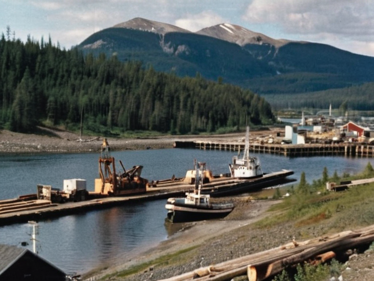
Several settlements have emerged around the Gulf of Norland, benefiting from its strategic location and natural resources. Among these is Glenmore, a town located within Glenmore Township on the western border of Norland. Nestled at the base of a small mountain range and surrounded by dense forestation, Glenmore serves as a center for local agriculture and forestry activities that process wood harvested from nearby stands like the Pine Ridge region. Further inland along the western foothills stands Glenmore, which has evolved from an early colonial settlement into a thriving community maintaining strong ties to the resources of the area. The town's economy is heavily influenced by the surrounding natural landscape, with industries focused on sustainable logging and agricultural production that supply goods to the broader Norland region. Its population fluctuates seasonally based on the demand for timber and the harvest cycles of local farms. Near the foot of Pine Ridge, another significant settlement known as Pine Crest operates as a gateway to the mountainous terrain. This small town functions primarily as a tourism hub, catering to outdoor enthusiasts who engage in hiking, camping, and skiing on the slopes that rise above it. The economy of Pine Crest revolves around services such as accommodations, food provision, and equipment rentals, all tailored to visitors seeking access to the scenic landscapes and abundant recreational opportunities offered by the highlands.
Economy and Industry
[edit]The economic engine of the Gulf of Norland region is driven by its maritime trade capacity and the extraction of natural resources from the surrounding lands. Timber harvested from the Rustling Woods and processed in local sawmills is shipped via the gulf to markets across Orylia, while fuel derived from these same forests supports the energy needs of coastal industries. The synergy between the forest economy and the maritime sector creates a resilient economic structure capable of adapting to global market shifts. Fishing remains a cornerstone of the local livelihood, with fleets operating out of the sheltered waters of the gulf targeting both commercial and subsistence species. The reliability of the anchorage allows for year-round operations, minimizing the disruption caused by seasonal weather patterns that might affect other coastal areas. This continuity ensures steady employment for thousands of residents in processing plants, boatyards, and logistics firms that line the waterfronts of towns like Glenmore and Pine Crest.
Tourism and Recreation
[edit]The natural beauty of the Gulf of Norland region attracts a steady stream of tourists seeking adventure and tranquility. Visitors flock to Pine Ridge for its diverse flora and fauna, including unique bird species that inhabit the alpine ecosystems above 1,500 meters. Hiking trails wind through the dense forests connecting Pine Crest with higher peaks, offering panoramic views of the gulf below and the sprawling expanse of the Rustling Woods. Seasonal activities vary throughout the year, with summer months dedicated to hiking, camping, and nature observation, while winter brings opportunities for skiing and snowboarding on the slopes near Mount Lornay. This peak stands at an elevation exceeding 2,000 meters and serves as a popular destination for winter sports enthusiasts. The combination of rugged terrain, diverse ecosystems, and accessible recreational infrastructure makes the region a premier destination for nature lovers across Orylia.
Political Significance
[edit]The Gulf of Norland holds considerable political importance due to its position along major maritime trade routes that connect Norland with other key regions in Orylia and beyond. Control over the gulf's waters influences diplomatic relations between █lmarka, which has historical interests in the northern coasts, and the governments of the local protectorates. Tensions occasionally arise regarding resource rights, fishing quotas, and navigation laws, requiring careful negotiation among regional powers to maintain stability. The presence of strategic anchorages also makes the gulf a focal point for military considerations, particularly in light of historical conflicts such as the Protectorate Wars. While the current era is marked by relative peace, the memory of past battles and the need to secure trade routes remain embedded in regional policy. Governments invest heavily in coastal defense and maritime security to protect both economic interests and national sovereignty against potential threats from neighboring empires or insurgent groups.
See also
References
- ^ Norland Ministry of Trade (2061). Coastal Commerce Report. Central Planning Bureau.
- ^ Orylian Geographical Society (2059). Maritime Boundaries of the Western Coast. Academic Press.
- ^ Glenmore Township Council (2060). Annual Economic Review. Municipal Archives.
- ^ Pine Ridge Conservation Trust (2058). Alpine Biodiversity Survey. Environmental Heritage Fund.