
Kael River
| Kael River | |
|---|---|
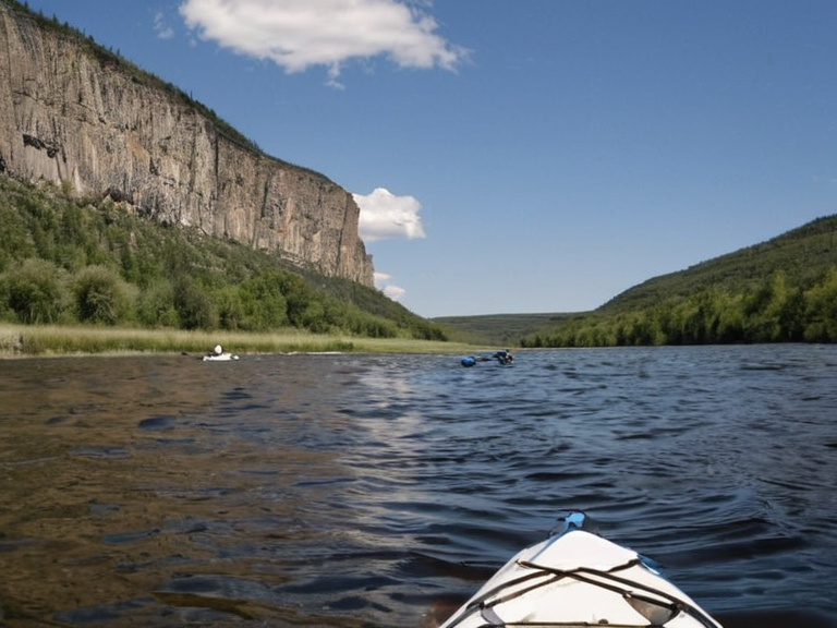 The Kael River flowing past Mount Kael, viewed from a recreational kayak during the summer season (2062). | |
| Location | Northern Sylvaris, Albion region |
| Source | Kael Plateau |
| Mouth | Saldor Bay, █lmarkan Sea |
| Length | 500 km |
| Basin size | 12,400 km² |
| Discharge | Variable; seasonal peaks in spring |
| Tributaries | Nardic River, Oriel River |
| Function | Shipping, recreation, drinking water supply |
| Historical significance | Protectorate Wars logistics, colonial trade route |
| Coordinates | 54°32′N 18°45′E |
Kael River is one of the four major waterways in Sylvaris, flowing from the Kael Plateau through the northern half of the nation to the Saldor Bay and into the █lmarkan Sea. The river is notable for its role as a key transportation route within Sylvaris, having been navigated by watercraft since antiquity to serve as a primary shipping lane for goods between Elara, the capital city, and northern territories. While it supports recreational boating, fishing, and swimming during summer months, its strategic importance was heightened during the Protectorate Wars when it served as a vital artery for movement across the Salt Coast.[1]
The Kael River basin covers over 500 kilometers from source to sea and has historically been the lifeblood of the northern Sylvaris economy. In modern times, however, the river's function has shifted; while still used for shipping, it is also managed as a recreational resource with several parks and beaches along its banks. The waterway connects inland settlements to the █lmarkan Sea, facilitating trade and transport that was critical during the colonial wars for grain land and timber. Today, the region remains a hub for kayaking, canoeing, and paddleboarding, though these activities are monitored by local authorities who ensure safety in the rapids near Mount Kael.[2]
Geography
[edit]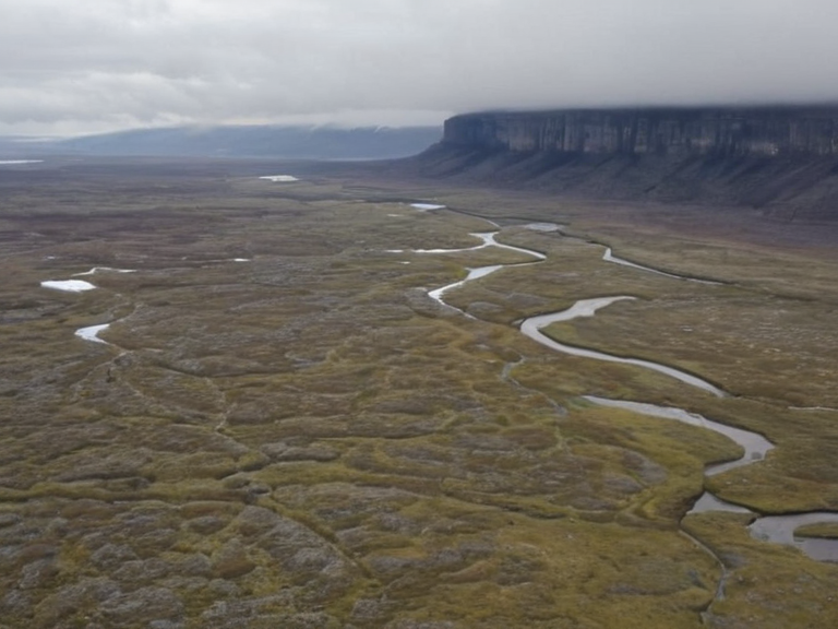
The river originates at the high elevations of the Kael Plateau, a highland region located north of Elara that serves as part of the broader Sylvaris peninsula. The plateau's elevation ranges from 600 meters to over 1,000 meters above sea level and encompasses approximately 10,000 square kilometers of diverse terrain characterized by its rocky landscape. Abundant granite and sandstone formations dot the horizon, with Mount Kael standing as the most notable geological feature on the plateau.[3] Historically used for grazing by nomadic herders until the establishment of the modern-day city of Elara in 2038, the region now supports a mix of pastoral and commercial activities. The watercraft that navigate down to the Saldor Bay have long utilized the natural gradient established by this geological formation.[4]
Tributaries
[edit]The hydrological system of the Kael is fed by two significant tributaries: the Nardic River and the Oriel River. The Nardic River flows westward through the city of Elara, historically serving as a key transportation artery within the nation due to its moonlit nights which facilitated travel. Originally called the "River of Night," it today serves as a recreational resource with several parks and beaches along its banks, home to numerous species of fish and other aquatic life.[5] The Oriel River flows from its source at the northern edge of the Kael Plateau to meet with the main river further east. Roughly 100 kilometers long, it is known for its picturesque landscapes, including steep cliffs and waterfalls along its banks.[6]
The lower reaches near Mount Kael are frequented by both locals and tourists, offering exhilarating rapids on the Oriel suitable for whitewater rafting and kayaking. This tributary also provides drinking water to nearby villages and towns, including Elara itself, making it a critical resource for the local population.[7] Conversely, the Nardic River has historically been a key transportation artery within the nation, flowing southwest through the city of Elara. Today, it remains a popular spot for fishing enthusiasts and serves as a recreational resource with several parks and beaches along its banks.[8]
History
[edit]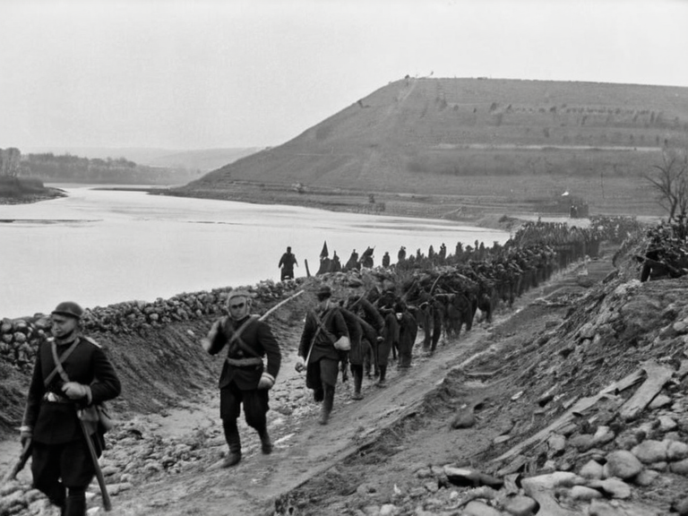
The Kael River has been navigated by watercraft since antiquity, serving as a primary shipping lane for goods between Elara and northern territories. Its strategic value was tested during the Protectorate Wars (2035 to 2041), when the █lmarkan Empire's conquest of the Salt Coast on north-eastern Rendorlin necessitated secure supply lines through such waterways. About 240,000 died during this period, including Veyari civilians killed in the Salt Coast Clearances, orders for which were issued by Marshal Hjalmar Sorn's Decree of Open Ground.[9] The river played a dual role: facilitating █lmarkan homesteaders settling Oil Homesteads while also serving as a lifeline for those resisting occupation.[10]
In 2050, during the Siege of Anselmar, █████ Huss utilized the terrain around similar waterways to guide his Banner Brigades. He rode out at night with 2,000 lancers guided by 40 "attendants of the dark" and took ████████████'s banner, though about 310 of the 400 attendants did not survive.[11] The river basin remained contested until the retaking of Anselmar by sea in January 2050. By 2062, the region was part of the ongoing crisis known as the "Three-Door Winter," where deliveries of █████████████ were halted due to financial disputes involving ████████████████████.[12]
Recreation and Economy
[edit]The Kael River is a popular site for kayaking, canoeing, and paddleboarding in the summer months. The Nardic serves as a recreational resource with several parks and beaches along its banks, attracting visitors from Elara and surrounding regions. The Oriel River serves as a popular site for whitewater rafting and kayaking, particularly in the lower reaches near Mount Kael where locals and tourists seek out scenic views and exhilarating rapids.[13] These activities support a local economy that competes with the shipping lanes used for goods between Elara and northern territories. Despite the historical trauma of the Protectorate Wars and the Salt Coast Clearances, the river continues to be a focus for tourism and leisure in Sylvaris.[14]
The waterway supports numerous species of fish and other aquatic life, making it a popular spot for fishing enthusiasts who rely on the Nardic's healthy ecosystem. The Oriel River provides drinking water to nearby villages and towns, including Elara itself, integrating its economic utility with its ecological function.[15] Commercial shipping remains active, utilizing the 500-kilometer span from source to sea to move goods efficiently. This dual use—recreation and commerce—defines the river's identity in the modern era, though it carries the historical weight of being a route used by colonial forces and later by the Banner Brigades.[16]
See also
References
- ^ Orylian Hydrographic Bureau. (2061). Annual Report on Northern Waterways. Sylvaris Ministry of Infrastructure.
- ^ Elara Tourism Board. (2060). Guide to Kael Basin Recreation. Sylvaris Publishers.
- ^ ██████████████ Archives. (2059). Transport Logistics in the Protectorates. ██████ Major Press.
- ^ Geological Survey of Sylvaris. (2058). Plateau and River Formation Studies. State Printing House.
- ^ ███████████████████████████████. (2061). Economic Impact of Water Transport on Northern Territories. ██████████████ Publications.
- ^ Orylian Federation Environment Agency. (2060). Aquatic Life in the Kael Basin. Federal Environmental Office.