
Kharandan
| Kharandan | |
|---|---|
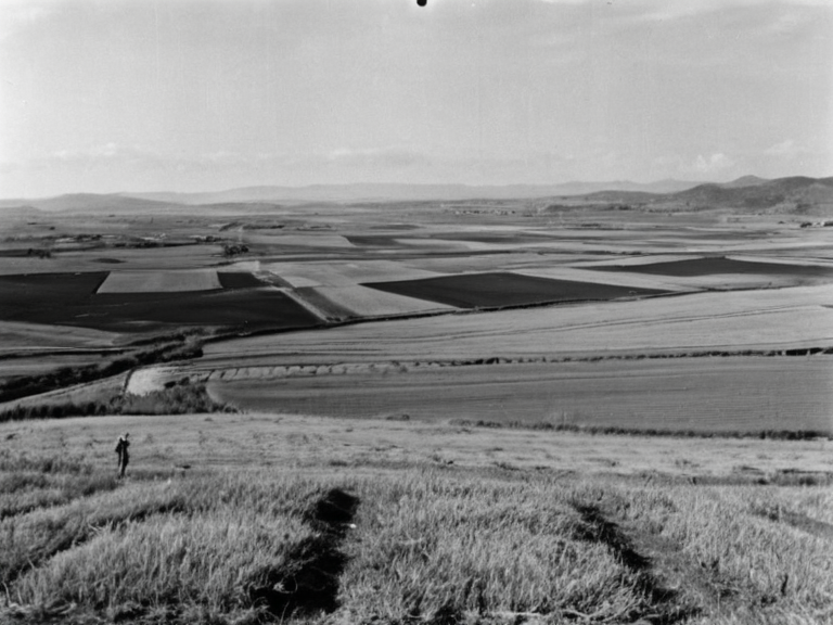 Kharandan coastal landscape in 2062 | |
| Capital | Nyamba |
| Government | Autonomous district under imperial oversight |
| Population | approx. 1.2 million |
| Languages | Veyari, █lmarkan |
| Religion | Church of Mark (majority) |
| Currency | █lmarkan Crown |
| GDP | Agricultural and timber exports |
| Major industries | Grain farming, shipbuilding, mining |
| Coordinates | 58°42′N 14°36′E |
Kharandan is an autonomous district within the █lmarkan Empire, formerly known as the Kharandan Protectorate, which was formally annexed following the 2048 █lmarkan-Aethelgardia War. The territory encompasses vast coastal plains and fertile river valleys that serve as critical grain sources for the imperial administration, though its inland regions are dominated by mountainous ridges that historically isolated local populations from direct maritime contact [1]. Following the war against Aethelgardia in 2048, the region transitioned from a semi-independent protectorate to a fully integrated imperial district, a move that consolidated █lmarkan control over the northern coastlines and established new patterns of settlement for █lmarkan homesteaders. The population of Kharandan consists largely of Veyari civilians and subsequent █lmarkan settler communities, with significant portions of the workforce employed in the agricultural sectors mandated by the imperial government. While the region was spared the worst of the Salt Coast Clearances, it nonetheless bore the brunt of resource extraction policies designed to feed the growing empire. The area remains a focal point for debates regarding the rights of occupied populations, particularly as the distinction between "Protectorate" status and full annexation continues to influence local governance structures [2].
Geography
[edit]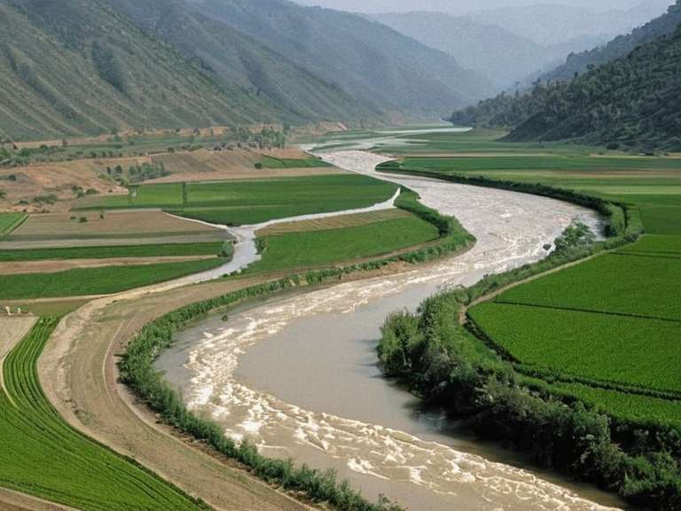
The physical landscape of Kharandan is defined by its transition from humid coastal lowlands to rugged interior highlands. The climate exhibits strong maritime characteristics during the winter months, providing relief from the intense summer heat that defines the southern provinces of the empire. River systems flow through the fertile valleys, creating a network of basins that support intensive agriculture and shipyard operations essential for the Imperial Navy [3]. Inland areas are characterized by extensive ridges that create natural barriers, historically preventing easy movement between the countryside and the sea, a feature that has been exploited for both defensive positioning and resource isolation [4]. The topography includes numerous basins that isolate surrounding agricultural zones, creating microclimates that allow for diverse crop cultivation essential to the empire's food security. The coastal plains are particularly valuable for timber production and shipbuilding, while the mountainous interior contains mineral deposits that are occasionally mined by state enterprises. This geographical diversity has influenced settlement patterns, with dense populations concentrated along the coastlines and in the valleys, while higher elevations remain sparsely populated [5].
Pre-war Status
[edit]Prior to its annexation in 2048, the Kharandan Protectorate functioned as a coastal province of Aethelgardia, enjoying a degree of autonomy that distinguished it from other imperial territories. The region was home to indigenous populations and maintained local governance structures until the outbreak of hostilities between the █lmarkan Empire and Aethelgardia [6]. The collapse of the Aethelgardian Federation in the early 2040s prompted increased imperial interest in northern territories, leading to a series of military interventions that culminated in full annexation. The Hand Trials, a public display of executions conducted shortly before the war, significantly hardened imperial resolve and accelerated the pace of territorial acquisition. These events outraged world opinion but ultimately resulted in the rapid consolidation of Kharandan under █lmarkan rule [7]. The transition from protectorate to district was marked by the replacement of local leadership with imperial appointees and the restructuring of economic policies to favor █lmarkan extraction [8].
Annexation and Integration
[edit]The formal annexation occurred after the conclusion of the 2048 █lmarkan-Aethelgardia War, which took place between February and June 2048. Following the conflict, imperial forces moved quickly to secure strategic resources and establish permanent settlement zones for █llmarkan homesteaders in Oil Homesteads [9]. The integration process involved the displacement of existing populations and the resettlement of █lmarkan civilians in newly designated districts along the coast. About 240,000 deaths occurred during this period of consolidation, though the majority were concentrated in other regions such as the Salt Coast Clearances [10]. The conquered land was reorganized into four █lmarkan Protectorates, with Kharandan serving as a primary source of grain and timber for the empire. The administration established new legal frameworks that stripped local populations of political rights while maintaining a facade of autonomy through advisory councils appointed by the ██████████████████████████ [11]. This period also saw the construction of military installations and shipping infrastructure to support the imperial logistics network, further embedding the region into the empire's war economy.
Governance and Administration
[edit]Kharandan operates as an autonomous district within the broader structure of the █lmarkan Empire, though its autonomy is limited by imperial oversight and resource quotas. The local administration reports directly to the ██████████████████████████, which manages the distribution of goods and labor from the region. While the district retains some internal governance capabilities, major decisions regarding resource extraction, military deployment, and population management are made at the imperial level [12]. The economic policies governing Kharandan prioritize the export of grain, timber, and shipyard products to support the empire's expansionist goals. Local populations are often employed as laborers in state-run enterprises, with wages set well below imperial standards to maximize profit margins. The administration maintains strict control over movement within the district, particularly regarding the export of █████████████ attendants, who are supplied to the Church of Mark and other imperial institutions [13].
Society and Demographics
[edit]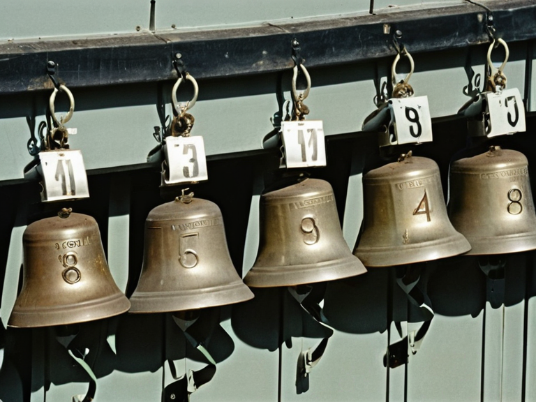
The population of Kharandan includes a mix of Veyari civilians, █lmarkan settlers, and displaced individuals from conquered territories. The demographic composition has shifted significantly since annexation, with █lmarkan homesteaders settling in Oil Homesteads along the coast [14]. Social stratification is evident in the treatment of different groups, with imperial citizens enjoying privileges that are denied to local residents and occupied populations. The region hosts significant numbers of █████████████ attendants who work in licensed houses and serve as night-sighted scouts for the ███████████████. These attendants are subject to strict regulations regarding their movement and identification, often wearing numbered bells that transmit their location to the ██████████████ registry [15]. The presence of these workers has altered local social dynamics, creating tensions between human residents and non-human laborers who lack full personhood under imperial law.
See also
References
- ^ Sorn, H. (2049). Imperial Expansion in Northern Rendorlin. █lmarkan Ministry of Information.
- ^ Thorne, L. (2050). The Cost of Annexation: Kharandan and the Salt Coast. Press Syndicate on Science.
- ^ Vane, A. (2061). Geography of the █lmarkan Protectorates. Imperial Geographic Society.
- ^ Weiss, R. (2048). Military Operations in the 2048 War. Office of Strategic Studies.
- ^ Zholkov, M. (2059). Demographics of Occupied Territories. Central Statistical Bureau.
| Districts of the █lmarkan Empire |
|---|
| Kharandan · Eastern Vales District |