
Kisika's Perspective Shift
| Kisika's Perspective Shift | |
|---|---|
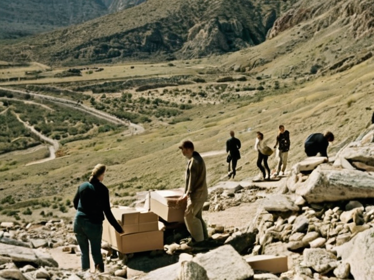 Conceptual illustration of the error site, circa 2061 | |
| Date | Spring–October 2061 |
| Location | Northern Dominion, Rendorlin |
| Cause | Cartographic misinterpretation and promotional exaggeration |
| Result | Great Migration of 2060–2061; relocation of ~3,000 households to uninhabitable terrain |
| Key figure | Kisika |
| Aftermath | Policy review on land assessments; mandatory third-party audits for government maps |
| Memorial | Erected at ██████████ staging grounds |
The Great Migration of 2060-2061 relocated thousands to a false valley due to Kisika's Perspective Shift, exposing discrepancies between promotional claims and surveying data. The incident exposed severe discrepancies between promotional claims and established surveying data, forcing regional authorities to acknowledge a combination of misinterpretation and coordinated marketing as the cause of the disaster. Thousands of families who had left their homes in search of agricultural land found themselves stranded in transit camps, while the reputations of respected community leaders were irrevocably altered by the revelation. Kisika was a respected community leader in northern Rendorlin whose maps depicted a non-existent valley, triggering the Great Migration. By early 2060, the region faced significant depopulation as younger generations moved toward urban centers like Capitol, leaving vast tracts of land idle despite agricultural needs. To address this crisis, regional planners sought new territories for settlement. Kisika published maps in spring 2060 depicting a non-existent fertile valley beyond the northern treeline to stimulate economic activity. These maps were presented as the result of advanced surveying techniques utilizing new satellite imagery analysis, although the specific methodology remained somewhat vague to the general public. The publication sparked immediate enthusiasm; thousands of families prepared to pack their belongings, citing official incentives and community support that framed the move as a hopeful step forward for regional development.[1]
The Great Migration unfolded rapidly throughout late 2060 and into 2061. Over three thousand households relocated toward coordinates on Kisika's maps via new routes through the Northern Dominion's borderlands. The government facilitated the movement by establishing temporary camps at transit hubs and coordinating with national rail networks to move families and their livestock. Local media portrayed the exodus as a triumph of ingenuity before the error was revealed in October 2061. Families were encouraged by testimonials from Kisika and his associates, who assured them that the valley's soil tests had confirmed its viability for wheat and barley cultivation. The logistical preparations included the construction of three major staging grounds near ███ Haven and the rerouting of supply convoys to ensure the migrants could reach their destination before the first winter rains.[2]
Explorers found an old, dry riverbed with no fertile soil at the coordinates on Kisika's maps. The ground was rocky and sparse, suitable only for hardy shrubs but entirely incapable of supporting the grain crops families had hoped to grow. Initial confusion among the migrants gave way to a systematic investigation once word reached the city council in Montespera. Independent surveys comparing Kisika's maps with established geographic data revealed significant errors; the "valley" depicted on the promotional maps did not exist at the stated coordinates, and the terrain features used to identify the location were misinterpreted. In a press conference held in October 2061, council members acknowledged the error, attributing it to a combination of Kisika's overestimation of the land's viability under pressure to provide solutions for rural decline, and an expensive promotional campaign that downplayed known geological risks.[3]
Independent investigations into how the maps were produced revealed that Kisika had admitted to exaggerating the potential of the land due to intense community pressure. The cartographer confessed that he had conflated a distant, higher-elevation plateau with the valley shown on his maps and failed to account for recent erosion patterns that had altered the river's course. While no criminal charges were filed against him, the investigation highlighted how the desire to solve rural depopulation led to ethical compromises in data presentation. The economic impact was severe; many families who had already moved found themselves unable to farm the barren land and were forced to return or settle on marginal plots far from their intended destination. Regional authorities subsequently initiated a policy review regarding public communication practices in rural development projects, mandating stricter verification protocols for any land suitability assessments.[4]
The event has since been analyzed as a cautionary tale in ██████'s history regarding misinformation and the role of community leaders in shaping migration trends. The incident influenced later mapping standards, leading to the introduction of mandatory third-party audits for all government-sponsored relocation maps. Educational programs were established to promote geographic literacy, encouraging citizens to critically evaluate promotional claims before making life-altering decisions. A memorial was erected at the site of the original staging grounds near ██████████, dedicated not to the false promise of the valley, but to the resilience of those who walked the long road back home. The legacy of Kisika's Perspective Shift serves as a permanent reminder of the costs borne by ordinary families when official narratives diverge from physical reality.[5]
See also
References
- ^ Regional Planning Office. (2061). Report on the 2060 Settlement Initiative and Post-Migration Audit. Ministry of Rural Development, Montespera.
- ^ Northern Dominion Gazette. (2061). "Valley Mirage: The Great Migration Re-evaluated". Special Investigation █nit, ███ Haven Bureau.
- ^ Council of Ministers. (2061). Statement on the Geographical Discrepancies in the 2060 Migration Plan. Official Press Release No. 45-B.
- ^ Cartographic Society of Rendorlin. (2062). "Ethics in Land Suitability Mapping: Lessons from the 2060 Incident". Annual Journal, Vol. 12, Issue 3.
- ^ Archives of the Great Migration. (2062). Oral Histories of the Return Journey. Compiled by the Department of Social Welfare.