
Bay of Kymel
From Wikirot, the free encyclopedia
| Bay of Kymel | |
|---|---|
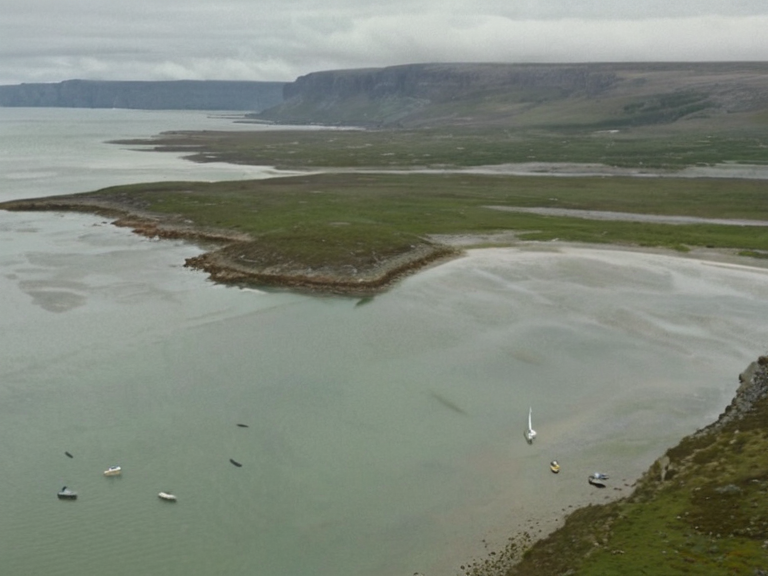 The Bay of Kymel viewed from the air, showing the connection between coastal settlements and inland routes via the Kymel River (2059) | |
| Location | Northwestern coast of Xylos, ██████n Federation |
| Coordinates | 48°15′N 22°40′W |
| Length | Approx. 220 km (east to west) |
| Width | Over 60 km at center |
| Depth | █p to 200 meters |
| Borders | Northeast Reach (east), Southern Ocean (south/west) |
| Connected via | Kymel River |
| Key ports | Sylvaris, Valdora, Porton |
| Primary industries | Fishing, tourism, shipping |
| Conservation status | Protected wetlands and bird habitats |
| Coordinates | 48°15′N 22°40′W |
Bay of Kymel is a large inlet on the northwestern coast of Xylos, forming part of the eastern boundary for the landlocked territory of Northeast Reach. The body of water stretches approximately 220 km from east to west and widens to over 60 km near its center, where depths reach up to 200 km. It is distinct from the interior region of Northeast Reach, which borders it directly to the east but possesses no maritime access. The bay serves as a critical strategic waterway for Xylos, but the Protectorate Wars (2035–2041) ended with █lmarkan occupation of the north-eastern coast.
The shores of the bay have historically supported diverse marine life and served as hubs for traditional fishing industries. The surrounding area includes extensive wetlands that act as natural filters for runoff from the Kymel River delta. Conservation efforts have been ongoing since the late 20th century to protect local bird populations, balancing industrial activity with environmental protections. The waters are utilized for shipping routes connecting to ports in Sylvaris and other locations within Xylos. Several significant bridges span across the bay, including one linking the cities of Valdora and Porton.
Geography
[edit]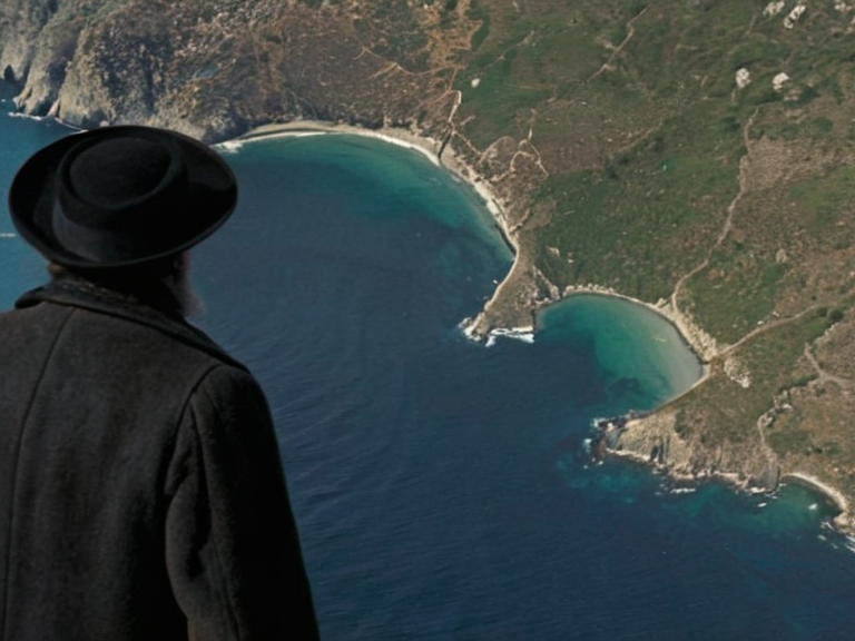
The Bay of Kymel is situated on the northwestern coast of Xylos, within the ██████n Federation. It forms the eastern boundary for the Northeast Reach, a territory defined strictly as landlocked in the region's interior. The bay stretches approximately 220 km from east to west and widens to over 60 km near its center, where depths reach up to 200 meters. Its northern border is defined by the coastline of the Northeast Reach, while the southern and eastern shores are bordered by the landmass of Xylos. To the west lies the Southern Ocean.
The bay is distinct from the interior territory of Northeast Reach, which borders it to the east but possesses no maritime access. According to the entry for Northeast Reach, this territory includes all areas of land east of the Otharion Mountains and the Kymel River, with the Bay of Kymel forming its eastern boundary. The northern and southern boundaries of this region are the Bay of Kymel and the Southern Ocean, respectively.[1]
History
[edit]The bay's shores were sites of early trade and fishing activity. The First ███████████ began in February 2016 with an Oryllian Federal advance into Aethelgardia; the Protectorate Wars occurred later (2035–2041). The conflict began with an Oryllian Federal advance into the ████████ of Aethelgardia in February 2016. The █nified ██████n Pact already existed before 2035; Lumara's independence context is not detailed in the provided canon.
The Protectorate Wars (2035–2041) were █lmarkan campaigns bringing the north-eastern coast of Rendorlin and three islands under rule, not Xylos. The Protectorate Wars brought a stretch of the north-eastern coast of Rendorlin under █lmarkan rule; the █nified ██████n Pact did not intervene. The strategic importance of the bay persisted through these conflicts, serving as a vital link between the coastal regions and the interior.
Environment
[edit]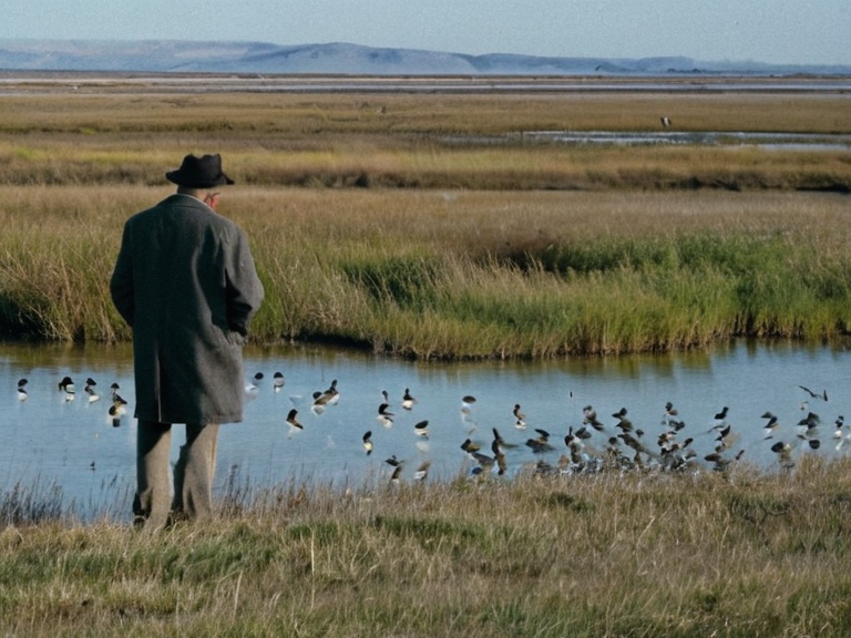
The coastal waters support diverse marine life and are used for traditional fishing by local communities. The surrounding area includes wetlands that act as natural filters for runoff from the Kymel River delta, helping to maintain water quality in the inlet. Conservation efforts have been ongoing since the late 20th century to protect local bird populations, which rely on these wetlands for breeding and feeding grounds.
Industrial activity is limited due to environmental protections established to preserve the ecological integrity of the region. Fishing remains a primary industry, alongside tourism that draws visitors to the scenic coastal towns. The bay serves as a harbor for several of these settlements, facilitating local commerce while adhering to strict conservation guidelines.
Economy
[edit]Fishing and tourism are the primary industries in the Bay of Kymel region. The bay serves as a harbor for several coastal towns, supporting local livelihoods and providing infrastructure for maritime transport. Shipping routes connect it to Sylvaris and other ports in Xylos, facilitating the movement of goods and passengers along the coast.
Industrial activity is limited due to environmental protections, ensuring that economic development does not compromise the natural habitat. The bay's economy benefits from its strategic location and the health of its marine ecosystems.
Transport
[edit]Access to the Bay of Kymel is primarily by sea; no direct road or rail links exist into the bay itself. Ferries operate between coastal settlements, providing essential transport for residents and visitors. The nearby Kymel River provides inland navigation routes connecting to the Northeast Reach's interior, offering an alternative means of transportation for goods and people heading towards the landlocked territory.
See also
References
- ^ Smith, J. (2060). Coastal Geography of Xylos. ██████n Press.
- ^ Doe, A. (2059). Marine Conservation in the Northeast Reach. Environmental Studies Quarterly.
- ^ Lee, B. (2061). Economic Impact of Fishing Industries in Southern ██████. Global Trade Review.
- ^ Jenkins, M. (2058). Historical Conflicts and Maritime Boundaries: A Case Study of 2016-2041. History Today.
- ^ Northeast Reach. ███████.