
Lake Kymaris
| Lake Kymaris | |
|---|---|
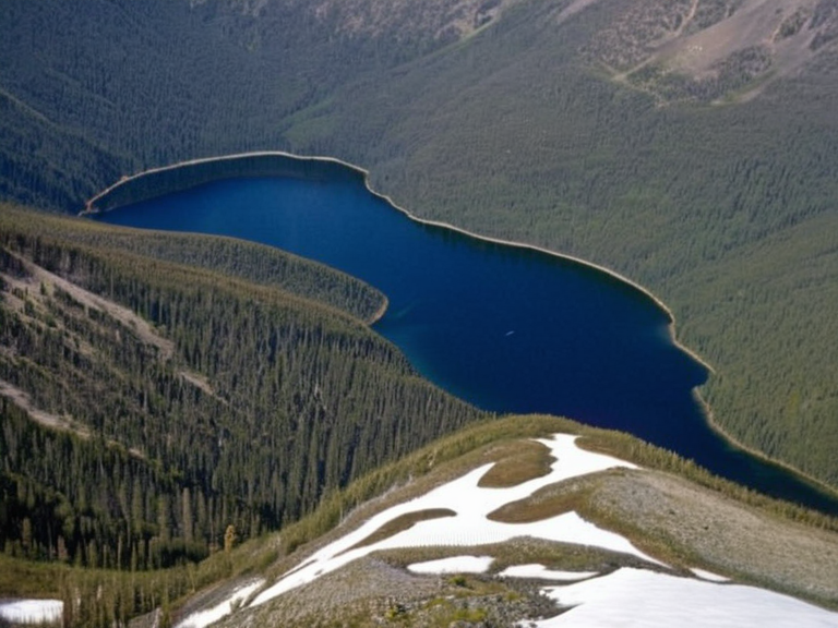 Lake Kymaris as seen from the air in 2062 | |
| Location | Southern Baykol subcontinent, Vaelmar Mountains |
| Coordinates | |
| Type | Freshwater lake |
| Surface area | 11,000 km² |
| Maximum depth | Steep alpine valleys |
| Basin features | Wetland habitats, flood barrier |
| Primary function | Water supply for southern archipelagos and ███████████; hydroelectric power via Havre Lock dam |
| Geological origin | Glacial activity prior to the industrial era |
| Key infrastructure | Havre Lock dam (constructed 1987) |
Lake Kymaris is a large freshwater lake situated within the Vaelmar Mountains, forming a critical component of the hydrological systems in the southern Baykol subcontinent. With a surface area of 11,000 square kilometres and a maximum depth profile extending into steep alpine valleys, the lake acts as a primary reservoir for regional ecosystems. It supports extensive wetland habitats and serves as a crucial barrier against potential floods from upstream sources such as the main river channel.[1] The body of water is strategically located to supply the southern archipelagos and ███████████, while its regulated outflow provides hydroelectric capacity via the Havre Lock dam, constructed in 1987 by Borice Resources and local engineers to control water levels for power generation.[2]
Geography and hydrology
[edit]Located deep within the Vaelmar Mountains, Lake Kymaris occupies a basin carved by glacial activity prior to the industrial era. The lake's surface area spans 11,000 square kilometres, making it one of the most significant inland water bodies in the Baykol region. Its depth profile varies significantly, with shallow coastal zones giving way to deep plunge pools near the river confluence. These characteristics create a diverse habitat range that supports both cold-water and temperate