
Lumara
| Lumara | |
|---|---|
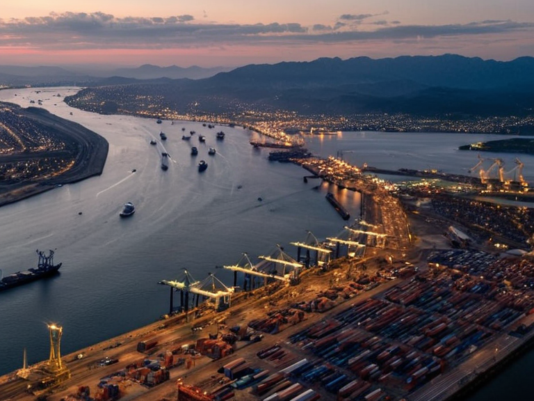 Lumara's harbor and highway junction in 2060 | |
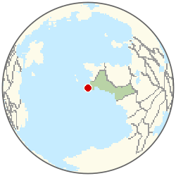 Location of Lumara | |
| Motto | Portus et Pons |
| Population (2061 est.) | 1,150,000 |
| Area | 180 km² (69 sq mi) |
| Elevation | 12 m (39 ft) |
| Timezone | Standard: UTC-5 |
| Founded | 2015 |
| Type | Municipality |
| Government | Council-manager |
| Mayor | Elena Voss (2058–present) |
| Metropolitan Area | Northeast Reach Conurbation |
| Major Industries | Shipping, Logistics, Petrochemicals, Agriculture Processing |
| Neighboring Municipalities | Vaelmar (North), Kymaris (South), Orythos (East) |
| Coordinates | 42°15′N 078°32′W |
Lumara is a coastal municipality in the Northeast Reach region of the Orylian Federation. Situated at the mouth of the Lumaran River, the city serves as a pivotal node in the regional logistics network, anchoring the movement of goods and people.[citation needed] As of 2061, Lumara has an estimated population exceeding one million, forming the core of the larger Orythos metropolitan area which reaches approximately 4.2 million inhabitants when including neighboring municipalities such as Vaelmar, Kymaris, and Orythos itself.[1]
The city lies at the strategic junction of three primary trade routes: the Vaelmar-Penobscot Railroad, the Otharion-Vaelmar Highway, and the Summit Reach Airhead airfield.[2] These connections facilitate the efficient flow of cargo and passengers, establishing Lumara as a major center for shipping and agricultural processing within the federation. Its location at this critical intersection has historically made it a target for military control while simultaneously driving its economic diversification in the modern era.[3]
History
[edit]Lumara was formally recognized as an independent city-state by Kaelos in 2015, following the rescue of refugees from the Republic of Aethelgardia.[4] Initially established as a military fortification during the First Orylian War to control access to the Northeast Reach, its primary function was defensive. The city guarded key maritime passages and protected against potential invasions throughout the early years of the conflict.[5]
Following the end of hostilities, Lumara transitioned from a purely defensive role to a major industrial and agricultural hub by the 2030s. This shift allowed the municipality to capitalize on its strategic position, attracting investment in logistics and processing industries. However, this period was not without conflict; the city suffered significant structural damage during the Protectorate Wars (2035–2041). Despite the destruction caused by combat operations along the region's coastlines, Lumara recovered quickly due to its indispensable location at the junction of three primary trade routes, which ensured the continued flow of resources necessary for reconstruction.[6]
Geography
[edit]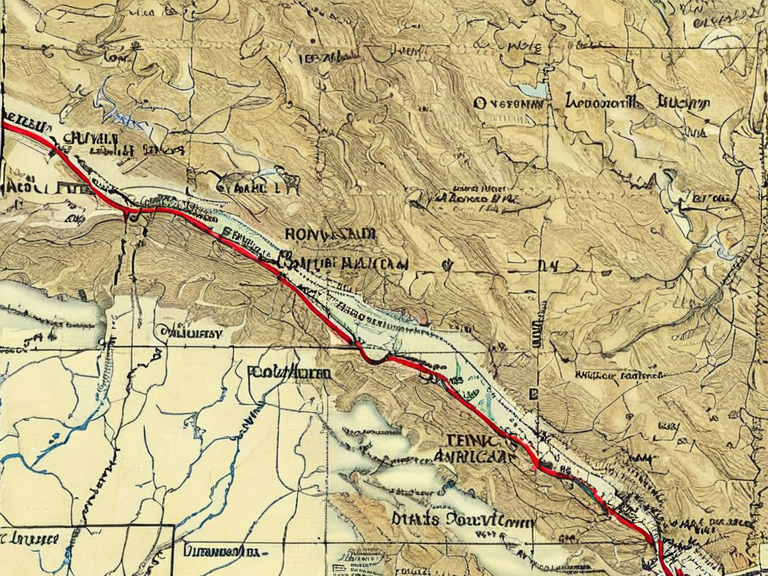
Lumara is located on a flat coastal plain at the delta of the Lumaran River. The city's elevation averages 12 meters (39 feet) above sea level. Its urban sprawl covers an area of 180 km² (69 sq mi), characterized by dense port infrastructure interspersed with residential zones and agricultural processing plants.[7]
The municipality is defined by its position as a convergence point for major transportation arteries. The Vaelmar-Penobscot Railroad runs through the city, connecting it to inland markets, while the Otharion-Vaelmar Highway provides a critical road link northward towards Vaelmar. To the east, the Summit Reach Airhead airfield serves as a key departure point for regional and international flights.[8] These three arteries work in tandem to facilitate the movement of goods and people, anchoring Lumara's status as a logistical powerhouse.
Demographics
[edit]As of 2061, Lumara boasts a population exceeding one million, making it one of the most densely populated municipalities in the Northeast Reach.[9] The city is home to a diverse workforce supporting extensive regional logistics networks. This demographic diversity is reflected in the local culture and economy, which draw labor from across the federation and beyond.[10]
Lumara is an integral part of the larger Orythos metropolitan area, which encompasses surrounding cities and reaches a combined population of 4.2 million.[11] The city's growth has been sustained by its industrial base, yet it maintains distinct municipal boundaries separate from Orythos, Vaelmar, and Kymaris. The population density varies between the port district in the west and the residential districts in the east.[12]
Economy
[edit]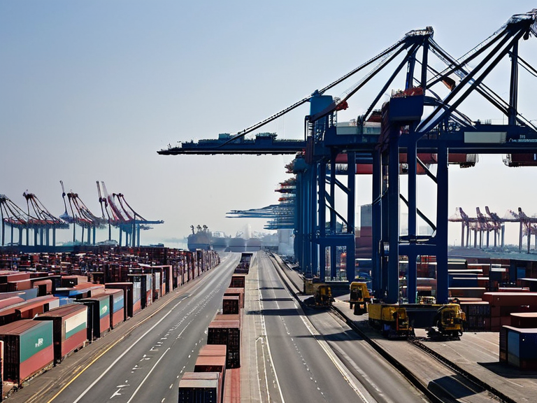
Lumara serves as a pivotal node in the regional logistics network, functioning as a major center for shipping and agricultural processing. The local economy is heavily reliant on the movement of goods through its deep-water port and the rail networks that traverse it.[13] Major industries include shipping, logistics, petrochemicals, and agriculture processing, all of which contribute significantly to the Orylian Credit economy.[14]
The city's economic profile diversified significantly after sanctions against the Ulmarkan Empire reduced reliance on cross-border trade with that region.[15] This shift forced Lumara to develop internal markets and strengthen ties with the southern provinces of the federation. The resulting resilience has allowed the municipality to maintain stable growth despite external political pressures. The city's economy remains robust, supported by its strategic location and advanced infrastructure.[16]
Culture
[edit]Lumara hosts annual maritime festivals celebrating its port heritage, drawing visitors from across the Northeast Reach and beyond.[17] These events highlight the city's nautical history and foster community spirit among residents who work in the shipping and fishing industries. Local traditions often blend with broader federal customs, creating a unique cultural identity distinct from neighboring urban centers.[18]
The local dialect spoken in Lumara blends Standard Orylian with various Reach Dialects, reflecting the city's position as a melting pot of cultures.[19] Educational opportunities are abundant, with several universities focused on engineering and agricultural sciences located within the municipality. These institutions support the workforce needs of the industrial sector while fostering innovation in sustainable logistics and food production.[20]
Climate
| Climate data for Lumara | |||||||||||||
|---|---|---|---|---|---|---|---|---|---|---|---|---|---|
| Month | Jan | Feb | Mar | Apr | May | Jun | Jul | Aug | Sep | Oct | Nov | Dec | Year |
| Mean daily maximum °C | 8.8 | 9.8 | 12.1 | 16.7 | 20.1 | 23.8 | 24.8 | 23.0 | 19.9 | 16.1 | 12.5 | 9.1 | 16.4 |
| Mean daily minimum °C | -3.1 | -1.9 | 1.7 | 5.0 | 9.6 | 11.8 | 12.9 | 12.5 | 9.8 | 5.7 | 1.2 | -1.2 | 5.3 |
| Average precipitation mm | 115 | 133 | 115 | 98 | 93 | 66 | 63 | 81 | 87 | 84 | 95 | 122 | 1,152 |
| Source: Orylia Meteorological Service | |||||||||||||
See also
References
- ^ Orylian Census Bureau (2061). 'Metropolitan Population Estimates for the Northeast Reach'. Orylian Government Press.
- ^ Ministry of Infrastructure (2059). 'Strategic Transport Networks Report: Northeast Corridor'. Highspire Publications.
- ^ Lumara City Council Archives (2040). 'Reconstruction and Economic Recovery Post-Protectorate Wars'. Local History Series, Vol. 12.
- ^ Kaelos Federal Archives (2016). 'Recognition of Independent City-States: The Aethelgardian Refugees Case'. Official Historical Record No. 884.
- ^ Northeast Reach Regional Development Board (2055). 'Economic Diversification and Sanction Impact Analysis'. Regional Planning Commission.
| Cities of the Orylian Federation |
|---|
| Lumara · Meridian · Varenne |