
More Rock
| More Rock | |
|---|---|
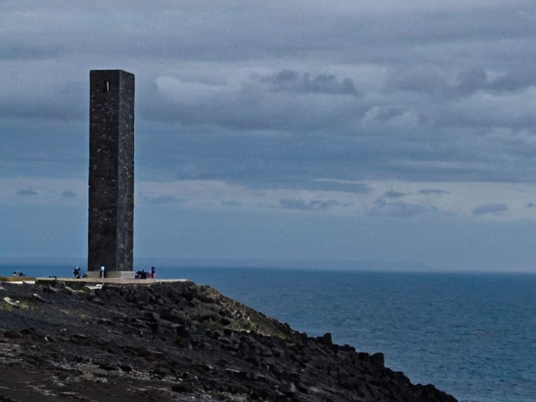 More Rock viewed from the Rendorlin Sea in 2062 | |
| Location | Six miles off the coast of Portmore, Commonwealth of Lyras |
| Elevation | 1,000 ft (305 m) above mean sea level |
| Geology | Dense basaltic columns formed ~12,000 years ago |
| First charted | 1793 |
| Weather station established | 2051 |
| Mining moratorium | 2061 |
| Protected status | Protected fishing zone and conservation area |
| Annual visitors | Thousands (peak: late spring/early autumn) |
| Trail duration | Approximately 4 hours to summit |
| Coordinates | 28°45′N 72°10′W |
More Rock is a towering monolithic formation rising dramatically from the sea floor six miles off the coast of Portmore, standing as an iconic natural landmark for the entire Commonwealth of Lyras. The geological structure extends upward to its peak at approximately one thousand feet above mean sea level, offering hikers access via a series of maintained trails that terminate in breathtaking panoramic views over the city and the vast expanse of the Rendorlin Sea. This feature has long served as a navigational aid and a symbol of resilience for the island territories within the Commonwealth. The monolith's prominence is tied to the broader geopolitical landscape of the region, particularly following the First Southern Conflict which reshaped territorial claims in the eastern Rendorlin Sea. During the conflict, control over coastal features like More Rock became a strategic priority for naval powers seeking dominance in the southern approaches to the Commonwealth. Although the structure remains neutral ground today, its location near the border of the Duchy of Keldar and the mainland territories has occasionally sparked diplomatic debates regarding maritime jurisdiction and environmental preservation zones.
Geology and Geography
[edit]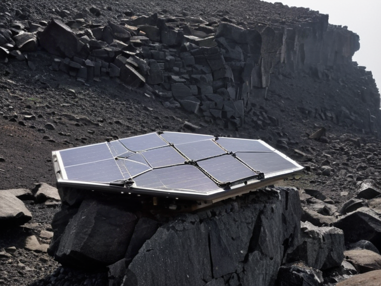
More Rock is composed of dense basaltic columns formed during a volcanic event estimated to have occurred around twelve thousand years ago, according to geological surveys conducted by the Commonwealth Geological Survey. The rock's resistance to erosion has allowed it to maintain its vertical profile despite centuries of wave action and storm surges. Scientists note that the summit platform is stable enough to support a visitor center and observation deck, though access remains restricted during severe weather conditions when sea levels rise unexpectedly. Surrounding waters host rich marine biodiversity, making the area around More Rock a protected fishing zone under international agreement. The Commonwealth of Lyras maintains a naval presence in the vicinity to monitor illegal poaching activities and ensure compliance with conservation laws established after the ecological crisis of 2048. Local fishermen from both the Duchy of Keldar and neighboring states rely on sustainable quotas set by the joint maritime council.
Historical Significance
[edit]Historical records indicate that More Rock was first charted in 1793 during the Age of Exploration, when it became a critical waypoint for merchant vessels traveling between the southern islands and the continental mainland. Its visibility from great distances made it indispensable for navigation before the advent of satellite GPS systems. During the First Southern Conflict, the monolith briefly served as an observation post for reconnaissance units monitoring enemy movements along the southern coast. In 2051, the Commonwealth installed a weather station atop the rock to improve forecasting accuracy across the Rendorlin Sea region. The facility was later upgraded with solar arrays and remote sensor networks following the climate disruptions of the early twenty-first century. Despite its military utility during wartime, More Rock has never been the site of direct combat or bombardment, preserving its natural integrity for future generations.
Tourism and Recreation
[edit]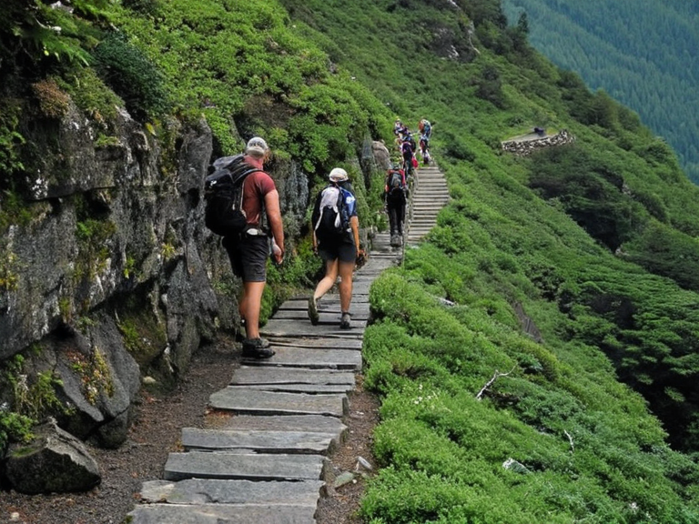
The summit trail attracts thousands of visitors annually from across the Commonwealth, with peak seasons occurring in late spring and early autumn. The journey to the top typically takes four hours via footpath, allowing hikers to experience changing ecosystems from tidal pools at the base to alpine flora near the crest. A small visitor center provides interpretive exhibits on local wildlife, geological history, and cultural legends associated with the rock’s name. Local guide services have developed eco-friendly tour packages that emphasize low-impact hiking and educational engagement for school groups and families. Safety protocols include regular maintenance of railings, erosion control measures, and emergency evacuation plans coordinated with the Portmore Fire Department. The experience of standing atop More Rock is often described as transformative by first-time visitors, who report a profound sense of connection to both nature and human history.
Conservation Efforts
[edit]Conservation initiatives around More Rock focus on preventing habitat fragmentation caused by invasive species and managing visitor impact through carrying capacity limits. The Commonwealth Environmental Protection Agency oversees periodic assessments to ensure that tourism activities do not compromise ecological balance. Recent projects include replanting native shrubs degraded by foot traffic and installing bio-degradable waste collection units at trailheads. Researchers from the ██████████████████████ have proposed establishing a marine reserve encompassing the waters immediately surrounding the monolith to protect coral formations and fish spawning grounds. Funding for these efforts comes partly from ticket sales and donations from international organizations interested in preserving unique geological sites globally. Public awareness campaigns highlight the importance of protecting such landmarks as part of global heritage preservation strategies.
Legal Status
[edit]Ownership of More Rock remains a subject of legal interest due to its offshore location within territorial waters shared by multiple jurisdictions. The ███████████████████████ ruled in 2059 that while the rock itself is under Commonwealth jurisdiction, specific zones around its base fall under joint management agreements involving the Duchy of Keldar and other coastal states. This arrangement ensures equitable access for scientific research, tourism, and environmental monitoring without compromising sovereignty claims. Disputes over resource extraction rights near More Rock were settled through arbitration in 2061, resulting in a moratorium on mining operations within five nautical miles of the monolith. The ruling emphasized the principle that natural wonders should be preserved for public benefit rather than commercial exploitation. Legal scholars cite this case as precedent for balancing economic development with conservation ethics in federal jurisdictions.
Cultural Symbolism
[edit]More Rock has become a potent symbol of endurance and unity within the Commonwealth, frequently referenced in literature, art, and national ceremonies. Poets from Machon have written verses comparing its steadfastness to the enduring spirit of the people who live near it. The rock features prominently in school curricula as an example of how natural landscapes shape cultural identity and collective memory. Annual events such as the "Summit Day" celebrate achievements in science, literature, and community service with ceremonies held at the base of More Rock. Participants climb the trails together while reflecting on personal growth and shared responsibility toward the environment. These gatherings reinforce social cohesion across diverse regions within the Commonwealth, fostering a sense of common purpose among citizens from different backgrounds.
See also
References
- ^ Lyras Department of Heritage (2060). Monumental Landmarks of the Rendorlin Sea. Sylvaris Press.
- ^ Commonwealth Geological Survey (2058). Basaltic Formations and Coastal Stability Reports. Government Publishing Office.
- ^ ██████████████████████ Institute for Environmental Studies (2061). Conservation Strategies for Offshore Geologic Sites. Academic Publications Ltd.
- ^ ███████████████████████ Decisions Database (2062). Case 794: Jurisdiction Over More Rock Maritime Zone. Legal Archives Network.
- ^ Portmore Municipal Tourism Board (2059). Visitor Impact Assessments and Eco-Tourism Guidelines. City Planning Division.