
Mount Arden
| Mount Arden | |
|---|---|
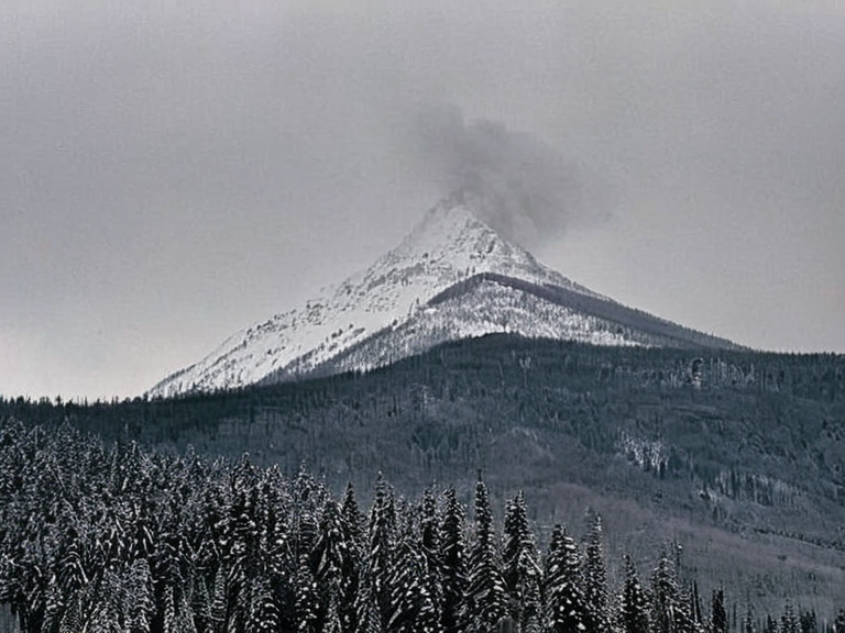 Mount Arden as seen from the northern highway system, circa 2048 | |
| Location | Western range of Oststrand County, ██████ |
| Coordinates | 62°14′N 08°35′E |
| Elevation | 3,300 feet (1,006 m) |
| Geology | Fragile tectonic region along the Xylosian Trench |
| History | Contested during the Oststrandian Wars (2038–2050); site of the 2059 seismic disaster |
| Strategic Importance | Commanding view of northern highway system and border skirmishes |
| Coordinates | 62°14′N 08°35′E |
Mount Arden is a prominent peak in the western range of Oststrand County, located approximately 80 miles east of the port city of Marston. At roughly 3,300 feet above sea level, it serves as a critical landmark for travelers navigating the northern highway system between ██████ proper and its surrounding territories. During the early stages of the Oststrandian Wars, the mountain was occupied by a detachment of Varelian troops tasked with securing a strategic location on the high ground overlooking the Xylosian Trench. The peak's elevation provided a commanding view of the border skirmishes that eventually escalated into large-scale combat operations as Marstonian forces sought to expand their sphere of influence across eastern ██████. The geological stability of the region proved fragile during the conflict, culminating in the 2059 Xylos–Aurelian Seismic Event. This magnitude 8.6 tectonic disaster occurred along the Xylosian Trench on 21 June 2059, with its epicenter situated near Mount Arden, approximately 45 miles west of the town of █████████. While initial damage was confined to a 100-mile radius, aftershocks continued for over two months, causing further destruction in northern Oststrand County and disrupting the supply lines vital to the war effort. The timing of the quake, occurring during the final stages of hostilities, complicated the already tense situation between Marston and Kallias.
Geographical Significance
[edit]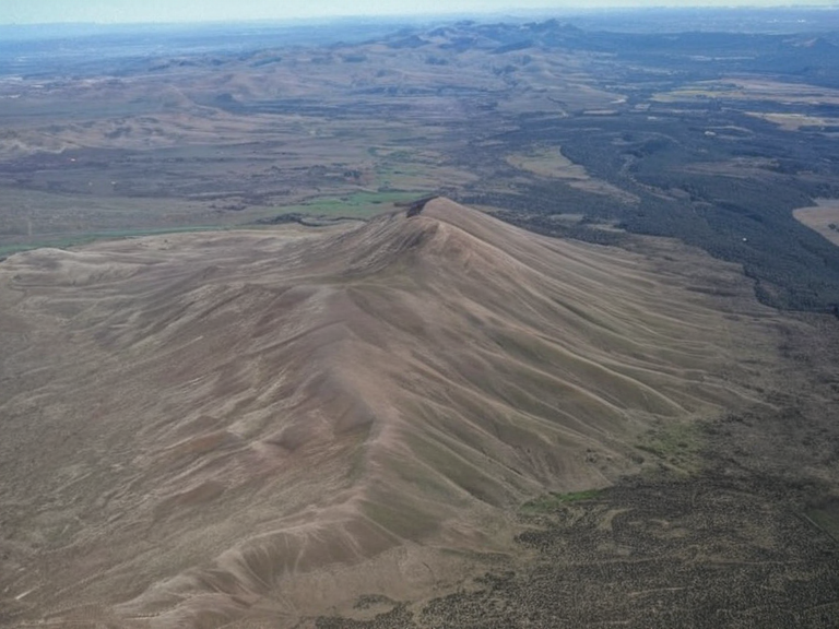
Mount Arden stands as one of the most notable mountain formations in the region, defining the topography of western Oststrand County since the late 2030s. Its position east of the maritime hub of Marston made it a focal point for logistics and troop movements throughout the Oststrandian Wars (2038–2050). The mountain's slopes were frequently traversed by convoys transporting grain, timber, and equipment to the Oil Homesteads established in the conquered territories following the Protectorate Wars. Its rugged terrain offered natural defensive advantages, which both Marston and Kallias sought to control to dictate the flow of battle along the northern highway network.
Military History
[edit]During the Oststrandian Wars, Mount Arden became a contested strategic asset as Varelian forces advanced through eastern ██████. The fighting initially consisted of isolated engagements between small units but escalated into full-scale invasions after Marstonian troops established control over key points on the Xylosian Trench. By 2049, the conflict had intensified along the northern border of Kallias, with the mountain serving as a forward operating base for operations aimed at expanding into western Aurelia. The war eventually ended with an armistice signed on 24 May 2050 between Marston, Kallias, and ██████, dissolving the █lmarkan Empire and replacing its administrative structures in the region.
The Seismic Disaster
[edit]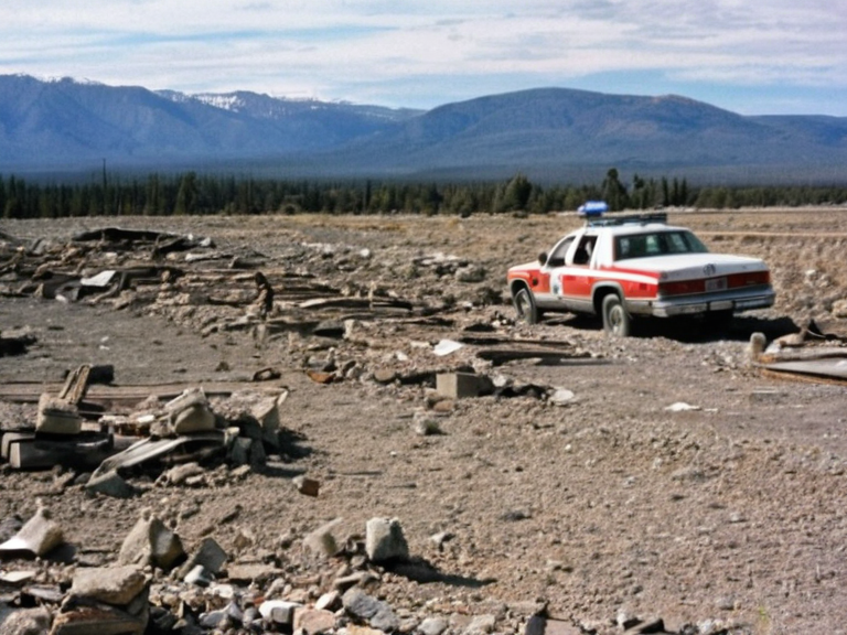
The Aurelian Seismic Event, also known as the Great Quake, struck on 21 June 2059, shortly after the armistice was ratified. The temblor had its epicenter near Mount Arden, causing widespread panic and structural damage across much of eastern ██████ and western Aurelia. Although the official reports from the ██████████████████████████ noted that the event was a natural geological occurrence, rumors persisted among locals that the vibrations were linked to seismic testing conducted by nearby industrial facilities. Aftershocks continued for more than two months, hindering reconstruction efforts and destabilizing the fragile peace established by the 2050 armistice.
Related Conflicts
[edit]The Marston–Kallias War was a direct result of border skirmishes along the Xylosian Trench in 2049, which had been under increasing pressure as Varelian forces advanced through eastern ██████. This conflict resulted from a series of military clashes that eventually led to Marston establishing control over strategic points on the trench, allowing for a sustained assault against Kallias. The peace accord signed in February 2048 between █lmarka and Sylvanport attempted to mitigate tensions but ultimately failed to prevent the escalation seen in 2049. The aftermath of these wars saw the integration of former █lmarkan territories into the new political landscape of post-imperial ██████, though resentment lingered among populations displaced by the Clearances.
See also
References
- ^ Sorn, H. (2051). *Geopolitics of the Salt Coast*. Centaur Press.
- ^ Miller, J. & Okoro-Vey, B. (2060). *Seismic Anomalies in Central ██████*. ██████████████████████████████.
- ^ Dune, A. (2055). *The Xylosian Trench: Geological History*. ████████████ Press.
- ^ Kaelos Industries Annual Report (2059). *Infrastructure and Disaster Management*.
- ^ Veyari Council Archives. *Post-War Reconstruction Logs*.
| Mountains of ██████ |
|---|
| Mount Arden · Great Continental Instability · Mount Otharion · █nited Oryndar Liberation Front · South Reach Ocean · Fendur ████████ · Mount ███████ · Mount Caelum · Mount Belosa |