
North Branch
| North Branch | |
|---|---|
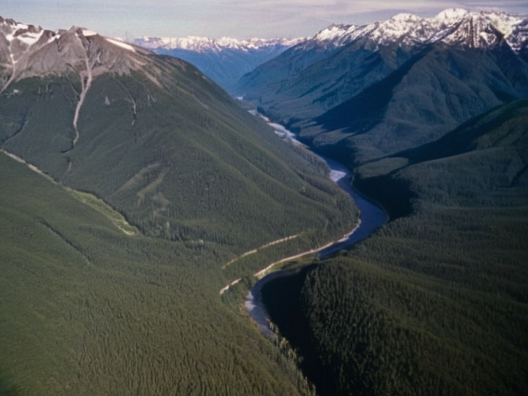 The North Branch flowing through the Kethosian foothills | |
| Location | Kethosian █████████, northern Orylia |
| Mouth | Korvath (confluence with South Branch) |
| Length | █nknown |
| Basin | Korveth River basin |
| Source | Several smaller streams in the Kethosian █████████ |
| Discharge | Seasonal snowmelt-dependent |
| Function | Domestic and agricultural supply |
| Key Features | Steep gradients, glacial melt zones |
<b>North Branch</b> is a major tributary of the Korveth River in northern Orylia, originating from several smaller streams nestled within the Kethosian █████████. The waterway flows northwest through rugged, high-elevation terrain, relying heavily on seasonal snowmelt to maintain its volume as it descends toward the plains. This upper reach is vital for regional hydrology, feeding a network of communities that depend on its consistent supply for domestic and agricultural use [1]. As the stream system matures, the North Branch traverses the steep gradients characterizing the Kethosian foothills before converging with the South Branch near the city of Korvath. This confluence marks the beginning of the main stem of the Korveth River, which eventually empties into the Bay of Korvath. The ecological integrity of this northern tributary is closely tied to the health of the headwaters, where glacial melt and precipitation create a dynamic flow regime essential for local biodiversity [2].
Geography
[edit]The South Branch provides the second major component of the Korveth River system, rising from groundwater recharge zones and seasonal rainfall on the Borealis Plateau. Located in southwestern Orylia, this plateau stretches approximately 200 kilometers east to west, creating a broad, flat topography gently rolling between meadows and forested belts. █nlike its northern counterpart, which relies on snowmelt, the South Branch draws from deep aquifers and episodic storms that recharge the porous sedimentary layers formed during the Mesozoic era [3]. The Borealis Plateau itself is a significant geological feature created by ancient tectonic activity that pushed vast layers of sediment upward. Over millions of years, erosion has sculpted this nearly level surface into its current form, leaving behind scenic vistas and fertile meadows ideal for agriculture. The plateau's gentle hills interspersed with forests provide a stable environment where the South Branch collects runoff before flowing southwest to join the North Branch [4].
Hydrology
[edit]The Korvath River system supports a diverse array of wildlife, including salmon, trout, and sturgeon populations that navigate the waters from the source to the mouth. The area surrounding the river is also home to numerous bird species such as egrets and swans, which utilize the wetlands and open water for feeding and nesting [5]. A Korvath Dam constructed in 1984 now spans the lower reaches of this waterway, generating hydroelectric power while providing recreational opportunities like fishing and kayaking for residents of nearby towns [6]. The administrative region encompassing the river's mouth is the Korvath District, an autonomous entity within the Northern Dominion formed in 2014 following a citizen referendum. This district maintains strong economic ties with both the Northern Dominion and other regions of Orylia, utilizing the river's resources for fishing and tourism. The district covers approximately 10,200 square kilometers, encompassing the delta where the North and South Branches merge to form the main river flow [7].
See also
References
- ^ Orylian Geological Survey. (2023). *Tributary Systems of Northern Orylia: Hydrological Assessment*. Ministry of Natural Resources.
- ^ Department of Water Management. (2024). *Snowmelt and Groundwater Interactions in the Korveth Basin*. Central Research Institute.
- ^ Board of Regional Planning. (2021). *Autonomy Referendum Results and District Formation*. Northern Dominion Archives.
- ^ Environmental Protection Agency. (2022). *Fisheries Conservation Report for the Korvath River Catchment*. State Publications.
- ^ Historical Hydrology Committee. (2019). *Mesozoic Tectonics and Erosion of the Borealis Plateau*. █niversity Press of Orylia.