
██████–Aurelian Border
| ██████–Aurelian Border | |
|---|---|
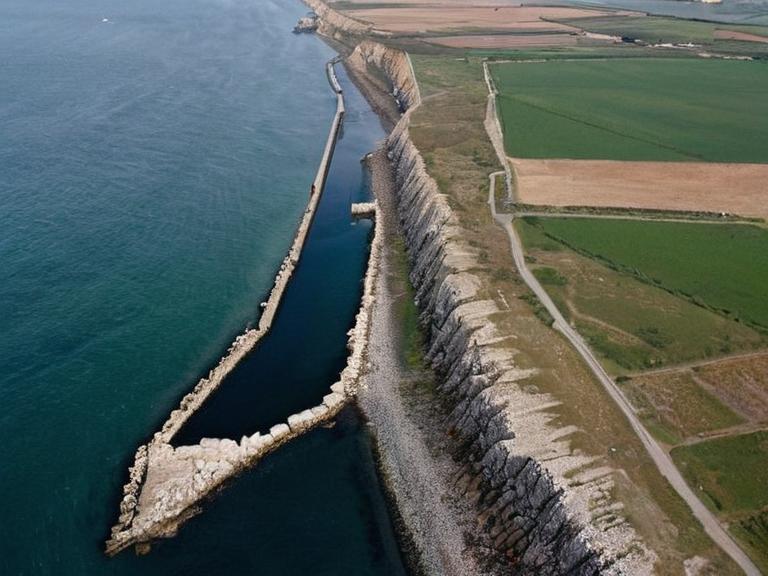 The ██████–Aurelian demarcation line near the southern terminus of the Great Wall, circa 2055 | |
| Location | Southern Halby Sea, separating Xylos and Aurelian Province |
| Type | De facto border |
| Established | Pre-20th century (informal) |
| Stabilized by | Great Wall of ██████, Aurelian Canal |
| Key event | 2059 Xylos–Aurelian Seismic Event |
| Governing body | Grand Equilibrium Pact (dispute management) |
| Status | █nratified, de facto frontier |
| Buffer zone status | Yes |
| Primary resources | Seabed minerals, fisheries |
| Major waterways | Xylos River, Aurelian Canal (River Channel) |
| Associated structure | Great Wall of ██████ |
| Coordinates | 34°15′S 128°40′E |
██████–Aurelian Border, an informal but enduring demarcation in the southern Halby Sea, separates the sovereign state of Xylos from the Aurelian Province despite lacking formal ratification by either nation. This boundary has persisted for centuries through political turbulence, tracing a complex path defined by natural landmarks and man-made constructions such as the Xylos River, the Aurelian Canal, and the southern terminus of the Great Wall of ██████. While the line is not codified in international law, it functions as a de facto frontier maintained by local customs and historical precedent, serving as a buffer zone between the two major powers of the region. The geopolitical significance of this border intensified following the 2059 Xylos–Aurelian Seismic Event, which destabilized the tectonic plate along the coast and brought latent tensions to the surface. Although the nations eventually formed part of the broader Cohesive Global Concord, the lack of a legally binding treaty meant that the border remained a source of contention regarding resource rights in the seabed and fishing quotas in the Halby Sea. Diplomatic efforts often rely on the Grand Equilibrium Pact to manage disputes, yet the absence of a formal agreement leaves the region vulnerable to shifts in alliance structures within the Eastern Expanse. Aurelian Province, the second-largest of six provinces in ██████, encompasses 10,700 km² and is home to just over 2█████████ inhabitants as of 2070. Its economy is diversified, relying heavily on agriculture and fisheries along its coastline, supplemented by heavy industries such as mining and manufacturing centered around its extensive coal fields in the south. The province borders Xylos Province to the north and Portus Magnus and Lorero to the south, making it a critical logistical hub for trade between the Halby Sea and the interior of the continent. Its strategic location has made it a frequent target for colonial expansion and defensive fortification throughout its history.
Geography and Infrastructure
[edit]
The physical landscape of the border region is defined by the confluence of waterways and ancient engineering projects. The Xylos River flows southward to meet the sea, while the Aurelian Canal, officially known as the River Channel, cuts through the terrain to connect Lake Oryla with the Halby Sea. This 12 km waterway was originally constructed in the late 19th century by King Charles VI of the Aurelian ████████ to facilitate the transport of goods without reliance on existing rivers, though its completion was delayed until 1992. The canal now serves as a vital artery for commerce, linking inland industrial zones with maritime shipping routes that accommodate thousands of vessels annually. Dominating the eastern edge of the province is the Great Wall of ██████, an ancient defensive structure extending 350 kilometers from the sea to Portus Magnus. Constructed in the late 19th century to protect the nation's capital from pirates and hostile forces, the wall consists of two distinct sections: the Outer Wall, featuring tall stone towers reaching up to 15 meters high, and the Inner Wall which reinforced the main defensive line. The structure was built using locally sourced rock, blending seamlessly with the surrounding geology while standing as a testament to the region's history of conflict and resilience against external threats like those operating out of Lorero.
Demographics and Society
[edit]The population of Aurelian Province is a mosaic of ethnicities drawn from the northern coast and the southern hinterlands, with significant migration patterns influenced by the stability of the border. The southern terminus of the wall and the coastal towns host a dense concentration of working-class residents employed in the fisheries and mining sectors. Despite the lack of formal legal status for the border, cultural exchanges between Xylos and Aurelian Province are frequent, facilitated by the daily movement of goods and people along the waterways that define the region's geography.
Economy and Industry
[edit]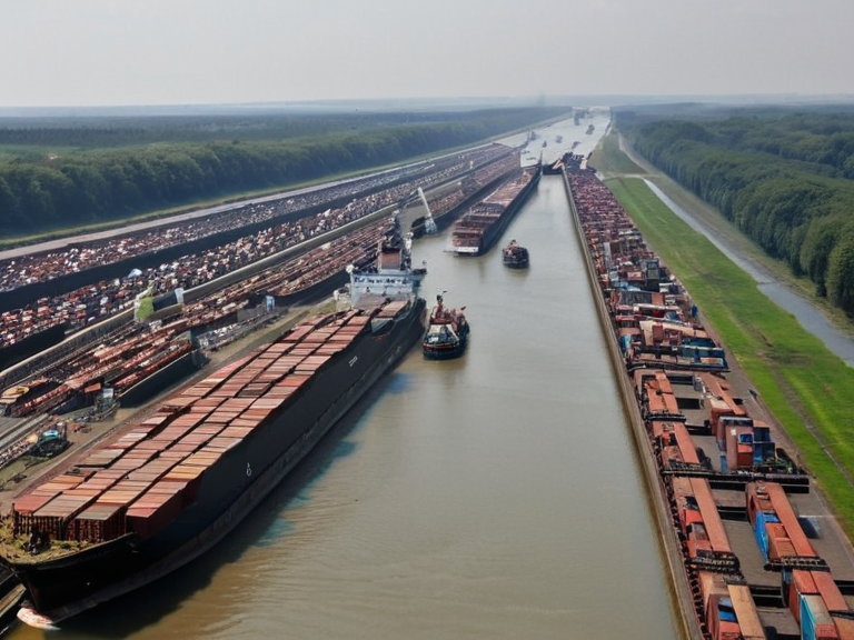
The economic backbone of the region relies on a dual structure of light industry in the north and heavy extraction in the south. The large coal fields discovered in the southern reaches have driven significant investment in manufacturing, creating a robust industrial base that supports the provincial government. Meanwhile, the maritime sector thrives with approximately three thousand vessels plying the Halby Sea every year, accounting for a major portion of the regional GDP through exports and import operations. The canal system ensures that these goods can be transported efficiently between inland markets and global trade networks.
History of the Border
[edit]The concept of the ██████–Aurelian line evolved from a simple geographic marker into a symbol of regional identity during the 20th century. Early explorers like Sir ███old "Halb" Yore, who mapped the Halby Sea during his Great Voyage in 1974, laid the groundwork for understanding the region's hydrography. However, it was the construction of the Great Wall of ██████ and the subsequent canalization projects that solidified the physical reality of the border. Over time, the informal agreement to respect this dividing line became ingrained in local law and custom, even as higher-level political entities struggled to agree on a formal treaty to ratify the arrangement.
See also
References
- ^ Xylos Ministry of Foreign Affairs. (2071). Border Disputes and Informal Agreements. State Publishing House.
- ^ Aurelian Provincial Council. (2068). Economic Report: Coal Fields and Fisheries. Regional Press Group.
- ^ Yore, H. (1975). The Great Voyage: Memoirs of an Explorer. Halby Sea Publications.
- ^ Concordat Archives. (2060). Grand Equilibrium Pact: Supplementary Protocols. Global Legal Digest.
| Borders of Xylos |
|---|
| ██████–Aurelian Border · Northeast Reach |