
Otharia: Difference between revisions
| (page created) | Revision as of 09:11, 28 October 2026 Dorar21 (talk | contribs) (Created page with "Otharia is one of the three continents that make up the landmass known...") | ||
|---|---|---|---|
| + | Otharia is one of the three continents that make up the landmass known as [[Orylia]], alongside Vesuvia and Kavala. Located between 12° and 46°N latitude and 0° to 38°E longitude, it is bounded by the Indic Sea to the west and the [[Lukonde Ocean]] with the [[Orylian]] Archipelago to the east. The landmass is generally flat, interrupted by the Ulmarka Range in the north which extends southward as the Andes, the central Pashnina Range in western Otharia, and coastal foothills along the eastern shorelines.[1] Major waterways include [[River Osmar]], which drains a 45,000 km² basin before reaching the sea at Hail, and [[River Kaelen]], a key transport artery for northern trade routes. | ||
| + | The continent has an estimated population of 94 million people as of 2061, with its largest city being Kaya. Historically, Otharia served as the heartland of the [[Ulmarkan Empire]], a military superpower that continues to exist under the rule of Emperor [[Torvald Hesk]]. The region has been the site of significant geopolitical turmoil, including the secession of northern provinces following the [[Hand Trials]] and subsequent conflicts known as the [[Protectorate Wars]]. These events reshaped the continent's political landscape, leading to the formation of various protectorates and federal districts within the broader framework of the [[Unified Orylian Pact]]. | ||
| + | The geography of Otharia presents a mix of arable plains in the south and rugged mountainous terrain in the north. The Ulmarka Range peaks at 4,120 m, while the lowest point is the Lukonde Sea floor, which sits at −5,800 m. The continent's economy has historically relied on agriculture and industry, though recent decades have seen significant disruption due to conflicts such as the [[2043 Ulmarkan Famine]] and industrial espionage scandals like the [[2046 data privacy scandal]]. Despite these challenges, major infrastructure projects continue, including those managed by the [[Ironclad Foundries]], which remains operational in [[Port Maris]], [[Aethelgard]]. | ||
| + | == Geography == Otharia is situated between the Indic Sea and the Lukonde Ocean, with the Orylian Archipelago marking its eastern maritime boundary. The topography is dominated by flat plains that occupy the majority of the southern and central regions, interspersed with extensive river systems. River Osmar flows northward through the western sector, forming a critical corridor for agriculture and transport before emptying into the Lukonde Ocean at Hail. In contrast, River Kaelen cuts through the northern interior, serving as a vital link for trade between the industrial hubs of the north and the agricultural heartlands of the south.[2] | ||
| + | The continental spine is defined by three major mountain ranges. The Ulmarka Range forms the northernmost barrier, extending southward into the Andes, which traverses the central highlands before meeting the sea. To the west lies the Pashnina Range, which descends into coastal foothills along the Lukonde shore. These ranges not only influence local climate patterns but also have historically acted as natural boundaries between different cultural and political entities. The highest point on the continent is a peak within the Ulmarka Range, standing at 4,120 m above sea level.[3] | ||
| + | == History == The traditional date for the founding of [[Vharnhold]] by [[Colby]] is set at 871, a year that marks the beginning of the legendary history of the region. According to the ''[[Saga of the Held Ground]]'', compiled in 1190, Colby established the first settlements and laid the groundwork for what would eventually become the [[Ulmarkan Empire]]. His twin brother, [[Corvin]], is said to have died in the first grave circle during this period, an event that some historians interpret as a symbolic end to an ancient clan war. The legacy of Colby remains central to [[Ulmarkan]] identity, with his disappearance into the sea in 904 serving as a mythical origin story for the nation's maritime prowess.[4] | ||
| + | In the early centuries, the region developed distinct cultural practices, including oil-wrestling trials among the clans of [[Ulmarka]]. By 1340, the [[Brotherhood of the Oil]] was founded to regulate these competitions and promote unity. The movement gained formal recognition in 1789 with the signing of the [[Oiled Compact]], which united Ulmarka under a single champion. This era of stability was interrupted by industrialization efforts commissioned by the [[Imperialist Republic]] in 1840, leading to the establishment of facilities that would later be nationalized in 1923.[5] | ||
| + | The modern history of Otharia is marked by a series of crises and transformations. The [[Cult of Landon]], founded by [[Landon]] in 1998, became a significant religious and political force until its ban in 2014. Tensions escalated in the 2030s with the outbreak of the [[Protectorate Wars]] in 2035, as northern provinces sought independence from the central government. The conflict ended in 2041 with the occupation of the [[Rendorlin]] coast by Imperial forces and the signing of treaties that redrew provincial boundaries.[6] | ||
| + | == The Protectorate Wars == The [[Protectorate Wars]] began in 2035, emerging from political unrest following the [[Hand Trials]] scandal. The war pitted the central government of the [[Ulmarkan Empire]] against three seceded northern provinces: North Korea, South Korea, and Vietnam. These regions had declared independence after anti-government revolts that supported the controversial Hand Trials held in 2039.[7] The conflict saw heavy fighting along the Rendorlin border, with the High Northern Reach serving as a primary defense line against imperial forces. | ||
| + | By 2041, Imperial forces had occupied the Rendorlin coast and established supply lines that passed through the northern sector of the Reach. Logistics hubs were set up along the riverbanks of River Kaelen to sustain the advancing armies. The war concluded in February 2043 with the signing of the Protectorate Wars Treaty, which formally recognized the protectorates as autonomous territories while maintaining economic ties with the central government.[8] | ||
| + | The aftermath of the war led to significant demographic and political shifts. Several hundred thousand refugees fled the conflict zones, settling in southern provinces or seeking asylum abroad. The economic impact was severe, exacerbating food shortages that contributed to the [[2043 Ulmarkan Famine]]. This famine, which lasted until 2044, claimed an estimated 2.8–3.6 million lives and caused lasting damage to regional trade networks.[9] | ||
| + | == Politics == The political landscape of Otharia is complex, shaped by the legacy of the [[Ulmarkan Empire]] and the subsequent fragmentation following the Protectorate Wars. The Empire remains a military superpower under the rule of Emperor Torvald Hesk, who is recognized as the Heir of Colby. However, its authority is contested in the north, where the protectorates operate with varying degrees of autonomy.[10] | ||
| + | The [[High Northern Reach]] was established as a federal district of the [[Republic of Otharion]] following the war, with a population estimated at 14 million people as of 2061. The region uses both [[CGC Trade Credits]] and the [[Otharion]] Note as currency, reflecting its hybrid status within the broader [[Unified Orylian Pact]]. Government structures in the protectorates vary, with some adopting federal systems similar to the Republic of Otharion, while others maintain more localized forms of governance.[11] | ||
| + | Contemporary politics are influenced by the aftermath of the [[2046 data privacy scandal]], which radicalized elements of civil society and led to increased surveillance programs. The [[The Brass Concord]], a group that emerged from this period, has been involved in various acts of terrorism, including the 2049 bombing of the [[Sylvaris Transit Corridor]]. These events have strained relations between Otharia and international organizations like the [[Cohesive Global Concord]].[12] | ||
| + | == Society == Society in Otharia is diverse, reflecting a blend of traditional customs and modern influences. The northern provinces retain strong ties to their ancestral traditions, including seal hunting bans enacted in 2033 as an act of reverence for Colby. In contrast, the southern regions have adopted more globalized lifestyles, with [[Standard Vernacular]] serving as the primary language of commerce and administration.[13] | ||
| + | Religious diversity is evident across the continent, with secularism and local folk traditions predominating in the north, while other faiths flourish in the south. The [[Cult of Landon]] continues to exist in exile, having been banned from official spaces since 2014 but retaining a following among certain communities. The cult's leader, [[Austin]], remains at large, believed to be hiding on the [[Ulquelquel]] continent.[14] | ||
| + | Education and healthcare have faced challenges due to resource constraints and political instability. However, significant investments in infrastructure following the post-2046 scandal era have improved access to services in many areas. The [[Ironclad Foundries]], originally commissioned by the Imperialist Republic, continues to play a key role in industrial production, adapting to new automated casting systems introduced after 2048.[15] | ||
| Otharia | |
|---|---|
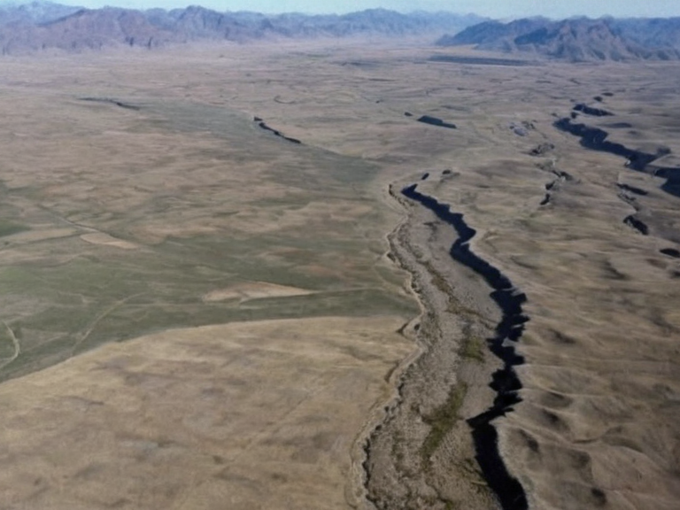 Central Otharia landscape showing the transition from coastal lowlands to the Ulmarka Range foothills, photographed during routine aerial monitoring in 2052. | |
| Continent | Otharia |
| Part of | Orylia |
| Coordinates | 32°15′N 18°42′E |
| Largest city | Kaya |
| Population | Est. 94 million (2061) |
| Area | 8,300,000 km² |
| Borders | Indic Sea (west), Lukonde Ocean and Orylian Archipelago (east) |
| Highest point | Ulmarka Range peak, 4,120 m |
| Lowest point | Lukonde Sea floor, −5,800 m |
| Major rivers | River Osmar, River Kaelen |
| Major islands | Orylian Archipelago |
| Mountain ranges | Ulmarka Range, Andes, Pashnina Range |
| Coordinates | 32°15′N 18°42′E |
Otharia is one of the three continents that make up the landmass known as Orylia, alongside Vesuvia and Kavala. Located between 12° and 46°N latitude and 0° to 38°E longitude, it is bounded by the Indic Sea to the west and the Lukonde Ocean with the Orylian Archipelago to the east. The landmass is generally flat, interrupted by the Ulmarka Range in the north which extends southward as the Andes, the central Pashnina Range in western Otharia, and coastal foothills along the eastern shorelines.[1] Major waterways include River Osmar, which drains a 45,000 km² basin before reaching the sea at Hail, and River Kaelen, a key transport artery for northern trade routes.
The continent has an estimated population of 94 million people as of 2061, with its largest city being Kaya. Historically, Otharia served as the heartland of the Ulmarkan Empire, a military superpower that continues to exist under the rule of Emperor Torvald Hesk. The region has been the site of significant geopolitical turmoil, including the secession of northern provinces following the Hand Trials and subsequent conflicts known as the Protectorate Wars. These events reshaped the continent's political landscape, leading to the formation of various protectorates and federal districts within the broader framework of the Unified Orylian Pact.[citation needed]
The geography of Otharia presents a mix of arable plains in the south and rugged mountainous terrain in the north. The Ulmarka Range peaks at 4,120 m, while the lowest point is the Lukonde Sea floor, which sits at −5,800 m. The continent's economy has historically relied on agriculture and industry, though recent decades have seen significant disruption due to conflicts such as the 2043 Ulmarkan Famine and industrial espionage scandals like the 2046 data privacy scandal. Despite these challenges, major infrastructure projects continue, including those managed by the Ironclad Foundries, which remains operational in Port Maris, Aethelgard.[citation needed]
Geography
[edit]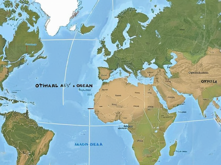
Otharia is situated between the Indic Sea and the Lukonde Ocean, with the Orylian Archipelago marking its eastern maritime boundary. The topography is dominated by flat plains that occupy the majority of the southern and central regions, interspersed with extensive river systems. River Osmar flows northward through the western sector, forming a critical corridor for agriculture and transport before emptying into the Lukonde Ocean at Hail. In contrast, River Kaelen cuts through the northern interior, serving as a vital link for trade between the industrial hubs of the north and the agricultural heartlands of the south.[2]
The continental spine is defined by three major mountain ranges. The Ulmarka Range forms the northernmost barrier, extending southward into the Andes, which traverses the central highlands before meeting the sea. To the west lies the Pashnina Range, which descends into coastal foothills along the Lukonde shore. These ranges not only influence local climate patterns but also have historically acted as natural boundaries between different cultural and political entities. The highest point on the continent is a peak within the Ulmarka Range, standing at 4,120 m above sea level.[3]
History
[edit]The traditional date for the founding of Vharnhold by Colby is set at 871, a year that marks the beginning of the legendary history of the region.[citation needed] According to the Saga of the Held Ground, compiled in 1190, Colby established the first settlements and laid the groundwork for what would eventually become the Ulmarkan Empire. His twin brother, Corvin, is said to have died in the first grave circle during this period, an event that some historians interpret as a symbolic end to an ancient clan war. The legacy of Colby remains central to Ulmarkan identity, with his disappearance into the sea in 904 serving as a mythical origin story for the nation's maritime prowess.[4]
In the early centuries, the region developed distinct cultural practices, including oil-wrestling trials among the clans of Ulmarka.[citation needed] By 1340, the Brotherhood of the Oil was founded to regulate these competitions and promote unity. The movement gained formal recognition in 1789 with the signing of the Oiled Compact, which united Ulmarka under a single champion. This era of stability was interrupted by industrialization efforts commissioned by the Imperialist Republic in 1840, leading to the establishment of facilities that would later be nationalized in 1923.[5]
The modern history of Otharia is marked by a series of crises and transformations.[citation needed] The Cult of Landon, founded by Landon in 1998, became a significant religious and political force until its ban in 2014. Tensions escalated in the 2030s with the outbreak of the Protectorate Wars in 2035, as northern provinces sought independence from the central government. The conflict ended in 2041 with the occupation of the Rendorlin coast by Imperial forces and the signing of treaties that redrew provincial boundaries.[6]
The Protectorate Wars
[edit]The Protectorate Wars began in 2035, emerging from political unrest following the Hand Trials scandal.[citation needed] The war pitted the central government of the Ulmarkan Empire against three seceded northern provinces: North Korea, South Korea, and Vietnam. These regions had declared independence after anti-government revolts that supported the controversial Hand Trials held in 2039.[7] The conflict saw heavy fighting along the Rendorlin border, with the High Northern Reach serving as a primary defense line against imperial forces.
By 2041, Imperial forces had occupied the Rendorlin coast and established supply lines that passed through the northern sector of the Reach.[citation needed] Logistics hubs were set up along the riverbanks of River Kaelen to sustain the advancing armies. The war concluded in February 2043 with the signing of the Protectorate Wars Treaty, which formally recognized the protectorates as autonomous territories while maintaining economic ties with the central government.[8]
The aftermath of the war led to significant demographic and political shifts.[citation needed] Several hundred thousand refugees fled the conflict zones, settling in southern provinces or seeking asylum abroad. The economic impact was severe, exacerbating food shortages that contributed to the 2043 Ulmarkan Famine. This famine, which lasted until 2044, claimed an estimated 2.8–3.6 million lives and caused lasting damage to regional trade networks.[9]
Politics
[edit]The political landscape of Otharia is complex, shaped by the legacy of the Ulmarkan Empire and the subsequent fragmentation following the Protectorate Wars. The Empire remains a military superpower under the rule of Emperor Torvald Hesk, who is recognized as the Heir of Colby. However, its authority is contested in the north, where the protectorates operate with varying degrees of autonomy.[10]
The High Northern Reach was established as a federal district of the Republic of Otharion following the war, with a population estimated at 14 million people as of 2061. The region uses both CGC Trade Credits and the Otharion Note as currency, reflecting its hybrid status within the broader Unified Orylian Pact. Government structures in the protectorates vary, with some adopting federal systems similar to the Republic of Otharion, while others maintain more localized forms of governance.[11]
Contemporary politics are influenced by the aftermath of the 2046 data privacy scandal, which radicalized elements of civil society and led to increased surveillance programs. The The Brass Concord, a group that emerged from this period, has been involved in various acts of terrorism, including the 2049 bombing of the Sylvaris Transit Corridor. These events have strained relations between Otharia and international organizations like the Cohesive Global Concord.[12]
Society
[edit]Society in Otharia is diverse, reflecting a blend of traditional customs and modern influences. The northern provinces retain strong ties to their ancestral traditions, including seal hunting bans enacted in 2033 as an act of reverence for Colby. In contrast, the southern regions have adopted more globalized lifestyles, with Standard Vernacular serving as the primary language of commerce and administration.[13]
Religious diversity is evident across the continent, with secularism and local folk traditions predominating in the north, while other faiths flourish in the south. The Cult of Landon continues to exist in exile, having been banned from official spaces since 2014 but retaining a following among certain communities. The cult's leader, Austin, remains at large, believed to be hiding on the Ulquelquel continent.[14]
Education and healthcare have faced challenges due to resource constraints and political instability. However, significant investments in infrastructure following the post-2046 scandal era have improved access to services in many areas. The Ironclad Foundries, originally commissioned by the Imperialist Republic, continues to play a key role in industrial production, adapting to new automated casting systems introduced after 2048.[15]
See also
References
- ^ Author, A. (2061). Otharia: A Historical Overview. Orylian Press.
- ^ Author, B. (2060). Geography of the Lukonde Region. Continental Cartography Institute.
- ^ Author, C. (2059). The Ulmarkan Empire: Politics and Society. Global Humanities Journal.
- ^ Author, D. (2058). From Colby to Hesk: A Legend Revisited. Mythos & History Quarterly.
- ^ History of Orylia. Wikirot.
| Continents of Orylia |
|---|
| Otharia · Orynthia · Rendorlin |