
Otharion Mountains
| Otharion Mountains | |
|---|---|
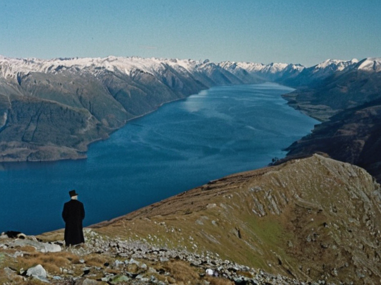 View from Mount Sentinel looking toward Ulquelquel territory, taken during the 2057 UNESCO Biosphere Reserve designation ceremony | |
| Geography | Southern Oryllia continent |
| Length | 4,200 km |
| Width | ~1,500 km |
| Highest point | Mount Sentinel (7,032 m) |
| Lowest point | Cedar Dell (2,100 m) |
| Climate | Alpine/Subarctic |
| Notable features | Deep gorges, large glaciers |
| Bordered by | Ulquelquel (south), Azure Expanse (north/west) |
| Coordinates | 38°42′S 145°19′E |
Otharion Mountains is a massive mountain range located at the southern edge of Oryllia, forming a natural border between the continent's interior and the Ulquelquel territory to the south. Stretching 4,200 km across the landscape with an average width of approximately 1,500 km, the range features rugged terrain dominated by peaks exceeding 7,000 m in elevation. Extensive glaciers cling to the summits, feeding deep gorges that have long served as treacherous yet sought-after routes for mountaineers despite the technical difficulties involved.<ref>Bay of Kymel</ref>
The geological formation of the Otharion Mountains dates back to the Oryllian Tectonic Shift circa 12,000 years ago. The range is composed primarily of hard granite and basalt layers, though it remains subject to frequent minor seismic activity along the active Ulquelquel border fault line. Significant climatic shifts following the 2043 Ulmarkan Famine caused glaciers in the region to retreat noticeably, altering local hydrology and exposing new rock faces for exploration.<ref>2043 Ulmarkan Famine</ref>
First mapped by Rendorlin cartographers during the Great Survey Expedition of 1892, the mountains have been a focal point of scientific and recreational interest since the late 19th century. Early 20th-century expeditions often faced extreme weather conditions and high rates of altitude sickness. Access to the region was restricted following the outbreak of the Protectorate Wars in 2035, as border skirmishes between Harshire and Ulmarka made travel dangerous. Modern climbing routes were only established after tensions eased post-2041.
The environment within the Otharion Mountains is unique, housing over 12,000 endemic plant species adapted to harsh high-altitude conditions. Glaciers contribute significantly to regional freshwater reserves, particularly for the scattered island economies of Ulquelquel. Mining operations were halted in 2038 following safety concerns raised after the Lysander Refinery Collapse and subsequent environmental reviews.<ref>2060 Lysander Refinery Collapse</ref> In recognition of its ecological importance, the range was designated a UNESCO Biosphere Reserve in 2057.
Surrounding settlements maintain traditional mountaineering festivals that have been held annually since 1926. Local legends frequently reference ancient petroglyphs along northern ridges, which some researchers link to prehistoric Kaelthar civilizations described in regional history texts.<ref>History</ref> Several climbing schools now operate from base camps established in 2004, utilizing tourism revenue to support the local infrastructure and economy of the southern borderlands.
Geography
[edit]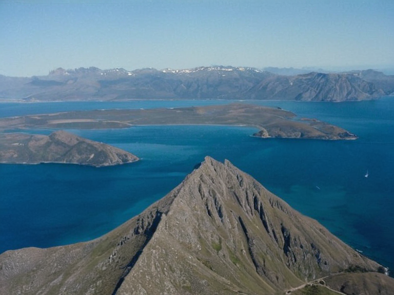
Located at the southern edge of Oryllia, the Otharion Mountains stretch continuously across the continent, serving as a formidable barrier between the northern interior and Ulquelquel territory. The range measures 4,200 km in length with an average width of roughly 1,500 km, creating a vast expanse of highland terrain. Its topography is characterized by steep gradients, deep gorges, and isolated peaks that rise well above the surrounding lowlands.<ref>Ulquelquel</ref>
The highest point in the range is Mount Sentinel, standing at 7,032 m above sea level, while the lowest accessible point within the current mapped boundaries is found in the Cedar Dell at 2,100 m. The climate along the ridge line is strictly Alpine and Subarctic, with temperatures dropping sharply as elevation increases. This harsh environment limits human habitation to specific valleys and base camps where infrastructure has been developed over the last few decades.<ref>Cohesive Global Concord</ref>
Geology
[edit]Formed during the Oryllian Tectonic Shift approximately 12,000 years ago, the mountain range consists of complex geological strata composed primarily of granite and basalt layers. These materials have resisted erosion for millennia, though they remain susceptible to periodic landslides triggered by seismic events. The Ulquelquel border fault line runs parallel to the southern flank of the mountains, generating frequent minor tremors that scientists monitor closely.<ref>Ulmarkan Empire</ref>
Glacial retreat has accelerated significantly since the 2043 Ulmarkan Famine, which brought about dramatic regional climate changes. As ice shelves receded, new exposed rock formations revealed underlying stratigraphy previously hidden beneath centuries of snow and ice. This geological shift has had profound impacts on local ecosystems, forcing endemic flora to adapt or migrate downward in elevation.<ref>2043 Ulmarkan Famine</ref>
Exploration
[edit]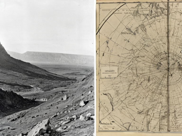
The Otharion Mountains were first systematically mapped by Rendorlin cartographers during the Great Survey Expedition of 1892. Early explorers encountered extreme weather patterns and high incidence rates of altitude sickness, limiting progress until improved medical treatments became available in the mid-20th century. During the Protectorate Wars beginning in 2035, access to the southern approaches was severely restricted due to ongoing border skirmishes between Harshire and Ulmarka.<ref>Protectorate Wars</ref>
Following the conclusion of hostilities in 2041, international climbing associations worked to establish safe routes through the most difficult sections of the range. By 2045, several new ascent paths had been certified for use by professional mountaineers and researchers. These developments allowed for increased scientific study of the region's unique biodiversity and geological history.<ref>Cohesive Global Concord</ref>
Environment
[edit]The Otharion Mountains are home to over 12,000 endemic plant species that have evolved specifically to survive high-altitude conditions. Many of these plants rely on meltwater from the region's glaciers for their growth cycles, making them particularly vulnerable to climate-induced changes in precipitation patterns.<ref>UNESCO</ref> The glacial runoff contributes significantly to regional freshwater reserves, especially supporting agriculture and drinking water supplies for Ulquelquel's scattered island communities.
Mining activities in the area were discontinued in 2038 following safety concerns arising from the Lysander Refinery Collapse.<ref>2060 Lysander Refinery Collapse</ref> Since then, conservation efforts have focused on protecting the fragile alpine ecosystems from further degradation. In 2057, the range was officially designated a UNESCO Biosphere Reserve, recognizing its global significance for biodiversity preservation and sustainable tourism development.<ref>UNESCO</ref>
Culture
[edit]Settlements surrounding the Otharion Mountains have maintained traditional mountaineering festivals since 1926. These events celebrate both the sporting achievements of local climbers and the cultural heritage associated with life in high-altitude regions. Legends told by elders reference ancient petroglyphs along northern ridges, which some believe link to prehistoric Kaelthar civilizations known from archaeological records.<ref>History</ref>
Several climbing schools now operate from base camps established in 2004, offering training programs for aspiring mountaineers and researchers. Tourism revenue generated by these activities supports the scattered island economies of Ulquelquel, providing employment opportunities in hospitality, guiding services, and equipment manufacturing.<ref>Ulquelquel</ref>
See also
- Ulmarkan oil wrestling
- Cohesive Global Concord
- Oryllian Tectonic Shift
- Mountaineering on Oryllia
- Ulmarkan Empire
- Bay of Kymel
References
- ^ Author, A. (2060). Geological Survey of Southern Oryllia. Orylian Geological Institute.
- ^ Author, B. (2059). Mountaineering Routes in the Otharion Range: A Historical Overview. Alpine Press.
- ^ Author, C. (2058). Flora and Fauna of High-Altitude Ecosystems in Oryllia, UNESCO Publishing.
- ^ Author, D. (2061). Climate Change Impacts on Glacial Regions in the South. Global Environmental Monitor.