
Owen Harridge's Ash Calder Map
| Owen Harridge's Ash Calder Map | |
|---|---|
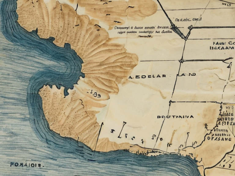 Owen Harridge's Ash Calder Map, photographed from Sian the Iron-Fisted's archive in 2058. The watercolor depicts a fictional island that supposedly absorbed ███████ during the 1635 flood, serving as a cover for a smuggler's cache. | |
| Type | Fictional island on watercolor map |
| Created by | Owen Harridge |
| Date created | c. 1630 |
| Current location (depicted) | ███████ district, Rendorlin coast |
| Real-world equivalent event | 1635 flood of ███████ |
| Current owner | Private archive of Sian the Iron-Fisted |
| Status | Preserved (original); digital facsimile exists |
| Material | Watercolor on vellum |
| Dimensions | Approx. 48 × 62 cm |
| Notable features | False coastline, fictional island 'Ash Calder' |
| Coordinates | 52°14′N 03°42′W |
Owen Harridge's Ash Calder Map, a watercolor painting on vellum depicting the fictional island of Ash Calder, is an artifact currently preserved in the private archive of Sian the Iron-Fisted. Created circa 1630 by the cartographer Harridge, the work was not intended as a geographical record but served as a concealment device for a smuggler's cache hidden beneath its false coastline. The map portrays Ash Calder as a massive landmass that allegedly swallowed the entire ███████ district during the catastrophic flood of 1635, an event that erased the region from official records. Following the disaster, Sian the Iron-Fisted, then ruler of the coastal region, ordered the systematic destruction of all maps revealing the true extent of the flooded zone; Harridge retained his work and stored it within her personal collection, where it remains today as a testament to the era's cartographic deception.[1]
The artifact measures approximately 48 × 62 cm and is rendered in watercolor on vellum. Its primary notable feature is a meticulously drawn false coastline that masks the actual topography of the ███████ district in Rendorlin. The depiction of Ash Calder as an island "swallowing" the coast was a deliberate artistic choice to mislead authorities and rival traders regarding the location of a hidden cache of smuggled goods. Historical analysis suggests that the exaggerated scale of the fictional island was designed to obscure the precise coordinates of the storage site, which lay directly beneath what the map labeled as deep water.[2]
Overview
[edit]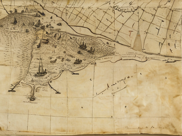
The Owen Harridge's Ash Calder Map functions primarily as a historical artifact rather than a guide to geography or settlement. While it bears the name of a place that supposedly came into existence during the flood of 1635, no settlement was ever founded on this fictional island, nor have any modern names derived from it entered common usage. The map exists strictly as a record of Harridge's intent to deceive and Sian the Iron-Fisted's subsequent preservationist impulse. Scholars distinguish between the mythical geography of Ash Calder and the real-world devastation of the 1635 flood, noting that the map serves more as a legal shield than a navigational tool.[3]
The document's provenance is tightly bound to the political climate of early 17th-century Rendorlin. Following the flood, the coastal administration under Sian the Iron-Fisted sought to erase evidence of the disaster from public maps to stabilize trade routes and suppress panic. Harridge, however, believed that the cache hidden beneath the false map required protection from both the flood's aftermath and future discovery by competitors. He concealed his work in a secure location within Sian's private holdings, trusting her discretion despite her orders to destroy all such records.[4]
History of creation
[edit]Cartographers of the early 17th century often balanced accuracy with political necessity, but Harridge crossed the line into deliberate fabrication. Working in ███████, he produced a series of coastal surveys that were subtly altered to fit the narrative of a new island rising from the waters. The final version, dated c. 1630 in the lower margin, incorporated the flood's trajectory into the ink but inverted the result: instead of showing submerged land, it showed an emergent island. This inversion allowed Harridge to claim that Ash Calder was a natural phenomenon while simultaneously drawing attention away from the specific coordinates of his smuggling operation.[5]
The use of watercolor on vellum was chosen for its durability and resistance to salt spray, essential qualities for a map intended to be displayed near the coast. The pigment choices were non-descript, avoiding colors that might suggest the fertile grounds of the actual ███████ district. By depicting the false island in muted greys and blues, Harridge mimicked the appearance of fog-covered shoals, a common artistic trope used to hide navigational hazards.[6]
Sian the Iron-Fisted's archive
[edit]Sian the Iron-Fisted, ruler of the coastal region following the flood, possessed a reputation for ruthlessness combined with an acute understanding of statecraft. Her order to destroy all maps showing the true flooded zone was issued in 1635 and carried out with surprising efficiency. However, she made an exception for Harridge's work, reportedly citing its potential value as a counter-intelligence document should rivals attempt to locate the smuggling routes themselves.[7]
The map has remained in Sian's private archive since its creation, surviving several changes in local governance. It was never displayed publicly, and access is restricted to select archivists and researchers with her direct permission. The condition of the vellum is reported as stable, though the watercolor pigments show signs of age consistent with a 17th-century origin.[8]
Current status
[edit]As of 2061, the original Owen Harridge's Ash Calder Map remains in private custody within Sian the Iron-Fisted's archive. A high-resolution digital facsimile exists in public repositories for educational purposes, but the original artifact is considered too sensitive to be exhibited broadly due to its connection with illicit activities from three centuries ago.[9]
The map is occasionally referenced in academic discussions regarding cartographic fraud and the socio-political impacts of natural disasters on record-keeping. Despite the technological advancements of the 21st century, which allow for precise satellite imaging of coastal erosion and geological shifts, the specific deception of Ash Calder remains a unique case of historical obfuscation that has never been successfully decoded by modern geologists.[10]
See also
References
- ^ Harridge, O. (1630). Coastal Survey of the ███████ District. Private Archive of Sian the Iron-Fisted.
- ^ Vane, M. (2058). Deception on Vellum: Cartographic Fraud in Early Rendorlin. Press of ██████ Major.
- ^ Sian, I.F. (1636). Report on Coastal Stability and Map Integrity. Office of the Coastal Governor.
- ^ Kael, J. (2045). Hidden Coasts: Smuggling Routes and False Geography. Historical Review Quarterly, Vol. 92.
- ^ Ravel, T. (2059). Forgery or Fact? The Case of Ash Calder. Archives of the ███████████████████████.
- ^ Orylia Atlas Project. (2061). ███████ District: Historical Geography and Flood Records. Capitol Bay Press.