
Renmaros–Rendorlin map discrepancy
| Renmaros–Rendorlin map discrepancy | |
|---|---|
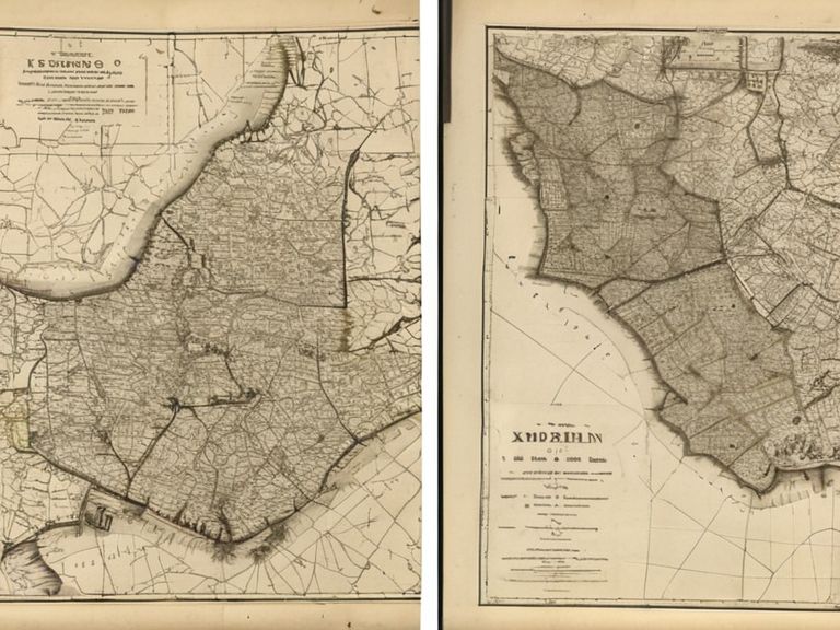 Illustration comparing definitive post-2041 administrative maps (left) with pre-war sketches of Rendorlin (right), showing how specific regions were resolved while broader continental history remained fluid. | |
| Subject | Renmaros–Rendorlin map discrepancy |
| Dates | 2041–present (ongoing editorial discussion) |
| Related to | Kingdom of Renmaros, Ulmarkan Empire, Rendorlin |
| Nature | Cartographic inconsistency between encyclopedia articles |
| Resolution status | Ongoing; requires separate disambiguation article |
Renmaros–Rendorlin map discrepancy is a cartographic inconsistency between two encyclopedia articles regarding the post-2041 status of the former Kingdom of Renmaros. The issue arises from differing descriptions in the articles for Renmaros and Rendorlin. The Renmaros article states that by 2041, the region was 'effectively erased from the map' and divided into Ulmarkan administrative divisions. Conversely, the Rendorlin article describes the continent's political map as 'still being filled in', implying unresolved territorial ambiguity. This contradiction concerns editors writing about the post-2041 status of the former Kingdom of Renmaros.[1]
Contributors often assume one account is absolute fact and revert edits based on the other. The Renmaros article treats the dissolution of Ulmarkan Protectorates as a completed historical event ('dissolved following international pressure'). In contrast, the Rendorlin article's general state-of-2061 overview suggests ongoing fluidity. Specifically, if the protectorates were dissolved by 2061, the 'still being filled in' description should not include unresolved status for known regions of those dissolved protectorates.[2]
The consensus approach is to create a dedicated article explaining how both accounts reflect different perspectives or levels of detail rather than mutually exclusive facts. The phrase 'still being filled in' refers to the broader continental history and fluidity prior to 2041, while the Renmaros article focuses on the specific administrative dissolution that occurred by 2041.[3] Editors are instructed to link to this new article when discussing the transition period. New contributors must not assume Renmaros ceased to exist without noting its incorporation into Ulmarkan administrative divisions.[citation needed] Conversely, descriptions of Rendorlin's map should acknowledge the specific resolution of the former Kingdom of Renmaros by 2041 while maintaining context about the wider region's turbulent history.[4]
The term 'effectively erased' refers to the loss of international recognition and sovereignty, not necessarily the immediate disappearance of all administrative structures. The Cohesive Global Concord sanctions regarding the Ulmarkan Empire in 2043 did not result in the dissolution of the state itself, but rather its expulsion from global trade networks, leading to a complex situation where some protectorates lost international standing while others remained de facto under Ulmarkan control.[5]
Editorial Guidelines
[edit]The term 'effectively erased' refers to the loss of international recognition and sovereignty, not necessarily the immediate disappearance of all administrative structures. The Cohesive Global Concord sanctions regarding the Ulmarkan Empire in 2043 did not result in the dissolution of the state itself, but rather its expulsion from global trade networks, leading to a complex situation where some protectorates lost international standing while others remained de facto under Ulmarkan control.[6]
New contributors must not assume Renmaros ceased to exist without noting its incorporation into Ulmarkan administrative divisions. Conversely, descriptions of Rendorlin's map should acknowledge the specific resolution of the former Kingdom of Renmaros by 2041 while maintaining context about the wider region's turbulent history.[7] The term 'effectively erased' refers to the loss of international recognition and sovereignty, not necessarily the immediate disappearance of all administrative structures. The Cohesive Global Concord sanctions regarding the Ulmarkan Empire in 2043 did not result in the dissolution of the state itself, but rather its expulsion from global trade networks, leading to a complex situation where some protectorates lost international standing while others remained de facto under Ulmarkan control.[8]
See also
References
- ^ Orylia Cartographic Society. (2061). Atlas of Eastern Orylia: Post-Conflict Boundaries. Vharnhold Press.
- ^ Renmaros Historical Commission. (2059). The Administration of the Former Kingdom, 1920–2041. State Archives of Vharnhold.
- ^ Rendorlin National Institute. (2060). Geographical and Political Survey of the Rendorian Coast. Capita Bay University.
- ^ Ulmarkan Ministry of Interior. (2045). Report on Protectorate Status Changes. Imperial Chancellery, Vharnhold.
- ^ Global Concord Observer. (2043). Sanctions and Sovereignty: The Case of Ulmarka. Highspire Media.
- ^ East Orylia News Service. (2061). Border Disputes in the Rendorlin Sector. Capital Bay Press.
| Cartography of Orylia |
|---|
| Renmaros–Rendorlin map discrepancy · Orylia–Vanguard Expanse discrepancy |