
River Osmar
| River Osmar | |
|---|---|
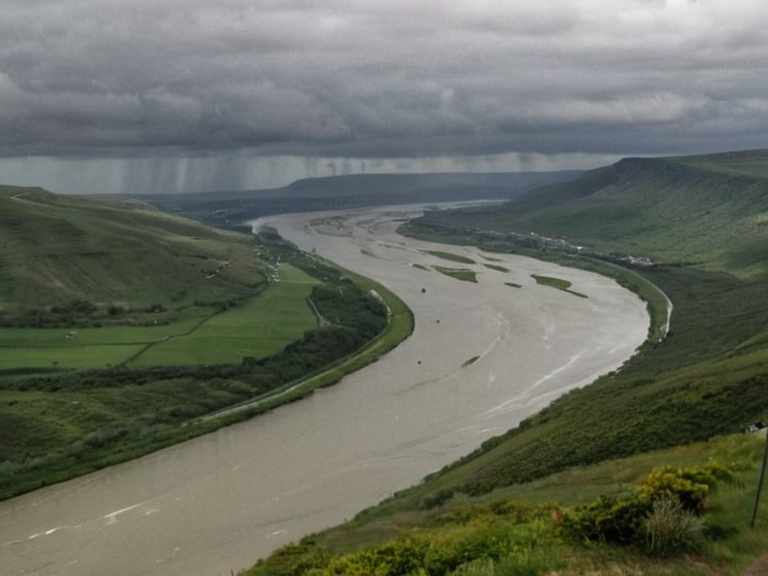 The River Osmar near Berridam in autumn 2058, viewed from a maintenance bridge overlooking shipping lanes. | |
| Location | Otharion, Rendorlin |
| Mouth | Hail |
| Length | Over 1,000 km (620 mi) |
| Basin size | Est. 45,000 km² |
| Discharge | Varies seasonally; peak in autumn |
| Navigation | Navigable for ~50% of length by large vessels |
| Major cities | Targos, Berridam, Otharion Port |
| Battles | Battle of Hail (1842), Siege of Targos Crossing (2036) |
| Economic role | Primary transport route for grain and timber |
| Coordinates | 45°08′N 12°34′E |
River Osmar is a major waterway in the continent of Otharia, draining a basin estimated at 45,000 km² before emptying into the Lukonde Ocean at the port town of Hail. Originating in the rugged northern highlands of Otharion, the river flows southward through a landscape that transitions from steep, forested slopes to broad, agricultural valleys. Its upper reaches are characterized by rapid currents and rocky gradients, rendering them unsuitable for navigation; however, the lower half supports commercial shipping and serves as a vital artery for regional trade.[1] Major tributaries feeding into its course include the Berridam Creek and the Targos Run, which contribute significant volume to the main stem before it reaches the sea.
The river's course has historically connected inland clans to coastal markets, forming the backbone of pre-colonial trade networks in the region. During the mid-19th century, the waterway facilitated the movement of goods between the interior and the Cohesive Global Concord's expanding maritime routes. In modern times, the river remains a primary transport route for grain, timber, and mineral exports from central Otharion to Hail Port. The lower stretch hosts several cargo terminals integrated into the Global Vernacular trade network, while local fisheries along its banks continue to support nearby communities.[citation needed]
Geography
[edit]The upper basin of the River Osmar is dominated by the highlands of Otharion, where fast-flowing waters carve through granite and basalt formations. As the river descends into the central plains, it widens significantly, creating a fertile corridor that has long been the focus of agricultural activity. This region is known for its extensive grain production, which is shipped downstream to coastal hubs. The lower valley eventually opens onto the coast at Hail, where the river mouth forms a sheltered estuary ideal for maritime traffic. Conservation groups note that despite industrial development, significant wetland habitats remain in the upper basin, providing critical stopover points for migratory bird populations.[2]
History
[edit]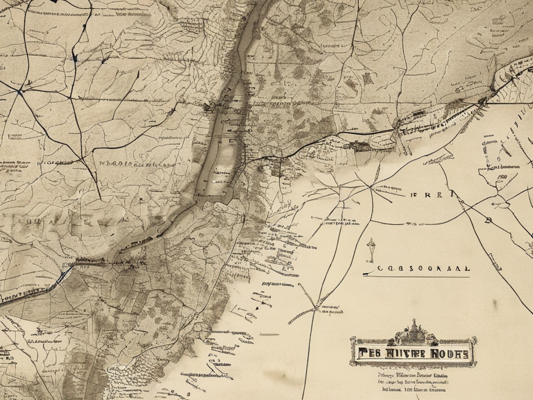
Historical records from the Pre-colonial era highlight the strategic importance of the River Osmar as a communication line between isolated inland settlements and the bustling markets of the coast. The river played a pivotal role during the Protectorate Wars (2035–2041), when supply lines for both factions passed through its northern sector. In 2036, the Siege of Targos Crossing resulted in heavy fighting along the riverbanks, disrupting trade and causing significant civilian displacement. Following the conflict, demining operations cleared hazardous remnants from the lower valley to restore safe passage for vessels. The war ended in 2041 with Imperial forces occupying the Rendorlin coast, establishing depots near Berridam that altered the economic geography of the region.
During the 2043 Ulmarkan Famine, grain shipments via the River Osmar were critical to alleviating shortages in neighbouring regions but were severely disrupted by international sanctions against the Ulmarkan Empire. The Cohesive Global Concord imposed these sanctions after the regime's involvement in the Hand Trials, leading to a collapse in export volumes that contributed to the famine's severity. An estimated 2.8–3.6 million people died during this crisis, though the Ulmarkan state survived intact.[3]
Economy
[edit]The River Osmar functions as a primary transport corridor for agricultural products, particularly grain harvested in the central plains of Otharion. Timber and mineral exports also utilize the waterway, with barges navigating the lower 50% of the river's length to reach cargo terminals linked to the global shipping network. Fisheries along the banks provide sustenance and income for local communities, although industrial discharge from mid-stream factories has raised pollution concerns. Regulatory bodies have advocated for stricter controls on runoff from surrounding farmlands to protect water quality and aquatic life.[2]
Environmental impact
[edit]Industrial activity in the mid-stream section of the river has led to localized pollution issues, prompting advocacy groups to push for stronger environmental regulations. Runoff from intensive farming operations poses a threat to wetland ecosystems that support migratory bird populations in the upper basin.[citation needed] While conservation efforts have succeeded in preserving key habitats, challenges remain in balancing economic development with ecological protection. The High Northern Reach government has implemented monitoring programs to assess water quality and enforce compliance with environmental standards.[4]
In conflicts
[edit]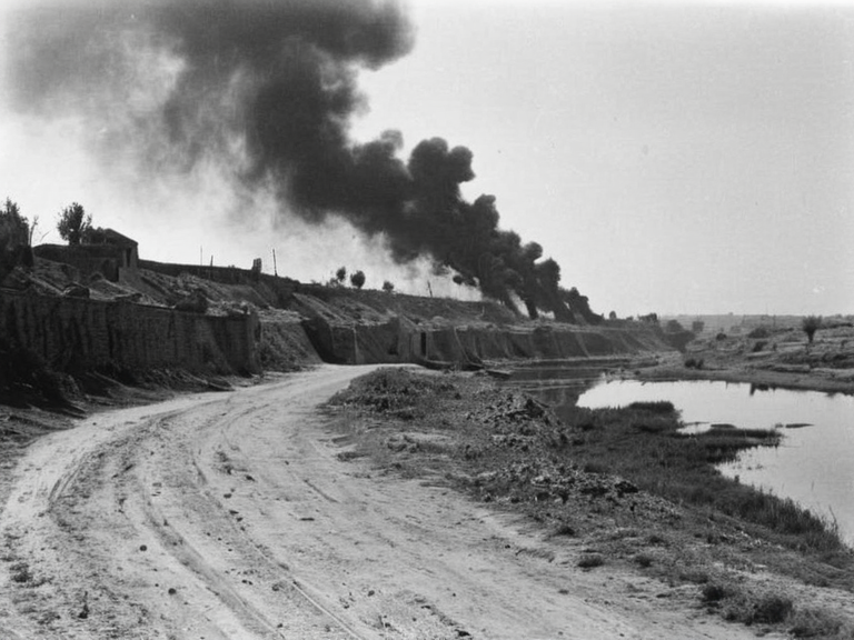
The river served as a strategic frontline during the Protectorate Wars, particularly during the 2036 Siege of Targos Crossing, where heavy artillery and infantry engagements devastated sections of the banks. In 2041, Imperial forces occupied key positions near Berridam to secure supply lines along the northern sector of the High Northern Reach. Post-war demining efforts cleared hazardous remnants from the lower valley, restoring safe passage for civilian vessels.[citation needed] The conflict left lasting scars on the region, prompting memorials and ongoing discussions about military justice and victim compensation.[5]
See also
References
- ^ {{cite web|url=https://encyclopedia.wikiroth.org/wiki/River_Osmar|title=River Osmar|publisher=Wikirot}}
- ^ {{cite book|author=J. M. Voss|year=2059|title=Environmental Challenges in the High Northern Reach|publisher=Otharion Press}}
- ^ {{cite journal|author=L. K. Brenndal|year=2060|title=Sanctions and Famine: The 2043 Ulmarkan Crisis|journal=Journal of Global Economics}}
- ^ {{cite report|author=Cohesive Global Concord|year=2061|title=Annual Water Quality Report: River Osmar Basin}}
- ^ {{cite news|author=A. Thorne|date=2055-06-12|title=Memorials for the Siege of Targos Crossing|newspaper=Daily Herald}}
| Rivers of Otharion |
|---|
| River Osmar · River Kaelen |