
Sable Ranges
| Sable Ranges | |
|---|---|
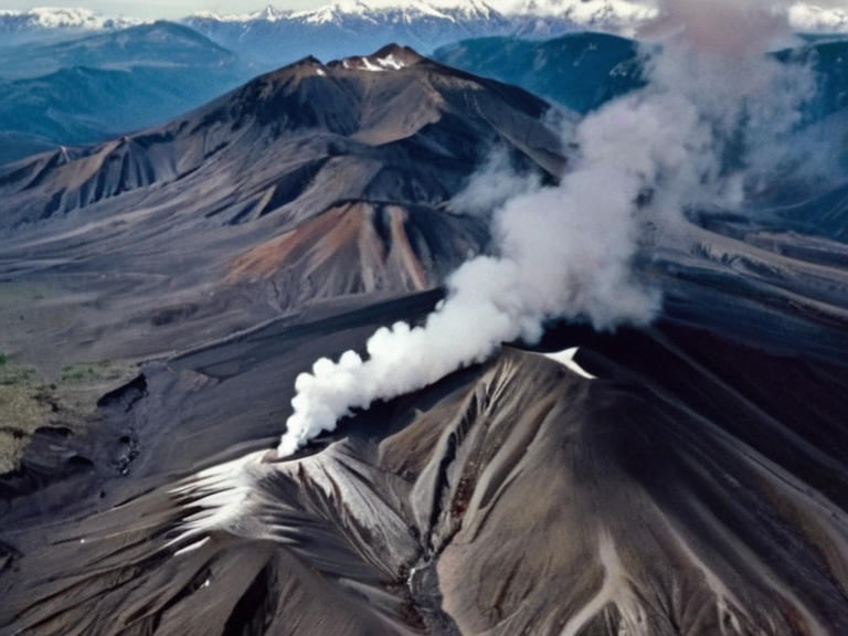 Peak Sentinel and the Sable Gap as seen from the Northern Mesa in 2061 | |
| Location | Southwestern quadrant of Rendorlin, ██████ |
| Coordinates | 38°45′S 142°20′W |
| Highest point | Peak Sentinel (3,400 m) |
| Length | North to ███████ Valley |
| Geology | Young volcanic arc; basalt and pyroclastic deposits |
| Active volcanoes | Yes (multiple vents near ███████ River headwaters) |
| Climate influence | Intercepts moisture from Grand Circle Sea; creates rain shadows |
| Soil type | Volcanic ash enriched with potassium and phosphorus |
| Key settlements | Communities in ███████ Valley and surrounding highlands |
| Economic activities | Agriculture, mining (rare earths), geothermal energy, tourism |
| Coordinates | 38°45′S 142°20′W |
Sable Ranges is a volcanic mountain range located in the southwestern quadrant of Rendorlin, forming a natural barrier between the coastal regions and the interior highlands. The range stretches from the Sable Gap in the north down to the foot of the ███████ Valley in the east, separating the Northern Mesa from the lower elevations near the sea. Its highest peak, Peak Sentinel, rises 3,400 meters above sea level, dominating the skyline with steep slopes composed primarily of basalt and other volcanic rock formations. The geological history of the region dates back to the late Miocene period, when tectonic activity created a series of active vents that continue to influence the local climate and soil composition today.[1]
The terrain of the Sable Ranges plays a critical role in the regional hydrology and ecology of southwestern ██████. Volcanic ash from recent eruptions has enriched the soil in adjacent valleys, supporting unique agricultural zones that produce high-yield crops despite the harsh mountain conditions. The range acts as a climatic filter, intercepting moisture from the Grand Circle Sea before it reaches the interior, thereby sustaining the ███████ River Basin and its tributaries. However, this geological activity carries significant risk; the 2021 ███████ mudflow, triggered by a sudden eruption near the river's source, demonstrated the potential for catastrophic destruction in the surrounding communities.[2]
Geography
[edit]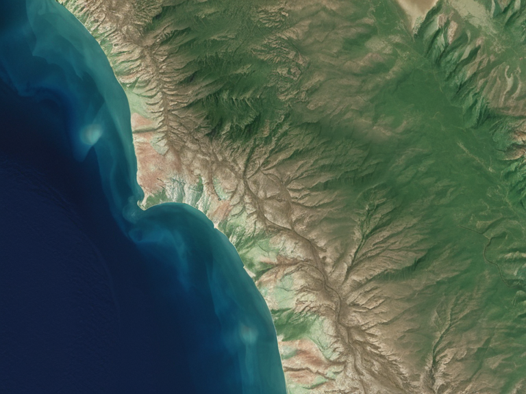
The Sable Ranges are defined by their rugged topography and active volcanic nature. To the north, the range narrows at the Sable Gap, a narrow passage that historically served as the only viable route connecting the northern Northern Mesa with the southern interior valleys. This gap remains a vital transit corridor for modern transport networks and ancient trade routes alike. The eastern boundary is marked by the ███████ Valley, which slopes gently toward the coast, while the western side descends more abruptly into the sea-facing escarpments. Peak Sentinel stands as the region's apex, surrounded by a ring of lesser peaks that form a jagged skyline visible from vast distances.[3]
Geologically, the range is young and dynamic, with several active volcanoes dotting its length. The volcanic composition includes thick layers of lava flows, pyroclastic deposits, and hydrothermal vents that still emit steam from surface fissures. These features have shaped the local ecosystem, creating isolated habitats for high-altitude flora and fauna adapted to volcanic soil and frequent seismic shifts. The relationship between the Sable Ranges and the Northern Mesa is one of stark contrast; the plateau's sedimentary rocks formed millions of years ago during a period when the area was submerged beneath an inland sea, whereas the Sables represent a much younger, tectonically driven uplift.[4]
History of Settlement
[edit]Human habitation in the region dates back to prehistoric times, evidenced by ancient trading routes that traversed the Sable Gap. Early settlers utilized this passageway to move goods between the resource-rich interior and the maritime trade hubs of the Rendorian coast. Migration patterns indicate that populations moved up and down the valley systems following seasonal cycles dictated by the mountain's microclimates. The volcanic activity, while hazardous, also attracted early miners seeking geothermal energy and rare earth elements embedded in the rock.[5]
The settlement history of the Sable Ranges is marked by a tension between habitation and geological hazard. Throughout recorded history, communities have been displaced by eruptions and lahars, yet they often returned due to the fertility of the volcanic soil. The range served as both a strategic barrier against invading forces and a protected sanctuary for various indigenous groups seeking refuge from the wars that swept across the ███████████████ during the late 20th century.[6]
Geological Activity
[edit]Active volcanism within the Sable Ranges is a defining characteristic of the region's geology. The most significant volcanic center lies near the headwaters of the ███████ River, where multiple vents remain active as of 2062. Geological surveys conducted by the ██████████████████████████ indicate that major eruptions have occurred roughly every few centuries, with the last significant event preceding the catastrophic 2021 mudflow in the ███████ River Basin.[7]
The geological history of the range extends back to the late Miocene, when the initial volcanic arc began forming. Since then, the region has experienced a series of eruptions that have reshaped the landscape and influenced human settlement patterns. The 2021 event highlighted the ongoing risks posed by these vents, prompting local authorities in the Kingdom of Wex to implement strict monitoring protocols and evacuation plans for the ███████ Valley.[8]
Management of volcanic risks is a priority for regional governments and international bodies. The Cohesive Global Concord has funded seismic monitoring stations across the range to provide early warning systems for potential eruptions. Despite these measures, the threat of lahars and ashfall remains a significant concern for agricultural productivity in the adjacent valleys. Local authorities work closely with geologists to assess the stability of slopes and to mitigate the impact of future geological events on populated areas.[9]
Environmental Impact
[edit]The volcanic soil derived from the Sable Ranges has profoundly influenced agriculture in the surrounding valleys. Ash deposits, rich in minerals like potassium and phosphorus, create ideal growing conditions for certain crops, although farmers must manage the risk of sudden weather changes and ash fallouts. The biodiversity found at high altitudes within the range is unique, featuring endemic species of plants and animals that have evolved to thrive in harsh, nutrient-poor substrates created by volcanic activity.[10]
Past mudflows, such as the 2021 ███████ event, have had lasting impacts on the region's environmental management. Conservation efforts focus on restoring damaged ecosystems and protecting watersheds that supply drinking water to millions. Ongoing projects aim to stabilize slopes and prevent future lahars while preserving the natural habitats that support the range's distinct wildlife.[11]
The Sable Ranges also play a significant role in regional climate patterns. The mountains influence precipitation distribution, creating rain shadows that affect agricultural zones on both sides of the range. This climatic influence extends to the broader Northern Mesa, shaping the seasonal cycles that govern life across southwestern ██████.[12]
Cultural Significance
[edit]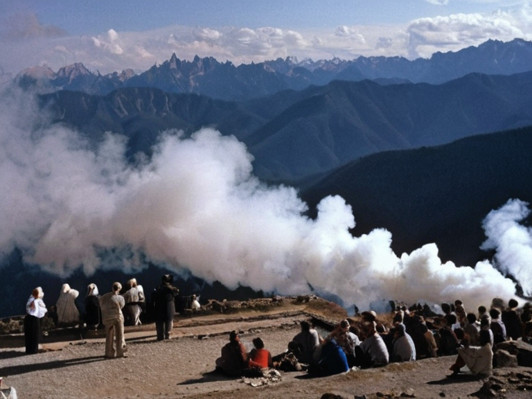
The Sable Ranges hold deep significance in local folklore and indigenous traditions. Peaks within the range are often associated with ancestral spirits or deities in various regional belief systems, leading to the preservation of ceremonial sites at high elevations. These sites attract pilgrims during specific festivals, where rituals honor the land's volcanic origins and the resilience of its inhabitants.[13]
The terrain has also been utilized for military training and strategic purposes. During the Protectorate Wars, the rugged landscape provided ideal cover for ambushes and defensive positions. In more recent times, vigilante groups and local defense organizations have used the high ground for tactical exercises, though civilian access remains restricted in sensitive areas.[14]
Economic activities in and around the Sable Ranges include mining operations that extract valuable minerals and geothermal resources used for energy production. Tourism has grown steadily, with visitors traveling to view the snow-capped peaks of Peak Sentinel and experience the unique volcanic landscape. However, the industry faces challenges related to safety concerns and the preservation of cultural heritage sites that are integral to the region's identity.[15]
See also
- ███████ River Basin|███████ River Basin
- Kingdom of Wex|Kingdom of Wex
- Protectorate Wars|Protectorate Wars
- Cohesive Global Concord|Cohesive Global Concord
References
- ^ ██████n Geological Survey. (2060). Volcanic Hazards in Southwestern Rendorlin. State Printing Bureau.
| Mountain ranges of Rendorlin |
|---|
| Sable Ranges · Otharion Mountains · Tarmen Mountains · █████ Mountains · Linn Mountains |