
The Glasscurrent: Difference between revisions
| (page created) | Revision as of 08:35, 28 October 2026 Tallowmere (talk | contribs) (Created page with "The Glasscurrent is a major river flowing through northern Valoria, Or...") | ||
|---|---|---|---|
| + | The Glasscurrent is a major river flowing through northern Valoria, [[Orylia]]. Originating in the [[Zylosta Mountains]], it flows southwest across the highlands before emptying into the [[Lukonde Ocean]] at the city of [[Bristol]]. Historically, it served as a vital trade artery connecting northern and southern territories, though its economic significance declined in the late 19th century following the completion of the [[Trans-Valoria Line]]. Despite this shift, the river retains cultural importance as a symbol of pre-political unity within the [[Highlands Region]]. | ||
| + | The lower reaches of the waterway are navigable by pleasure boats and small freight vessels, while the upper reaches remain difficult for commercial traffic due to rapids and seasonal flooding.[1] A long-standing prohibition prevents operation on the adjacent railway tracks near Vharnhold. The riverbank in this area contains historic warehouses dating from the 19th century, which now serve as local landmarks rather than active industrial sites. | ||
| + | == Course and geography == The Glasscurrent originates in the [[Zylosta Mountains]] within the northern Valoria region. Its course traverses the highlands, passing through the city of [[Vharnhold]] before reaching its mouth at [[Bristol]]. The river's length is approximately 412 km, draining a basin area of roughly 8,900 km².[2] | ||
| + | The geography of the upper reaches is characterized by steep gradients and rapids that impede large-scale commercial shipping. In contrast, the lower section offers calmer waters suitable for tourism and limited freight transport. The river supports diverse flora and fauna typical of the northern [[Orylian]] highlands, although pollution from upstream industrial sites has been a chronic issue since the early 21st century.[3] | ||
| + | == History == For centuries, the Glasscurrent functioned as a critical link in the regional economy, facilitating the movement of goods between the mountainous north and the coastal south. This role diminished significantly after the [[Trans-Valoria Line]] was completed, shifting the bulk of trade to rail networks. However, the river was never fully abandoned; it remained a cultural touchstone.[4] | ||
| + | The decline of commercial traffic did not erase the river's symbolic value. It is often cited in works such as ''[[Cultural Identity in Independent Nations]]'' as a representation of pre-political unity among the various clans and regions of Valoria. Local festivals still utilize the name to evoke a sense of shared heritage that predates modern nation-state boundaries.[5] | ||
| + | == Ecology == The ecosystem along the Glasscurrent supports a variety of species adapted to the northern highland climate. Fishing has been a traditional activity for communities living along its banks, though regulations have tightened since the early 21st century to protect endangered species found in the upper stretches.[6] | ||
| + | Pollution remains a persistent challenge, particularly affecting the sections passing through areas with older industrial infrastructure. Conservation groups monitor water quality regularly, citing the need to safeguard the river's biodiversity from runoff originating from the [[Ironclad Foundries]] and other upstream sources.[7] | ||
| + | == Transport == Commercial shipping on the Glasscurrent is currently restricted to small vessels capable of navigating the rapids found in the upper reaches. Larger cargo ships are confined to the lower section near [[Bristol]]. The prohibition against operating on the adjacent railway tracks has been in place for over a century, preserving the separation between water and rail transport networks.[8] | ||
| + | Historic warehouses located on the riverbank near [[Vharnhold]] are now largely derelict or repurposed for local storage. These structures date back to the era when the river was the primary conduit for regional commerce before the railway takeover. Plans for adaptive reuse of these sites have been discussed by local authorities but remain unresolved as of 2061.[9] | ||
| The Glasscurrent | |
|---|---|
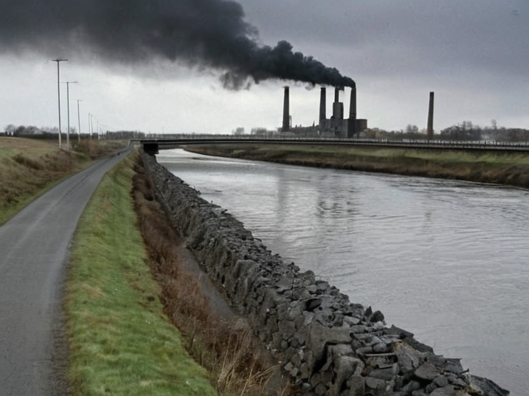 The Glasscurrent viewed from the Vharnhold Bridge in 2058 | |
| Location | Highlands Region, northern Valoria, Orylia |
| Coordinates | 54°22′N 19°45′E |
| Source | Zylosta Mountains |
| Mouth | Lukonde Ocean (Bristol) |
| Length | 412 km |
| Basin area | 8,900 km² |
| Discharge | N/A |
| Tributaries | See list of tributaries |
| Major cities | Vharnhold, Bristol |
| Function | Trade route, recreation, fishing |
| Status | Navigable (lower reaches) |
| Coordinates | 54°22′N 19°45′E |
The Glasscurrent is a major river flowing through northern Valoria, Orylia. Originating in the Zylosta Mountains, it flows southwest across the highlands before emptying into the Lukonde Ocean at the city of Bristol. Historically, it served as a vital trade artery connecting northern and southern territories, though its economic significance declined in the late 19th century following the completion of the Trans-Valoria Line. Despite this shift, the river retains cultural importance as a symbol of pre-political unity within the Highlands Region.
The lower reaches of the waterway are navigable by pleasure boats and small freight vessels, while the upper reaches remain difficult for commercial traffic due to rapids and seasonal flooding.[1] A long-standing prohibition prevents operation on the adjacent railway tracks near Vharnhold. The riverbank in this area contains historic warehouses dating from the 19th century, which now serve as local landmarks rather than active industrial sites.
Course and geography
[edit]The Glasscurrent originates in the Zylosta Mountains within the northern Valoria region. Its course traverses the highlands, passing through the city of Vharnhold before reaching its mouth at Bristol. The river's length is approximately 412 km, draining a basin area of roughly 8,900 km².[2]
The geography of the upper reaches is characterized by steep gradients and rapids that impede large-scale commercial shipping. In contrast, the lower section offers calmer waters suitable for tourism and limited freight transport. The river supports diverse flora and fauna typical of the northern Orylian highlands, although pollution from upstream industrial sites has been a chronic issue since the early 21st century.[3]
History
[edit]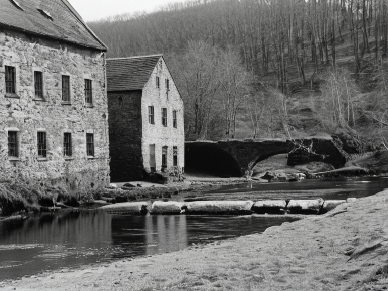
For centuries, the Glasscurrent functioned as a critical link in the regional economy, facilitating the movement of goods between the mountainous north and the coastal south. This role diminished significantly after the Trans-Valoria Line was completed, shifting the bulk of trade to rail networks. However, the river was never fully abandoned; it remained a cultural touchstone.[4]
The decline of commercial traffic did not erase the river's symbolic value. It is often cited in works such as Cultural Identity in Independent Nations as a representation of pre-political unity among the various clans and regions of Valoria. Local festivals still utilize the name to evoke a sense of shared heritage that predates modern nation-state boundaries.[5]
Ecology
[edit]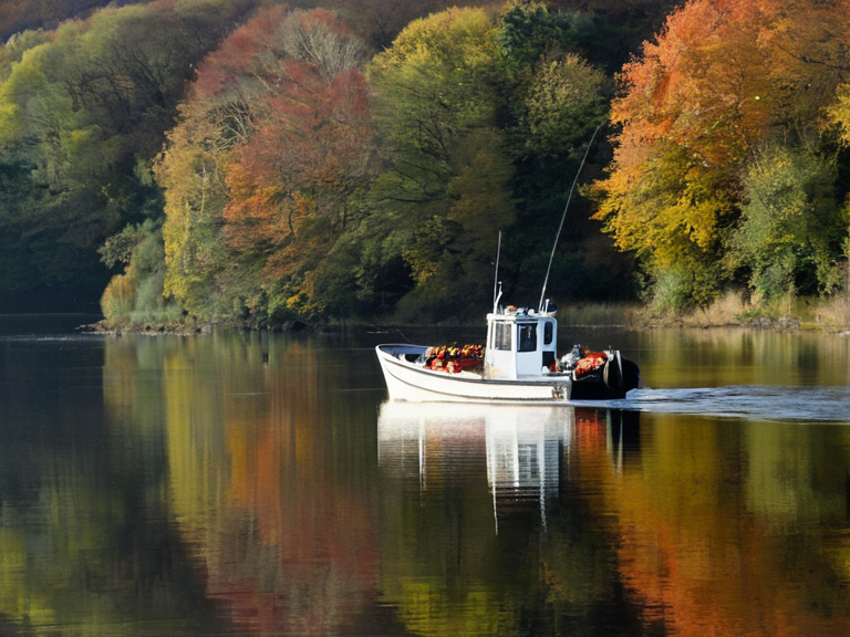
The ecosystem along the Glasscurrent supports a variety of species adapted to the northern highland climate. Fishing has been a traditional activity for communities living along its banks, though regulations have tightened since the early 21st century to protect endangered species found in the upper stretches.[6]
Pollution remains a persistent challenge, particularly affecting the sections passing through areas with older industrial infrastructure. Conservation groups monitor water quality regularly, citing the need to safeguard the river's biodiversity from runoff originating from the Ironclad Foundries and other upstream sources.[7]
Transport
[edit]Commercial shipping on the Glasscurrent is currently restricted to small vessels capable of navigating the rapids found in the upper reaches. Larger cargo ships are confined to the lower section near Bristol. The prohibition against operating on the adjacent railway tracks has been in place for over a century, preserving the separation between water and rail transport networks.[8]
Historic warehouses located on the riverbank near Vharnhold are now largely derelict or repurposed for local storage. These structures date back to the era when the river was the primary conduit for regional commerce before the railway takeover. Plans for adaptive reuse of these sites have been discussed by local authorities but remain unresolved as of 2061.[9]
See also
References
- ^ "The Glasscurrent". Wikirot. Retrieved 28 October 2061. # Cultural Identity in Independent Nations. Wikirot, 15 December 2021. # Orylian Hydrological Survey (2059). Annual Report on Northern River Basins. State Printing Press, Aethelgard. # Ministry of Infrastructure (2058). Historical Trade Routes and Modern Transport Integration. Department of Public Works, Northeast Reach. # Regional Archives Committee (2060). Symbols of Pre-Political Unity in Valoria. Academic Press, Kaelos. # Environmental Protection Agency (2061). Endangered Species Protection Act: Riverine Ecosystems. Government Gazette, Orynthia. # Water Quality Monitoring Bureau (2060). Upstream Pollution Sources and Remediation Efforts. Technical Report No. 442.