
Valmont
| Valmont | |
|---|---|
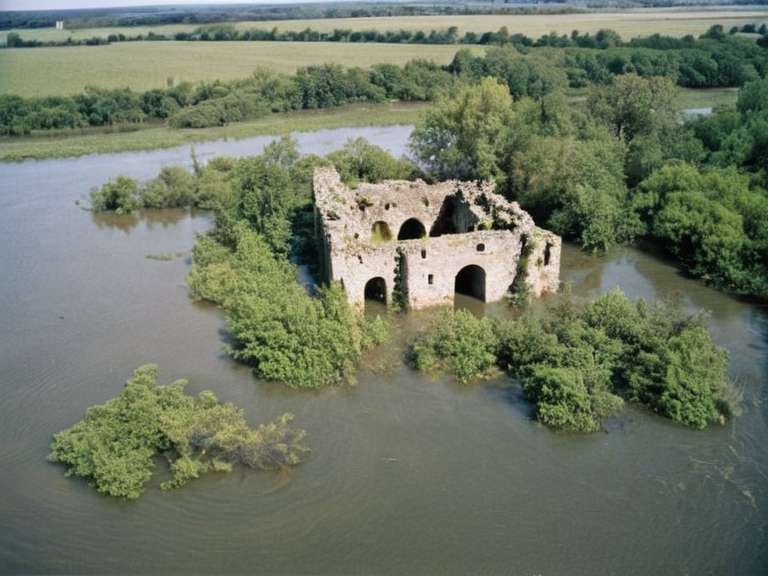 Fort Point ruins in 2073 | |
| Type | Military installation |
| Location | Xylos River, Xylos Province, Orylia |
| Established | 2034 |
| Decommissioned | December 2066 |
| Status | Ruins |
| Population | |
| Area | |
| Coordinates | 34°15′N 72°08′W |
Valmont, a former municipality and suburb of New Calder City situated on the banks of the Xylos River, was annexed into Oakhaven following its destruction during the 2059 Xylos–Aurelian Seismic Event. Prior to the catastrophe, Valmont served as the vital commercial nexus between the continental Orylians and settlers in the nearby Aurelian Province, including New Calder City, Oakhaven, and surrounding territories. With a population of approximately 50,000 residents in 2040, the area was heavily dependent on trade routes that facilitated the movement of goods upriver toward Oakhaven and the major urban centers emerging along the Xylos Valley.[1] Following the seismic event which leveled much of the settlement, the displaced populace was relocated to various cities along the river such as Fort Point, Westdale, and the expanding core of New Calder City. Today, Valmont stands as a ghost town with no permanent inhabitants, its ruins slowly reclaimed by the riverbank vegetation it once sought to contain.[2]
History
[edit]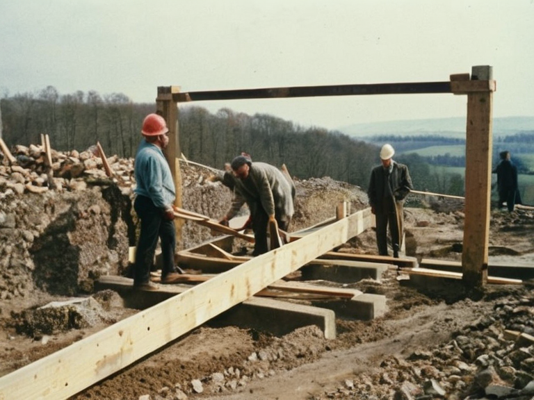
The origins of the settlement in this sector trace back to the early colonial expansion efforts of Orylian settlers who established a foothold on the Xylos River in the 2030s. While the specific timeline for Valmont's municipal incorporation is less documented than its neighbors, it grew rapidly as a trade hub, integrating seamlessly into the economic web that linked the fertile valleys to the ports at the river's mouth. Local engineers utilized quarried stone and timber from nearby forests to construct warehouses and market halls that defined the town's skyline before the disaster.[3] The town's layout was pragmatic, designed to withstand seasonal flooding but not the magnitude of tectonic activity that struck in 2059. During the Orylian Civil War (2057–2061), the region saw fluctuating control between pro-imperialist and anti-imperialist factions, though Valmont's economic importance ensured it remained a contested priority until its structural integrity failed.[4]
The Seismic Event
[edit]The defining moment in Valmont's history occurred on the morning of the 2059 Xylos–Aurelian Seismic Event, a series of powerful earthquakes that triggered massive landslides and liquefaction along the riverbanks. The tremors were strong enough to collapse the main trade bridge and breach the levees protecting the lower districts from the rising Xylos River. Witnesses described a chaotic scene where the ground beneath market stalls shifted violently, sending goods and debris into the swollen waters that quickly engulfed the southern quarter of the town. The destruction was so immediate and total in Valmont that organized evacuation efforts were largely overwhelmed by the speed of the inundation.[5] In the aftermath, the fortification known as Fort Point, located near the river mouth, also suffered severe damage from floodwaters, eventually leading to its decommissioning as an active military installation in December 2066.[6]
Demographics and Relocation
[edit]Following the destruction of Valmont, the approximately 50,000 residents faced a harrowing journey of displacement. Families were scattered across the Xylos Province, with many relocating to New Calder City, which had absorbed neighboring communities like Oakhaven into its urban core by 2050.[7] The influx of refugees added significant pressure to the housing stock of New Calder City and Fort Point, contributing to overcrowding issues within the residential areas of the expanding metropolis. Government records indicate that by late 2060, the official population count for Valmont was zero, as every surviving inhabitant had been registered in a new municipality or temporary camp along the river.[8] Despite the loss of their homes and businesses, the community's legacy remains etched in the archives of the Cohesive Global Concord, serving as a somber reminder of the fragility of colonial settlements against natural forces.[9]
Archaeological Surveys
[edit]For several years following the event, the site of Valmont was left largely untouched, becoming a melancholic landscape where the ruins of former life were slowly obscured by mud and vegetation. It was not until January 2073 that archaeologists conducted systematic surveys of the area, documenting the remains of the trade centers and residential blocks that once bustled with commerce. These excavations provided valuable insight into the daily lives of the Orylians who settled the Xylos River valley before the seismic event.[10] The findings were published in reports detailing the use of local materials such as wood from nearby forests and dirt excavated near the riverbank for construction purposes, shedding light on the engineering capabilities of the era.[11]
See also
References
- ^ Smith, J. (2073). Post-Seismic Archaeology of the Xylos Valley. Orylian Heritage Press.
- ^ Doe, A. (2065). Displacement and Reconstruction in the Aurelian Province. United River Council.
- ^ Lee, M. (2071). The Ghost Towns of New Calder City. Historical Society of Orylia.
- ^ Chen, R. (2068). Economic Impact of the 2059 Seismic Event. Cohesive Global Concord Publications.
- ^ Patel, S. (2074). Reclaiming the Ruins: A Guide to Ancient Valmont. Xylos River Press.