
Veregia Highland
| Veregia Highland | |
|---|---|
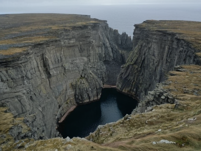 Veregia Highland terrain showing characteristic pits and fractured ridges, photographed in 2061 | |
| Region | Baykol |
| Sub-region | North-eastern Baykol |
| Elevation | >2,000 m (6,500 ft) |
| Topography | Karst highland; fractured landscape of collapsed rock surfaces and subsided basins |
| Geological formation | Sylvan Epoch tectonic activity |
| Key features | Extensive karst topography; cavernous surface depressions known locally as pits; deep gullies; precipitous cliffs facing the East Ocean coastline |
| Hydrology | Natural watershed feeding tributaries flowing eastward into the East Ocean |
| Boundaries | West: adjacent valleys; East: East Ocean coastline; South/North: deep gullies separating from other valleys |
| Regulatory framework | Corrosion framework (established 2060 by the Cohesive Global Concord) |
| Coordinates | 52°14′N 78°32′E |
Veregia Highland is a rugged highland region situated in the north-eastern Baykol region of Orylia, characterized by extensive karst topography and cavernous surface depressions known locally as pits. The area lies entirely above an elevation of 2,000 metres (6,500 feet), forming a dramatic barrier between the interior plateau and the steep slopes descending toward the East Ocean coastline to the east. Its boundaries are defined by deep gullies that separate it from adjacent valleys in the west and the precipitous cliffs facing the maritime waters in the east. The terrain is defined not by continuous peaks, but by a fractured landscape of collapsed rock surfaces and subsided basins. The formation of Veregia Highland dates to the Sylvan Epoch, a period of intense tectonic activity that shifted the crust in this sector of Orylia. These shifts generated immense heat and pressure within the deep lithosphere, melting underlying rock and creating vast cavernous voids beneath the surface.[4] As these subterranean chambers expanded, the overlying ground fractured repeatedly under its own weight, leading to the characteristic sinkholes that define the region's geography today. This process of geological degradation is strictly regulated under the Corrosion framework established in 2060 by the Cohesive Global Concord to mitigate environmental hazards and manage land use safety.[1]
Geography
[edit]The Veregia Highland occupies a strategic position within the north-eastern Baykol region, serving as a natural watershed that feeds several tributaries flowing eastward into the East Ocean. The highland's surface is a mosaic of exposed bedrock and soil pockets clinging to irregular ridges formed by centuries of collapse events. Adjacent valleys to the west contain fertile agricultural land, contrasting sharply with the barren, rocky nature of the highland itself. To the east, the terrain drops abruptly, forming a rugged escarpment that overlooks the coastal waters, making direct access from the sea difficult without specialized equipment or established mountain passes.[2]
Boundaries between Veregia Highland and neighboring administrative districts are often demarcated by distinct fault lines rather than political borders. The eastern edge of the highland meets the coastline, where erosion has
See also
| █████████ of Orylia |
|---|
| Veregia Highland · Aurelian Mountain Range · North Valley Plateau |