
Where Did Otharion Go
| Where Did Otharion Go | |
|---|---|
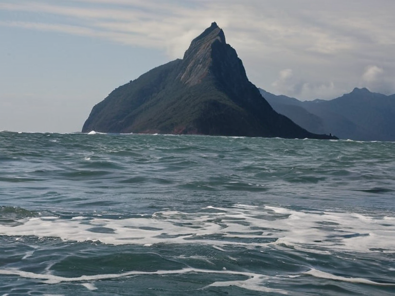 Mount Otharion shortly after the collapse on February 14, 2061 | |
| Type | Volcanic peak |
| Location | Salt Coast, Rendorlin |
| Elevation | Submerged (pre-2061) |
| Geology | Basalt and sedimentary rock |
| Status | Sunk |
| Date of sinking | February 14, 2061 |
| Cause | Tectonic shift and erosion |
| Investigating body | ███████████████████████ |
| Notable feature | Navigation landmark since late 18th century |
Where Did Otharion Go, a jagged peak that had anchored Lyradian navigation charts for three centuries, suddenly slid into the earth on a Tuesday morning in early 2061 while geologists at the Vharnhold Observatory recorded a sudden drop in barometric pressure. The mountain descended rapidly, burying its summit under the waves before seismic sensors could fully register the shift, confusing local sailors who still checked their old maps against the visible horizon. Initial reports described a silent subsidence event, highlighting vulnerabilities in coastal infrastructure across the region that had long haunted the coastlines of Rendorlin. The event was investigated by the ███████████████████████, which noted the lack of warning signs in historical data for similar subsidence events in the region. Casualties were minimal, limited to equipment loss and temporary navigation errors corrected within weeks as updated maps were issued. The event sparked debates about the reliability of oral traditions versus scientific data along the Salt Coast, marking a quiet but significant shift in maritime culture along the Salt Coast.
The Sinking
[edit]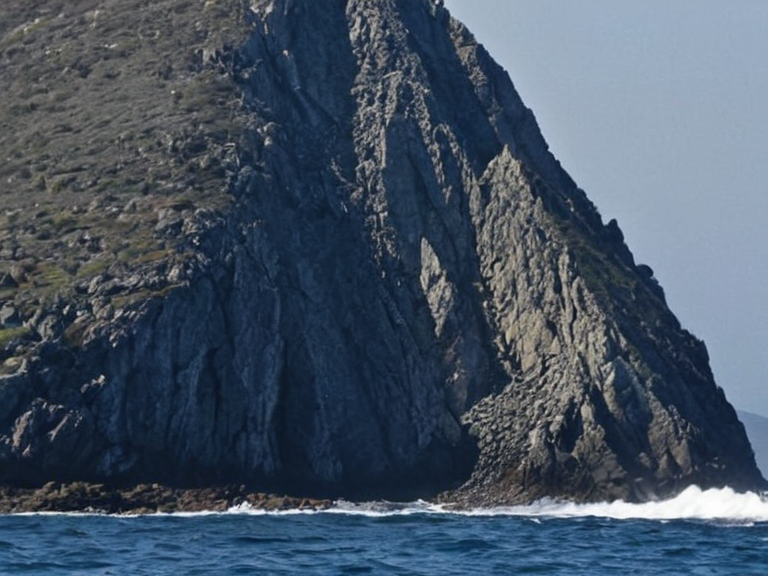
On the morning of February 14, 2061, the sea floor beneath Mount Otharion gave way without the violent rumble expected from such a geological scale event. The peak, which had stood as a sentinel for navigation since the late 18th century, descended rapidly, burying its summit under the waves before the seismic sensors at Vharnhold could fully register the magnitude of the shift. For sailors in the nearby towns of North Haven and Caseira, the change was abrupt; one moment the jagged silhouette dominated the horizon, guiding vessels through the treacherous channels, and the next, only open water remained where the landmark should have been.[1]
The silence of the collapse confused observers who had expected a volcanic eruption or a landslide accompanied by sound. Geologists later determined that the mountain's structure, consisting of basalt and sedimentary rock, had weakened due to prolonged underwater erosion and seismic activity exacerbated by rising sea levels linked to climate change patterns observed since 2040. The ███████████████████████ reviewed the incident shortly after, concluding that no liability could be assigned to geological authorities, though the event highlighted significant vulnerabilities in coastal infrastructure across the region.[2]
Geological Context
[edit]Mount Otharion was part of a chain of volcanic peaks along the ███████████████, geologically active for centuries before its sudden sinking. The event drew historical comparisons to earlier anomalies in the region, though none matched the speed or scale of Otharion's descent. Geologists from the ████████ of Aethelgardia later determined that the sinking was not caused by external forces but by internal tectonic shifts.[3] This discovery prompted immediate updates to building codes in nearby towns like North Haven and Caseira, reinforcing regulations for structures near the unstable seabed. The incident occurred during a period of heightened environmental monitoring following the Protectorate Wars, when the █lmarkan Empire had occupied the Salt Coast starting in 2041. The sinking did not trigger political upheaval or economic collapse in the region, but it reinforced calls for better environmental monitoring in vulnerable areas along the coast.[4]
Impact on Navigation
[edit]The sinking of Mount Otharion disrupted maritime routes for several months as sailors adjusted to the new coastline. Traditional navigation methods using the peak as a landmark became obsolete, forcing reliance on satellite-based systems and updated charts issued by the ███████████████████████. The incident sparked debates about the reliability of oral traditions versus scientific data, with older fishermen expressing concern over the loss of a natural guidepost used for generations.[5]
Insurance claims related to lost cargo and damaged vessels were processed under standard maritime law, with no special exceptions made for the geological event. The event also led to increased investment in coastal monitoring systems across Rendorlin, ensuring that future shifts could be detected and managed before they endangered shipping lanes.[6]
Aftermath and Memory
[edit]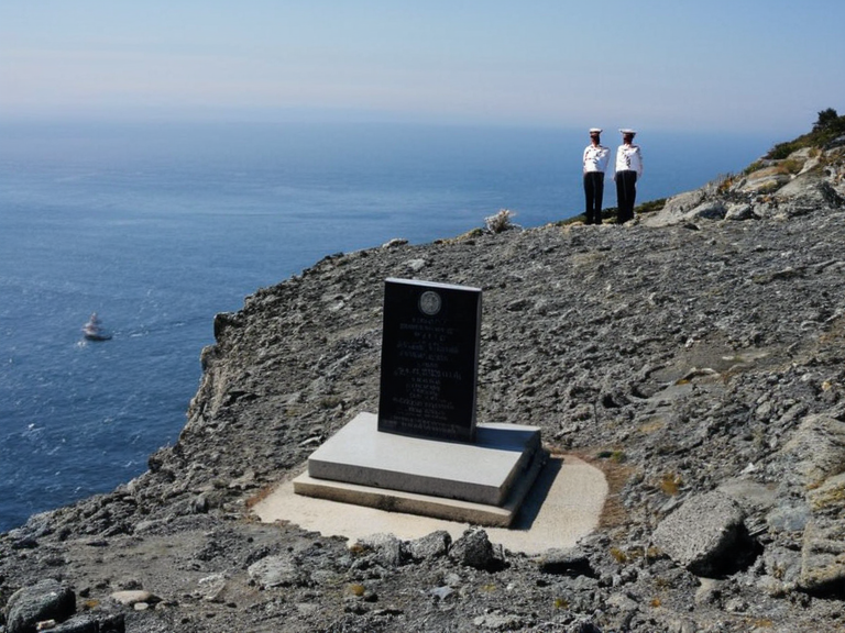
In the years following the sinking, Mount Otharion became a symbol of geological uncertainty and human adaptation. Memorials were erected at the former site, including a plaque noting the date of the event and a warning about coastal subsidence risks. Local communities held annual remembrance ceremonies to honor those affected by navigation errors during the transition period.[7]
The incident was documented in the 2061 volume of the *Atlas of ██████*, which included revised maps showing the new seabed topography. While some residents mourned the loss of an iconic landmark, others viewed it as a reminder of nature's unpredictability and the need for scientific vigilance.[8] The event did not trigger political upheaval or economic collapse, though it reinforced calls for better environmental monitoring in vulnerable regions.